
Magnitude |
2 |
| Date & Time (UTC) | 2012-12-27 16:31:40.3 |
| Date & Time (Local) | 1391/10/7 20:01:40.3 |
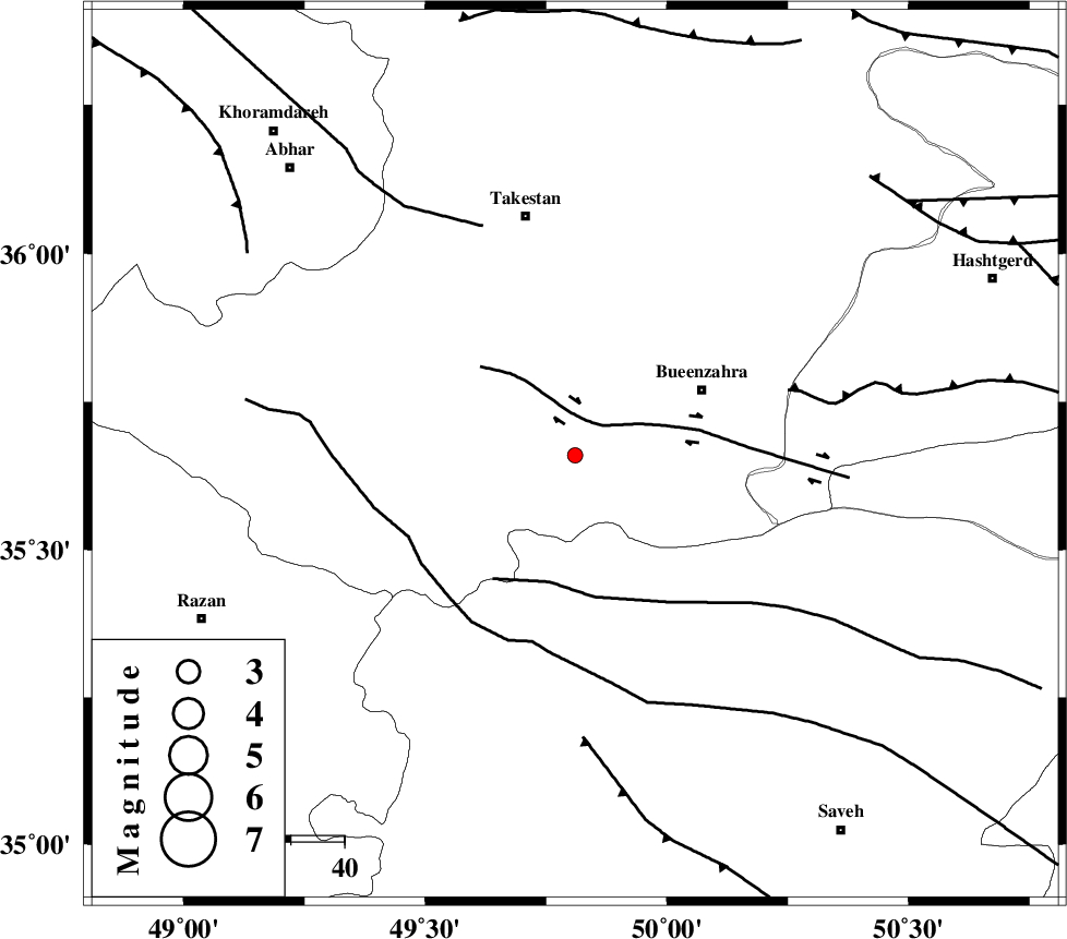
| Location | Lat:35.66 Lon: 49.81 |
| Region | Ghazvin Province, 27 km South-West of Buinzara |
Nearest Cities |
|
| 15 km South of Danesfahan, Ghazvin Province | |
| 16 km South West of Sagezabad, Ghazvin Province | |
| 27 km South of Shal, Ghazvin Province | |
| 27 km South West of Buinzara, Ghazvin Province | |
| 29 km North of Duzaj, Markazi Province | |
| Depth | 31 km |
| Agency | |
Faults within 150 km: |
|
| IPAK_F (Length: 80 km) , Distance to epicenter: 7 km | |
| S_PARANDAK_F (Length: 116 km) , Distance to epicenter: 24 km | |
| KUSHK_E_NOSRAT_F (Length: 230 km) , Distance to epicenter: 35 km | |
| Number of Phases | 6 |
| RMS | 0.1 |
| Number of Stations | 5 |
| Error in Latitude | >1.4 km |
| Error in Longitude | 1.8 km |
| Error in Depth | 4.4 km |
Download waveform in seisan format
to download seisan software Click here
to access information about IIEES stations Click here
Amplitude | ||||||||
| UID | Agency | Station | Component | Amplitude | Period | Arrival Time | Proccessing Time | Signal Clip |
| 87454 | IIEES | ZNJK | E | 26.1 | 0.12 | 2012-12-27 16:32:25 | 2012-12-27 05:12:00 | n |
| 87455 | IIEES | SNGE | N | 9.4 | 0.4 | 2012-12-27 16:32:49 | 2012-12-27 05:12:00 | n |
Phase | ||||||||||||
| Agency | Station | Component | Phase Type | Phase Quality | First Motion | Observed Arrival Time | Time Residual | Loc. Flag | Input Weight | Distance | Azimuth | |
| IIEES | THKV | Z | Pg | E | 2012-12-27 16:31:57 | -0.08 | y | 101 | 73 | |||
| IIEES | CHTH | Z | Pg | E | 2012-12-27 16:32:00 | -0.25 | y | 122 | 76 | |||
| IIEES | CHTH | E | Sg | E | 2012-12-27 16:32:16 | 0.22 | y | 122 | 76 | |||
| IIEES | ASAO | E | Sg | E | 2012-12-27 16:32:16 | 0.04 | y | 125 | 171 | |||
| IIEES | ZNJK | Z | Pn | E | 2012-12-27 16:32:05 | 0.04 | y | 151 | 318 | |||
| IIEES | ZNJK | N | Sg | E | 2012-12-27 16:32:23 | 0.03 | y | 151 | 318 | |||