
Magnitude |
3 |
| Date & Time (UTC) | 2013-01-10 18:32:55.4 |
| Date & Time (Local) | 1391/10/21 22:02:55.4 |
| Location | Lat:32.82 Lon: 50.1 |
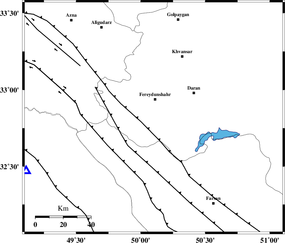
| Region | Esfahan Province, 13 km South of Fereydunshahr |
Nearest Cities |
|
| 8 km of Sibak, Esfahan Province | |
| 13 km South of Fereydunshahr, Esfahan Province | |
| 15 km North West of Ghale? sorkh, Esfahan Province | |
| 20 km South of Sangbaran, Esfahan Province | |
| 22 km South of Afus, Esfahan Province | |
| Depth | 17 km |
| Agency | |
Faults within 150 km: |
|
| MAIN_ZAGROS_R_F (Length: 1106 km) , Distance to epicenter: 10 km | |
| ARDAL_F (Length: 170 km) , Distance to epicenter: 26 km | |
| ZARDKUH_F (Length: 139 km) , Distance to epicenter: 39 km | |
| Number of Phases | 6 |
| RMS | 0.3 |
| Number of Stations | 4 |
| Error in Latitude | >4.3 km |
| Error in Longitude | 6.7 km |
| Error in Depth | 6.9 km |
Download waveform in seisan format
to download seisan software Click here
to access information about IIEES stations Click here
Amplitude | ||||||||
| UID | Agency | Station | Component | Amplitude | Period | Arrival Time | Proccessing Time | Signal Clip |
| 87565 | IIEES | SHGR | E | 295.4 | 0.6 | 2013-01-10 18:33:45 | 2013-01-10 06:58:00 | n |
| 87566 | IIEES | SHGR | N | 234.1 | 0.28 | 2013-01-10 18:33:45 | 2013-01-10 06:58:00 | n |
Phase | ||||||||||||
| Agency | Station | Component | Phase Type | Phase Quality | First Motion | Observed Arrival Time | Time Residual | Loc. Flag | Input Weight | Distance | Azimuth | |
| IIEES | SHGR | Z | Pg | E | 2013-01-10 18:33:19 | -0.06 | y | 146 | 237 | |||
| IIEES | ASAO | Z | Pn | E | 2013-01-10 18:33:26 | 0.01 | y | 191 | 358 | |||
| IIEES | ASAO | E | Sg | E | 2013-01-10 18:33:49 | -0.31 | y | 191 | 358 | |||
| IIEES | GHVR | Z | Pn | E | 2013-01-10 18:33:28 | -0.42 | y | 212 | 30 | |||
| IIEES | GHVR | E | Sg | E | 2013-01-10 18:33:56 | 0.37 | y | 212 | 30 | |||
| IIEES | SNGE | Z | Pn | E | 2013-01-10 18:33:47 | 0.48 | y | 358 | 315 | |||