
Magnitude |
3.3 |
| Date & Time (UTC) | 2013-01-12 06:29:02.5 |
| Date & Time (Local) | 1391/10/23 09:59:02.5 |
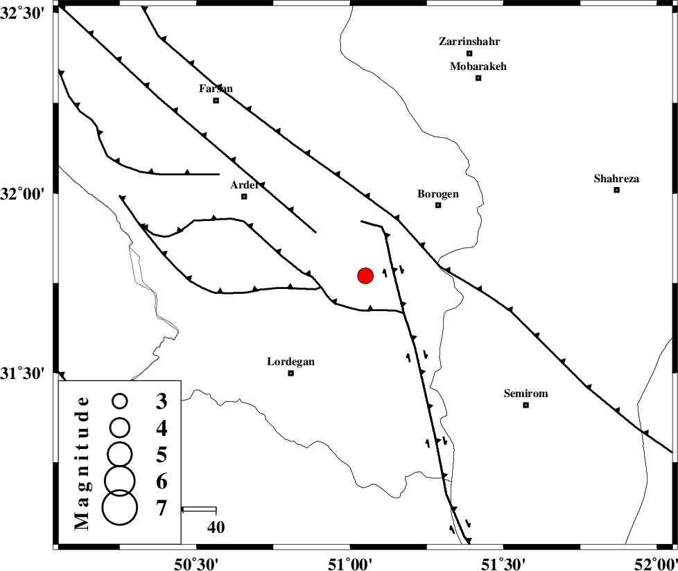
| Location | Lat:31.77 Lon: 51.05 |
| Region | Chaharmahal Bakhtiari Province, 31 km South-West of Borujen |
Nearest Cities |
|
| 15 km West of Gandoman, Chaharmahal Bakhtiari Province | |
| 18 km South of Baladaji, Chaharmahal Bakhtiari Province | |
| 24 km North of Aluni, Chaharmahal Bakhtiari Province | |
| 29 km South West of Faradonbeh, Chaharmahal Bakhtiari Province | |
| 29 km North East of Armand-e olia, Chaharmahal Bakhtiari Province | |
| Depth | 46 km |
| Agency | |
Faults within 150 km: |
|
| DENA_F (Length: 137 km) , Distance to epicenter: 9 km | |
| DOPOLAN_F (Length: 107 km) , Distance to epicenter: 11 km | |
| SABZKUH_F (Length: 67 km) , Distance to epicenter: 14 km | |
| Number of Phases | 5 |
| RMS | 0.1 |
| Number of Stations | 3 |
| Error in Latitude | >3.1 km |
| Error in Longitude | 5.9 km |
| Error in Depth | 5.5 km |
Download waveform in seisan format
to download seisan software Click here
to access information about IIEES stations Click here
Amplitude | ||||||||
| UID | Agency | Station | Component | Amplitude | Period | Arrival Time | Proccessing Time | Signal Clip |
| 87603 | IIEES | SHGR | N | 261.8 | 0.52 | 2013-01-12 06:30:20 | 2013-01-12 08:32:00 | n |
| 87604 | IIEES | SHGR | E | 218.4 | 0.64 | 2013-01-12 06:30:21 | 2013-01-12 08:32:00 | n |
| 87605 | IIEES | KHMZ | E | 157.2 | 0.56 | 2013-01-12 06:30:12 | 2013-01-12 08:32:00 | n |
| 87606 | IIEES | KHMZ | N | 161.4 | 0.56 | 2013-01-12 06:30:13 | 2013-01-12 08:32:00 | n |
Phase | ||||||||||||
| Agency | Station | Component | Phase Type | Phase Quality | First Motion | Observed Arrival Time | Time Residual | Loc. Flag | Input Weight | Distance | Azimuth | |
| IIEES | SHGR | Z | Pg | E | 2013-01-12 06:29:37 | 0.08 | y | 216 | 281 | |||
| IIEES | SHGR | N | Sg | E | 2013-01-12 06:30:03 | -0.04 | y | 216 | 281 | |||
| IIEES | KHMZ | Z | Pn | E | 2013-01-12 06:29:36 | -0.11 | y | 242 | 335 | |||
| IIEES | KHMZ | N | Sg | E | 2013-01-12 06:30:10 | 0.03 | y | 242 | 335 | |||
| IIEES | ASAO | Z | Pn | E | 2013-01-12 06:29:47 | 0.06 | y | 323 | 343 | |||