
Magnitude |
3.5 |
| Date & Time (UTC) | 2013-01-23 06:37:02.7 |
| Date & Time (Local) | 1391/11/4 10:07:02.7 |
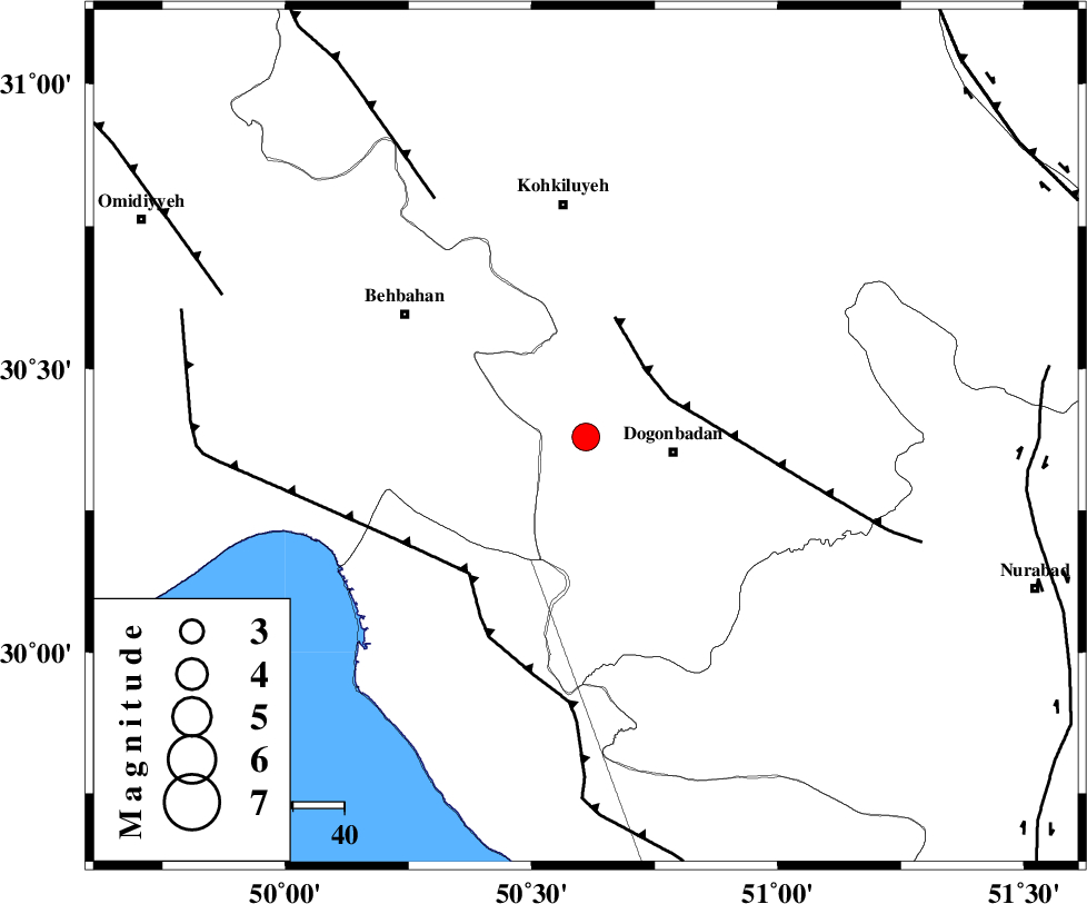
| Location | Lat:30.38 Lon: 50.61 |
| Region | Kohkiluieh va boyerahmad Province, 17 km West of Dogonbadan |
Nearest Cities |
|
| 17 km North West of Dogonbadan, Kohkiluieh va boyerahmad Province | |
| 38 km North East of Sardasht, Khoozestan Province | |
| 41 km South East of Mansuriyeh, Khoozestan Province | |
| 43 km South East of Behbahan, Khoozestan Province | |
| 43 km West of Abdehgah, Kohkiluieh va boyerahmad Province | |
| Depth | 14 km |
| Agency | |
Faults within 150 km: |
|
| MISHAN_F (Length: 76 km) , Distance to epicenter: 18 km | |
| ZFF3 (Length: 125 km) , Distance to epicenter: 35 km | |
| RAG_E_SEFID_F (Length: 84 km) , Distance to epicenter: 35 km | |
| Number of Phases | 6 |
| RMS | 0.2 |
| Number of Stations | 5 |
| Error in Latitude | >3.9 km |
| Error in Longitude | 5.5 km |
| Error in Depth | 8.8 km |
Download waveform in seisan format
to download seisan software Click here
to access information about IIEES stations Click here
Amplitude | ||||||||
| UID | Agency | Station | Component | Amplitude | Period | Arrival Time | Proccessing Time | Signal Clip |
| 87680 | IIEES | AHRM | N | 605.3 | 0.3 | 2013-01-23 06:37:59 | 2013-01-23 07:01:00 | n |
| 87681 | IIEES | AHRM | E | 528.8 | 0.38 | 2013-01-23 06:38:01 | 2013-01-23 07:01:00 | n |
Phase | ||||||||||||
| Agency | Station | Component | Phase Type | Phase Quality | First Motion | Observed Arrival Time | Time Residual | Loc. Flag | Input Weight | Distance | Azimuth | |
| IIEES | AHRM | Z | Pg | E | 2013-01-23 06:37:32 | 0.06 | y | 181 | 158 | |||
| IIEES | AHRM | N | Sg | E | 2013-01-23 06:37:54 | -0.06 | y | 181 | 158 | |||
| IIEES | SHGR | Z | Pn | E | 2013-01-23 06:37:42 | 0.15 | y | 257 | 318 | |||
| IIEES | GHIR | Z | Pn | E | 2013-01-23 06:37:51 | 0 | y | 328 | 135 | |||
| IIEES | KHMZ | Z | Pn | E | 2013-01-23 06:37:57 | -0.3 | y | 377 | 351 | |||
| IIEES | TABS | Z | Pn | E | 2013-01-23 06:38:39 | 0.23 | y | 713 | 58 | |||