
Magnitude |
3.3 |
| Date & Time (UTC) | 2013-01-30 01:56:38.5 |
| Date & Time (Local) | 1391/11/11 05:26:38.5 |
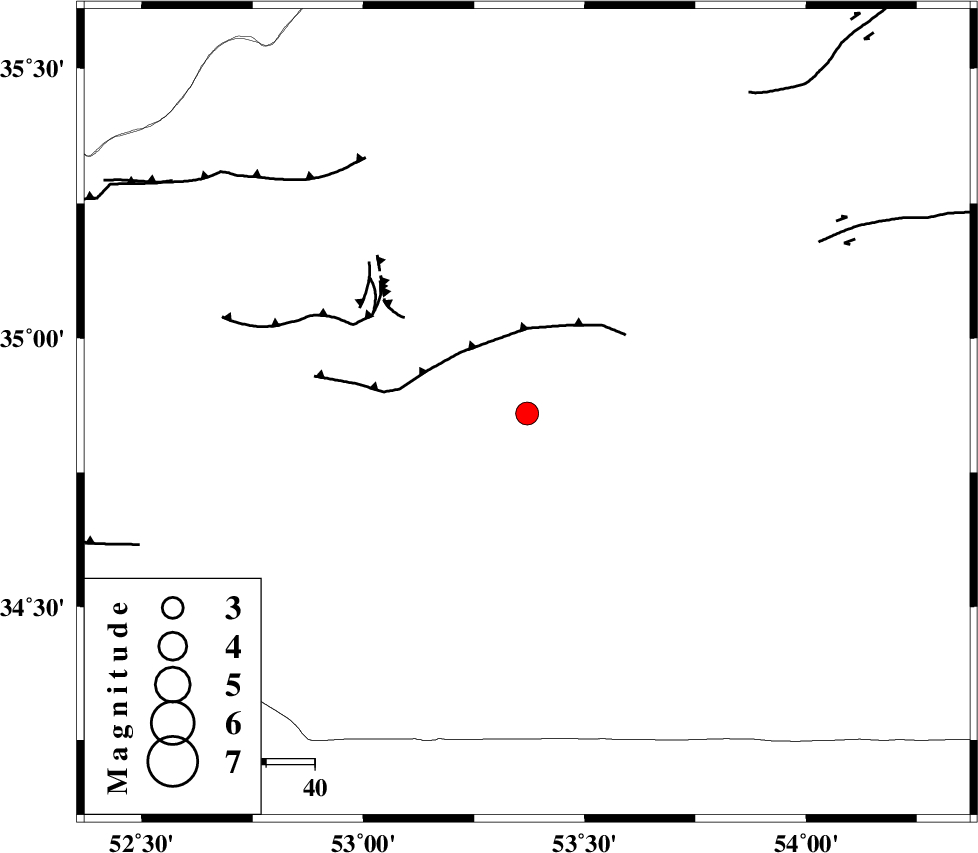
| Location | Lat:34.86 Lon: 53.37 |
| Region | Semnan Province, 79 km South of Semnan |
Nearest Cities |
|
| 66 km South East of Lasjerd, Semnan Province | |
| 68 km South East of Sorkheh, Semnan Province | |
| 76 km South West of Alae, Semnan Province | |
| 79 km South of Semnan, Semnan Province | |
| 85 km South East of Kohanabad, Semnan Province | |
| Depth | 15 km |
| Agency | |
Faults within 150 km: |
|
| KUH_E_GUGERD_F (Length: 73 km) , Distance to epicenter: 18 km | |
| KUH_E_GACHAB_F1 (Length: 53 km) , Distance to epicenter: 38 km | |
| KUH_E_GACHAB_F2 (Length: 31 km) , Distance to epicenter: 45 km | |
| Number of Phases | 6 |
| RMS | 0.3 |
| Number of Stations | 6 |
| Error in Latitude | >4 km |
| Error in Longitude | 2.2 km |
| Error in Depth | 0 km |
Download waveform in seisan format
to download seisan software Click here
to access information about IIEES stations Click here
Amplitude | ||||||||
| UID | Agency | Station | Component | Amplitude | Period | Arrival Time | Proccessing Time | Signal Clip |
| 87776 | IIEES | GHVR | N | 260.5 | 0.72 | 2013-01-30 01:57:38 | 2013-01-30 02:34:00 | n |
Phase | ||||||||||||
| Agency | Station | Component | Phase Type | Phase Quality | First Motion | Observed Arrival Time | Time Residual | Loc. Flag | Input Weight | Distance | Azimuth | |
| IIEES | GHVR | Z | Pn | E | 2013-01-30 01:57:10 | -0.31 | y | 199 | 258 | |||
| IIEES | CHTH | Z | Pn | E | 2013-01-30 01:57:15 | -0.22 | y | 235 | 300 | |||
| IIEES | SHRO | Z | Pn | E | 2013-01-30 01:57:20 | 0.09 | y | 272 | 61 | |||
| IIEES | YZKH | Z | Pn | E | 2013-01-30 01:57:23 | -0.1 | y | 297 | 157 | |||
| IIEES | ASAO | Z | Pn | E | 2013-01-30 01:57:25 | 0.48 | y | 308 | 264 | |||
| IIEES | KHMZ | Z | Pn | E | 2013-01-30 01:57:28 | 0.11 | y | 337 | 249 | |||