
Magnitude |
2.8 |
| Date & Time (UTC) | 2013-02-05 21:40:24.1 |
| Date & Time (Local) | 1391/11/18 01:10:24.1 |
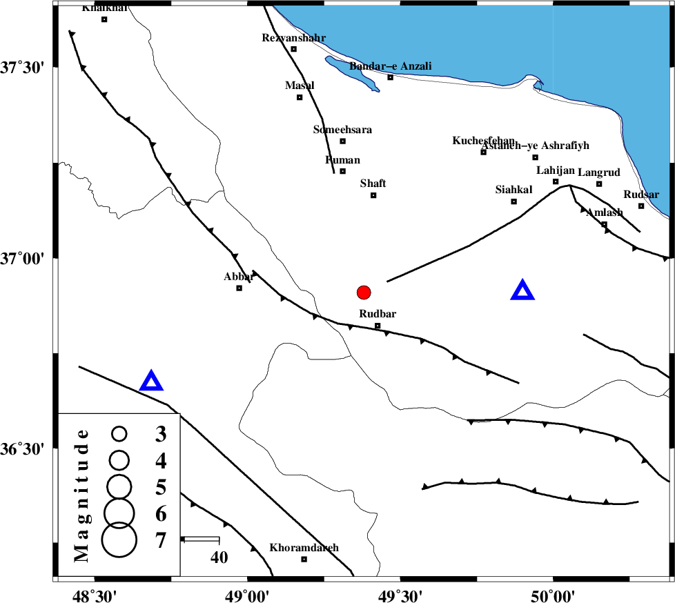
| Location | Lat:36.91 Lon: 49.38 |
| Region | Gilan Province, 11 km Rudbar |
Nearest Cities |
|
| 10 km North of Rostamabad, Gilan Province | |
| 11 km North of Rudbar, Gilan Province | |
| 13 km West of Nasir mahalleh, Gilan Province | |
| 19 km North of Manjil, Gilan Province | |
| 22 km South East of Siyahmargi, Gilan Province | |
| Depth | 17 km |
| Agency | |
Faults within 150 km: |
|
| LAHIJAN_F (Length: 92 km) , Distance to epicenter: 7 km | |
| RUDBAR_F (Length: 93 km) , Distance to epicenter: 11 km | |
| MASULEL_F (Length: 90 km) , Distance to epicenter: 33 km | |
| Number of Phases | 5 |
| RMS | 0.2 |
| Number of Stations | 4 |
| Error in Latitude | >3.4 km |
| Error in Longitude | 3.3 km |
| Error in Depth | 4.9 km |
Download waveform in seisan format
to download seisan software Click here
to access information about IIEES stations Click here
Amplitude | ||||||||
| UID | Agency | Station | Component | Amplitude | Period | Arrival Time | Proccessing Time | Signal Clip |
| 87802 | IIEES | THKV | N | 118.4 | 0.2 | 2013-02-05 21:41:15 | 2013-02-05 09:56:00 | n |
Phase | ||||||||||||
| Agency | Station | Component | Phase Type | Phase Quality | First Motion | Observed Arrival Time | Time Residual | Loc. Flag | Input Weight | Distance | Azimuth | |
| IIEES | ZNJK | Z | Pg | E | 2013-02-05 21:40:36 | -0.04 | y | 67.9 | 247 | |||
| IIEES | THKV | Z | Pg | E | 2013-02-05 21:40:53 | 0.12 | y | 174 | 129 | |||
| IIEES | CHTH | Z | Pn | E | 2013-02-05 21:40:55 | -0.23 | y | 192 | 125 | |||
| IIEES | ASAO | Z | Pn | E | 2013-02-05 21:41:05 | 0.23 | y | 269 | 167 | |||
| IIEES | ASAO | E | Sg | E | 2013-02-05 21:41:39 | -0.08 | y | 269 | 167 | |||