
Magnitude |
2.4 |
| Date & Time (UTC) | 2013-02-15 23:42:43.8 |
| Date & Time (Local) | 1391/11/28 03:12:43.8 |
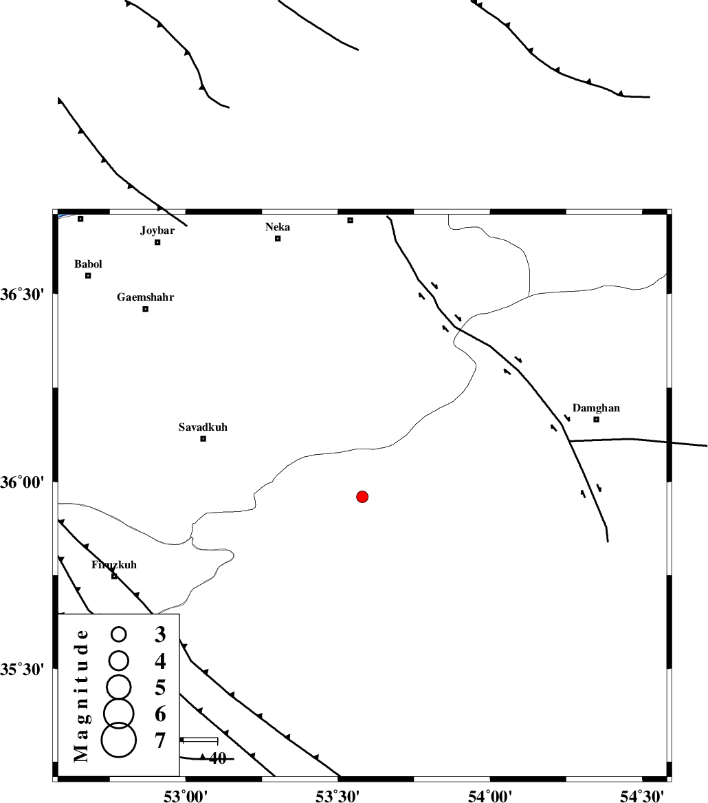
| Location | Lat:35.96 Lon: 53.58 |
| Region | Semnan Province, 46 km North-East of Semnan |
Nearest Cities |
|
| 29 km North East of Chashem, Semnan Province | |
| 30 km South West of Talma darreh, Mazandaran Province | |
| 30 km West of Darvar, Semnan Province | |
| 31 km South of Kiasar, Mazandaran Province | |
| 32 km North East of Shahmirzad, Semnan Province | |
| Depth | 15 km |
| Agency | |
Faults within 150 km: |
|
| ATARI_F (Length: 185 km) , Distance to epicenter: 24 km | |
| DAMGHAN_F (Length: 95 km) , Distance to epicenter: 31 km | |
| N_ALBORZ_F (Length: 360 km) , Distance to epicenter: 42 km | |
| Number of Phases | 4 |
| RMS | 0.2 |
| Number of Stations | 5 |
| Error in Latitude | >6.5 km |
| Error in Longitude | 1.7 km |
| Error in Depth | 0 km |
Download waveform in seisan format
to download seisan software Click here
to access information about IIEES stations Click here
Amplitude | ||||||||
| UID | Agency | Station | Component | Amplitude | Period | Arrival Time | Proccessing Time | Signal Clip |
| 87930 | IIEES | THKV | N | 22 | 0.4 | 2013-02-15 23:44:02 | 2013-02-16 04:04:00 | n |
| 87931 | IIEES | GHVR | N | 19.1 | 0.4 | 2013-02-15 23:44:08 | 2013-02-16 04:04:00 | n |
Phase | ||||||||||||
| Agency | Station | Component | Phase Type | Phase Quality | First Motion | Observed Arrival Time | Time Residual | Loc. Flag | Input Weight | Distance | Azimuth | |
| IIEES | SHRO | Z | Pn | E | 2013-02-15 23:43:18 | -0.23 | y | 220 | 88 | |||
| IIEES | CHTH | Z | Pn | E | 2013-02-15 23:43:18 | -0.25 | y | 221 | 269 | |||
| IIEES | GHVR | Z | Pn | E | 2013-02-15 23:43:25 | 0.25 | y | 268 | 233 | |||
| IIEES | MRVT | Z | Pn | E | 2013-02-15 23:43:28 | 0.25 | y | 293 | 49 | |||