
Magnitude |
2.3 |
| Date & Time (UTC) | 2013-02-23 19:27:23.6 |
| Date & Time (Local) | 1391/12/5 22:57:23.6 |
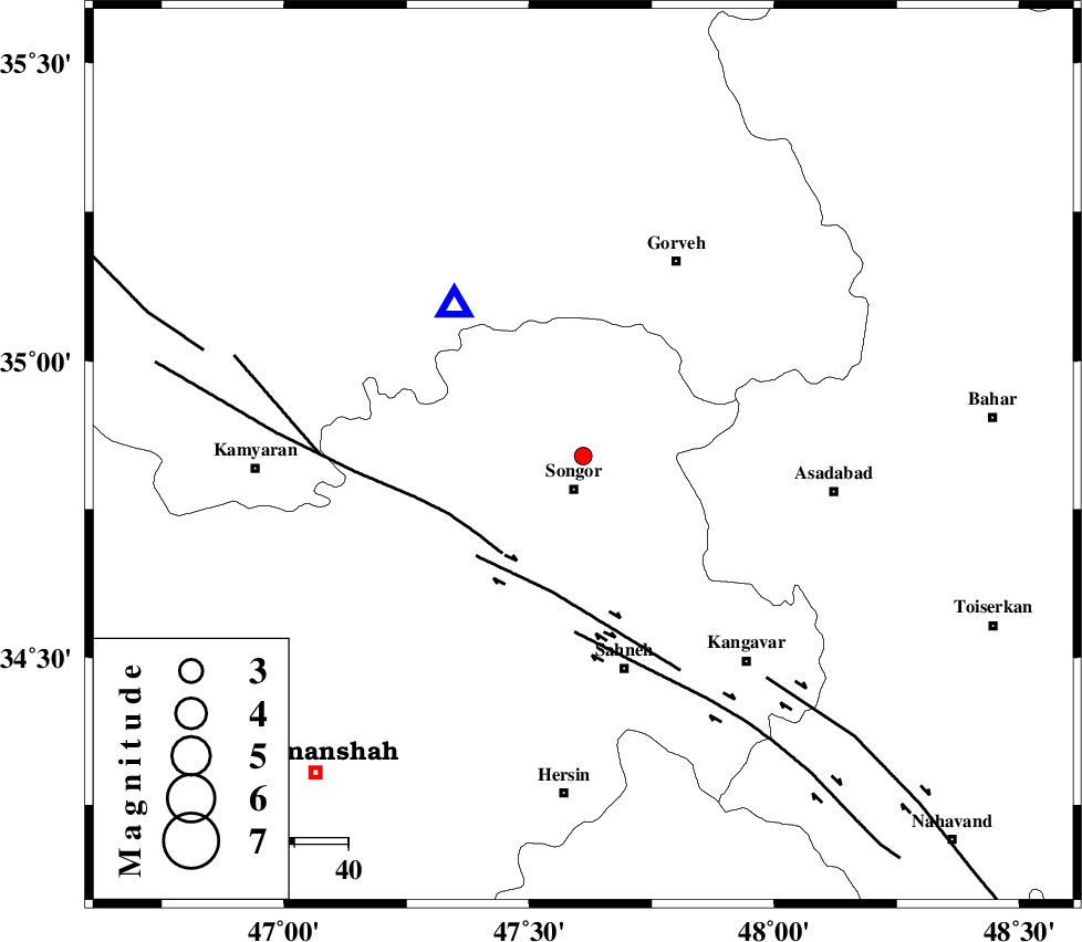
| Location | Lat:34.84 Lon: 47.61 |
| Region | Kermanshah Province, 7 km Sonqor |
Nearest Cities |
|
| 6 km North of Sonqor, Kermanshah Province | |
| 9 km of Qamam, Kermanshah Province | |
| 10 km of Bavoleh, Kermanshah Province | |
| 14 km North of Gaznahleh, Kermanshah Province | |
| 14 km North West of Abbarik-e olia, Kermanshah Province | |
| Depth | 14 km |
| Agency | |
Faults within 150 km: |
|
| SARTAKHT_F (Length: 78 km) , Distance to epicenter: 24 km | |
| DINEHVAR_F (Length: 46 km) , Distance to epicenter: 26 km | |
| SAHANEH_F (Length: 77 km) , Distance to epicenter: 33 km | |
| Number of Phases | 5 |
| RMS | 0.2 |
| Number of Stations | 3 |
| Error in Latitude | >6.1 km |
| Error in Longitude | 4.6 km |
| Error in Depth | 5.2 km |
Download waveform in seisan format
to download seisan software Click here
to access information about IIEES stations Click here
Amplitude | ||||||||
| UID | Agency | Station | Component | Amplitude | Period | Arrival Time | Proccessing Time | Signal Clip |
| 88012 | IIEES | KHMZ | E | 16.2 | 0.4 | 2013-02-23 19:28:40 | 2013-02-24 12:31:00 | n |
Phase | ||||||||||||
| Agency | Station | Component | Phase Type | Phase Quality | First Motion | Observed Arrival Time | Time Residual | Loc. Flag | Input Weight | Distance | Azimuth | |
| IIEES | SNGE | Z | Pg | E | 2013-02-23 19:27:30 | -0.13 | y | 37 | 319 | |||
| IIEES | ASAO | Z | Pn | E | 2013-02-23 19:27:59 | 0.34 | y | 223 | 98 | |||
| IIEES | ASAO | E | Sg | E | 2013-02-23 19:28:27 | -0.08 | y | 223 | 98 | |||
| IIEES | KHMZ | E | Pn | E | 2013-02-23 19:28:02 | 0.02 | y | 249 | 119 | |||
| IIEES | KHMZ | N | Sg | E | 2013-02-23 19:28:33 | -0.14 | y | 249 | 119 | |||