
Magnitude |
2.5 |
| Date & Time (UTC) | 2013-02-26 00:54:54.3 |
| Date & Time (Local) | 1391/12/8 04:24:54.3 |
| Location | Lat:29.74 Lon: 51.43 |
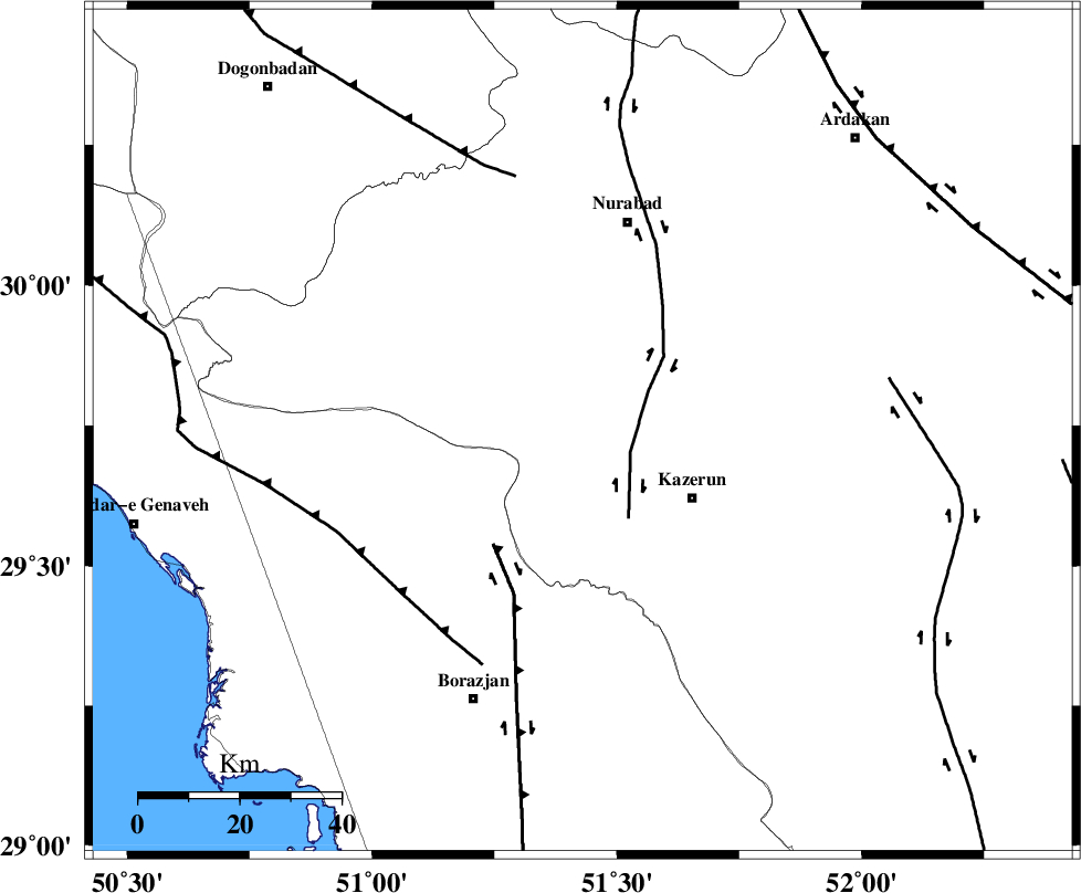
| Region | Fars Province, 26 km North-West of Kazerun |
Nearest Cities |
|
| 13 km North of Kamaraj, Fars Province | |
| 15 km North West of Deris, Fars Province | |
| 20 km West of Seyyed hasan, Fars Province | |
| 22 km North of Khesht, Fars Province | |
| 25 km North West of Kazerun, Fars Province | |
| Depth | 18 km |
| Agency | |
Faults within 150 km: |
|
| KAZERUN_F (Length: 96 km) , Distance to epicenter: 10 km | |
| BORAZJAN_F (Length: 168 km) , Distance to epicenter: 29 km | |
| ZFF3 (Length: 125 km) , Distance to epicenter: 48 km | |
| Number of Phases | 4 |
| RMS | 0.1 |
| Number of Stations | 3 |
| Error in Latitude | >3.3 km |
| Error in Longitude | 3.1 km |
| Error in Depth | 6.3 km |
Download waveform in seisan format
to download seisan software Click here
to access information about IIEES stations Click here
Amplitude | ||||||||
| UID | Agency | Station | Component | Amplitude | Period | Arrival Time | Proccessing Time | Signal Clip |
| 88034 | IIEES | AHRM | E | 149.8 | 0.48 | 2013-02-26 00:55:28 | 2013-02-26 03:51:00 | n |
| 88035 | IIEES | AHRM | N | 130.5 | 0.28 | 2013-02-26 00:55:29 | 2013-02-26 03:51:00 | n |
| 88036 | IIEES | GHIR | N | 30 | 0.4 | 2013-02-26 00:56:07 | 2013-02-26 03:51:00 | n |
| 88037 | IIEES | GHIR | E | 34.6 | 0.36 | 2013-02-26 00:56:17 | 2013-02-26 03:51:00 | n |
Phase | ||||||||||||
| Agency | Station | Component | Phase Type | Phase Quality | First Motion | Observed Arrival Time | Time Residual | Loc. Flag | Input Weight | Distance | Azimuth | |
| IIEES | AHRM | Z | Pg | E | 2013-02-26 00:55:10 | 0.04 | y | 97.5 | 187 | |||
| IIEES | GHIR | Z | Pn | E | 2013-02-26 00:55:29 | -0.13 | y | 222 | 136 | |||
| IIEES | GHIR | N | Sg | E | 2013-02-26 00:55:57 | 0.04 | y | 222 | 136 | |||
| IIEES | YZKH | Z | Pn | E | 2013-02-26 00:55:54 | 0.06 | y | 422 | 45 | |||