
Magnitude |
3.2 |
| Date & Time (UTC) | 2013-02-27 11:21:26.1 |
| Date & Time (Local) | 1391/12/9 14:51:26.1 |
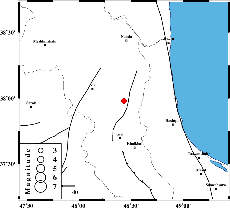
| Location | Lat:37.98 Lon: 48.43 |
| Region | Ardebil Province, 32 km North of Givi |
Nearest Cities |
|
| 8 km of Budalalu, Ardebil Province | |
| 11 km of Mehmandust, Ardebil Province | |
| 15 km North East of Kuraeim, Ardebil Province | |
| 19 km South of Hir, Ardebil Province | |
| 28 km East of Nir, Ardebil Province | |
| Depth | 14 km |
| Agency | |
Faults within 150 km: |
|
| SANGAVAR_F (Length: 61 km) , Distance to epicenter: 4 km | |
| BOZQUSH (Length: 70 km) , Distance to epicenter: 34 km | |
| MASULEL_F (Length: 90 km) , Distance to epicenter: 43 km | |
| Number of Phases | 7 |
| RMS | 0.1 |
| Number of Stations | 6 |
| Error in Latitude | >2.5 km |
| Error in Longitude | 3.8 km |
| Error in Depth | 4.3 km |
Download waveform in seisan format
to download seisan software Click here
to access information about IIEES stations Click here
Amplitude | ||||||||
| UID | Agency | Station | Component | Amplitude | Period | Arrival Time | Proccessing Time | Signal Clip |
| 88046 | IIEES | ZNJK | E | 337.5 | 0.36 | 2013-02-27 11:22:12 | 2013-02-27 11:43:00 | n |
| 88047 | IIEES | THKV | N | 96.3 | 0.6 | 2013-02-27 11:22:58 | 2013-02-27 11:43:00 | n |
Phase | ||||||||||||
| Agency | Station | Component | Phase Type | Phase Quality | First Motion | Observed Arrival Time | Time Residual | Loc. Flag | Input Weight | Distance | Azimuth | |
| IIEES | GRMI | Z | Pg | E | 2013-02-27 11:21:43 | -0.11 | y | 104 | 333 | |||
| IIEES | GRMI | E | Sg | E | 2013-02-27 11:21:56 | 0.08 | y | 104 | 333 | |||
| IIEES | THKV | Z | Pn | E | 2013-02-27 11:22:13 | -0.07 | y | 316 | 136 | |||
| IIEES | CHTH | Z | Pn | E | 2013-02-27 11:22:15 | 0.19 | y | 332 | 133 | |||
| IIEES | CHTH | N | Sg | E | 2013-02-27 11:22:59 | -0.03 | y | 332 | 133 | |||
| IIEES | SNGE | Z | Pn | E | 2013-02-27 11:22:15 | -0.02 | y | 334 | 197 | |||
| IIEES | ASAO | Z | Pn | E | 2013-02-27 11:22:24 | -0.04 | y | 406 | 159 | |||