
Magnitude |
3.4 |
| Date & Time (UTC) | 2013-03-04 05:00:21.3 |
| Date & Time (Local) | 1391/12/14 08:30:21.3 |
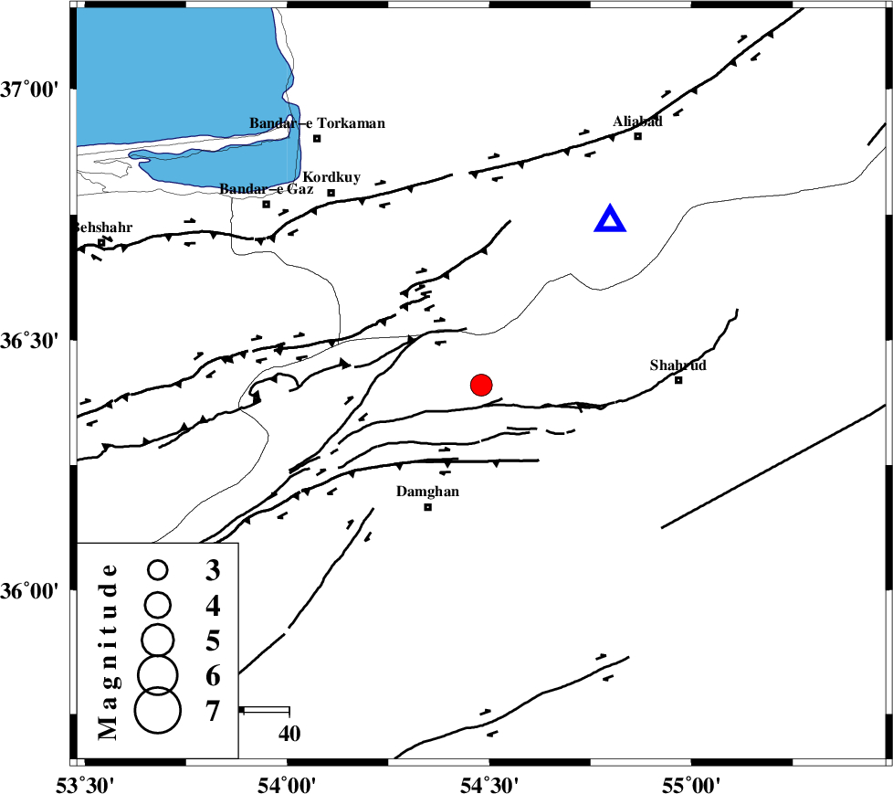
| Location | Lat:36.41 Lon: 54.48 |
| Region | Semnan Province, 29 km North-East of Damghan |
Nearest Cities |
|
| 16 km South of Cheharbagh, Golestan Province | |
| 17 km West of Majen, Semnan Province | |
| 22 km North of Mehmandust, Semnan Province | |
| 29 km South of Naharkhoran, Golestan Province | |
| 30 km North East of Damghan, Semnan Province | |
| Depth | 14 km |
| Agency | |
Faults within 150 km: |
|
| ASTANEH_F (Length: 72 km) , Distance to epicenter: 11 km | |
| DAMGHAN_F (Length: 95 km) , Distance to epicenter: 16 km | |
| SHAVAR_F (Length: 87 km) , Distance to epicenter: 19 km | |
| Number of Phases | 6 |
| RMS | 0.1 |
| Number of Stations | 7 |
| Error in Latitude | >3.5 km |
| Error in Longitude | 3.7 km |
| Error in Depth | 8.6 km |
Download waveform in seisan format
to download seisan software Click here
to access information about IIEES stations Click here
Amplitude | ||||||||
| UID | Agency | Station | Component | Amplitude | Period | Arrival Time | Proccessing Time | Signal Clip |
| 88086 | IIEES | THKV | N | 107.8 | 0.52 | 2013-03-04 05:02:01 | 2013-03-04 05:24:00 | n |
Phase | ||||||||||||
| Agency | Station | Component | Phase Type | Phase Quality | First Motion | Observed Arrival Time | Time Residual | Loc. Flag | Input Weight | Distance | Azimuth | |
| IIEES | SHRO | Z | Pg | E | 2013-03-04 05:00:45 | 0.01 | y | 145 | 107 | |||
| IIEES | MRVT | Z | Pg | E | 2013-03-04 05:00:54 | -0.02 | y | 200 | 45 | |||
| IIEES | GHVR | Z | Pn | E | 2013-03-04 05:01:14 | 0.15 | y | 363 | 235 | |||
| IIEES | TABS | Z | Pn | E | 2013-03-04 05:01:17 | 0.11 | y | 389 | 141 | |||
| IIEES | YZKH | Z | Pn | E | 2013-03-04 05:01:24 | -0.18 | y | 445 | 179 | |||
| IIEES | ASAO | Z | Pn | E | 2013-03-04 05:01:25 | -0.1 | y | 454 | 244 | |||