
Magnitude |
2.9 |
| Date & Time (UTC) | 2013-03-05 15:48:40.3 |
| Date & Time (Local) | 1391/12/15 19:18:40.3 |
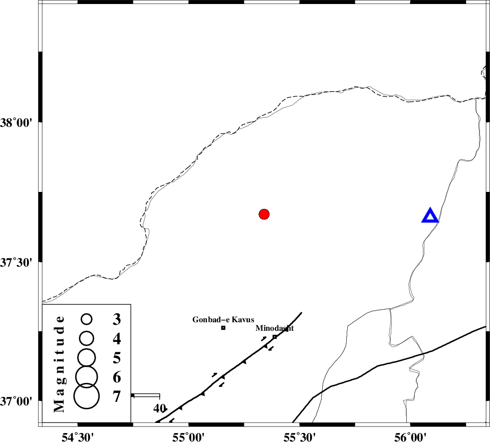
| Location | Lat:37.67 Lon: 55.34 |
| Region | Golestan Province, 35 km North-West of Kalaleh |
Nearest Cities |
|
| 18 km South West of Qareh aghaj, Golestan Province | |
| 25 km North West of Tamarqarquzi-e sofla, Golestan Province | |
| 30 km North West of Pashikmar, Golestan Province | |
| 34 km North West of Ajen sangarli, Golestan Province | |
| 34 km North of Kangur, Golestan Province | |
| Depth | 14 km |
| Agency | |
Faults within 150 km: |
|
| ROBATE_QARABIL_F (Length: 168 km) , Distance to epicenter: 74 km | |
| KHAZAR_F (Length: 523 km) , Distance to epicenter: 81 km | |
| SHAVAR_F (Length: 87 km) , Distance to epicenter: 100 km | |
| Number of Phases | 5 |
| RMS | 0 |
| Number of Stations | 4 |
| Error in Latitude | >2.2 km |
| Error in Longitude | 3.6 km |
| Error in Depth | 4.9 km |
Download waveform in seisan format
to download seisan software Click here
to access information about IIEES stations Click here
Amplitude | ||||||||
| UID | Agency | Station | Component | Amplitude | Period | Arrival Time | Proccessing Time | Signal Clip |
| 88108 | IIEES | MRVT | N | 563.8 | 0.2 | 2013-03-05 15:49:00 | 2013-03-05 04:21:00 | n |
| 88109 | IIEES | BJRD | N | 131.9 | 0.36 | 2013-03-05 15:49:38 | 2013-03-05 04:21:00 | n |
Phase | ||||||||||||
| Agency | Station | Component | Phase Type | Phase Quality | First Motion | Observed Arrival Time | Time Residual | Loc. Flag | Input Weight | Distance | Azimuth | |
| IIEES | MRVT | Z | Pg | E | 2013-03-05 15:48:51 | -0.05 | y | 66.4 | 91 | |||
| IIEES | MRVT | E | Sg | E | 2013-03-05 15:49:00 | 0.03 | y | 66.4 | 91 | |||
| IIEES | SHRO | Z | Pg | E | 2013-03-05 15:49:12 | 0.04 | y | 194 | 162 | |||
| IIEES | SHRO | N | Sg | E | 2013-03-05 15:49:35 | -0.02 | y | 194 | 162 | |||
| IIEES | TABS | Z | Pn | E | 2013-03-05 15:49:46 | 0 | y | 475 | 160 | |||