
Magnitude |
2.6 |
| Date & Time (UTC) | 2013-03-07 19:58:54.8 |
| Date & Time (Local) | 1391/12/17 23:28:54.8 |
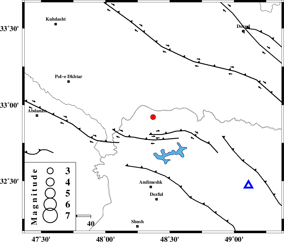
| Location | Lat:32.92 Lon: 48.37 |
| Region | Khoozestan Province, 51 km North of Andimeshk |
Nearest Cities |
|
| 17 km North of Sorkhakan, Khoozestan Province | |
| 22 km North East of Bidruyeh, Khoozestan Province | |
| 29 km North East of Hoseinieh, Khoozestan Province | |
| 43 km North West of Shuy, Khoozestan Province | |
| 51 km South West of Chamsangar, Lorestan Province | |
| Depth | 14 km |
| Agency | |
Faults within 150 km: |
|
| BALARUD_F_Z2 (Length: 58 km) , Distance to epicenter: 13 km | |
| BALARUD_F_Z3 (Length: 53 km) , Distance to epicenter: 17 km | |
| BALARUD_F_Z1 (Length: 87 km) , Distance to epicenter: 31 km | |
| Number of Phases | 4 |
| RMS | 0 |
| Number of Stations | 4 |
| Error in Latitude | >2.4 km |
| Error in Longitude | 4.5 km |
| Error in Depth | 6.4 km |
Download waveform in seisan format
to download seisan software Click here
to access information about IIEES stations Click here
Amplitude | ||||||||
| UID | Agency | Station | Component | Amplitude | Period | Arrival Time | Proccessing Time | Signal Clip |
| 88126 | IIEES | SHGR | E | 365.3 | 0.92 | 2013-03-07 19:59:42 | 2013-03-08 03:37:00 | n |
| 88127 | IIEES | SHGR | N | 139.9 | 0.68 | 2013-03-07 19:59:45 | 2013-03-08 03:37:00 | n |
| 88128 | IIEES | KHMZ | E | 47.1 | 0.52 | 2013-03-07 19:59:55 | 2013-03-08 03:37:00 | n |
Phase | ||||||||||||
| Agency | Station | Component | Phase Type | Phase Quality | First Motion | Observed Arrival Time | Time Residual | Loc. Flag | Input Weight | Distance | Azimuth | |
| IIEES | SHGR | Z | Pg | E | 2013-03-07 19:59:11 | 0 | y | 98.6 | 156 | |||
| IIEES | KHMZ | Z | Pg | E | 2013-03-07 19:59:23 | -0.04 | y | 174 | 58 | |||
| IIEES | ASAO | Z | Pn | E | 2013-03-07 19:59:32 | 0.06 | y | 237 | 40 | |||
| IIEES | SNGE | Z | Pn | E | 2013-03-07 19:59:34 | -0.02 | y | 259 | 339 | |||