
Magnitude |
2.6 |
| Date & Time (UTC) | 2013-03-08 16:09:30.6 |
| Date & Time (Local) | 1391/12/18 19:39:30.6 |
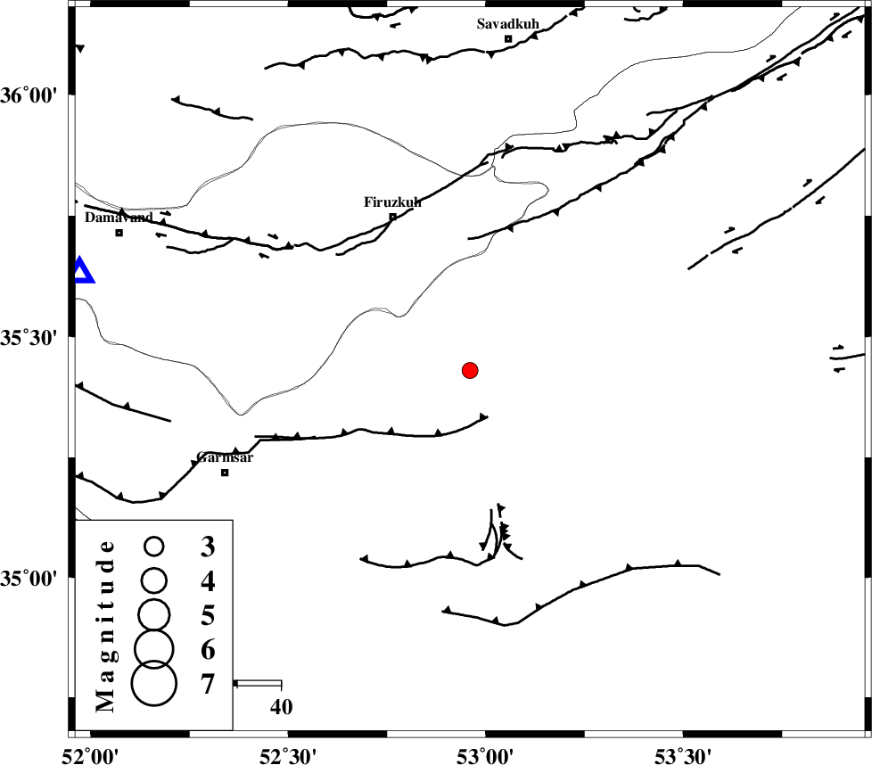
| Location | Lat:35.43 Lon: 52.96 |
| Region | Semnan Province, 40 km South-East of Firuzkuh |
Nearest Cities |
|
| 12 km North West of Lasjerd, Semnan Province | |
| 23 km West of Sorkheh, Semnan Province | |
| 23 km South West of Aftar, Semnan Province | |
| 36 km South East of Atashan, Tehran Province | |
| 40 km South East of Firuzkuh, Tehran Province | |
| Depth | 40 km |
| Agency | |
Faults within 150 km: |
|
| KUH_E_GACHAB_F2 (Length: 31 km) , Distance to epicenter: 25 km | |
| ATARI_F (Length: 185 km) , Distance to epicenter: 30 km | |
| KUH_E_GACHAB_F1 (Length: 53 km) , Distance to epicenter: 31 km | |
| Number of Phases | 6 |
| RMS | 0.1 |
| Number of Stations | 4 |
| Error in Latitude | >2.3 km |
| Error in Longitude | 2.7 km |
| Error in Depth | 4.1 km |
Download waveform in seisan format
to download seisan software Click here
to access information about IIEES stations Click here
Amplitude | ||||||||
| UID | Agency | Station | Component | Amplitude | Period | Arrival Time | Proccessing Time | Signal Clip |
| 88134 | IIEES | CHTH | E | 42.6 | 0.44 | 2013-03-08 16:10:24 | 2013-03-08 04:30:00 | n |
| 88135 | IIEES | CHTH | N | 53.5 | 0.4 | 2013-03-08 16:10:26 | 2013-03-08 04:30:00 | n |
| 88136 | IIEES | GHVR | E | 149.6 | 0.4 | 2013-03-08 16:10:26 | 2013-03-08 04:30:00 | n |
| 88137 | IIEES | ASAO | E | 23.1 | 0.4 | 2013-03-08 16:10:51 | 2013-03-08 04:30:00 | n |
Phase | ||||||||||||
| Agency | Station | Component | Phase Type | Phase Quality | First Motion | Observed Arrival Time | Time Residual | Loc. Flag | Input Weight | Distance | Azimuth | |
| IIEES | CHTH | Z | Pn | E | 2013-03-08 16:09:57 | 0.03 | y | 175 | 288 | |||
| IIEES | CHTH | N | Sg | E | 2013-03-08 16:10:20 | -0.04 | y | 175 | 288 | |||
| IIEES | GHVR | Z | Pn | E | 2013-03-08 16:09:59 | -0.23 | y | 189 | 237 | |||
| IIEES | GHVR | N | Sg | E | 2013-03-08 16:10:23 | 0.04 | y | 189 | 237 | |||
| IIEES | SHRO | Z | Pn | E | 2013-03-08 16:10:11 | 0.01 | y | 283 | 76 | |||
| IIEES | ASAO | Z | Pn | E | 2013-03-08 16:10:11 | 0.2 | y | 285 | 251 | |||