
Magnitude |
2.2 |
| Date & Time (UTC) | 2013-03-09 09:46:51.3 |
| Date & Time (Local) | 1391/12/19 13:16:51.3 |
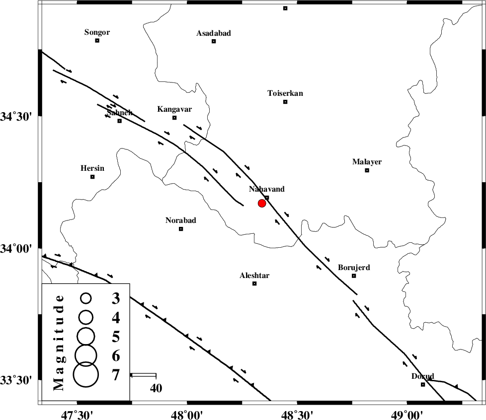
| Location | Lat:34.17 Lon: 48.34 |
| Region | Hamedan Province, 3 km Nahavand |
Nearest Cities |
|
| 3 km of Nahavand, Hamedan Province | |
| 7 km of Dehghul, Hamedan Province | |
| 9 km of Gian, Hamedan Province | |
| 9 km of Barzul, Hamedan Province | |
| 16 km North West of Babaqasem, Hamedan Province | |
| Depth | 14 km |
| Agency | |
Faults within 150 km: |
|
| NAHAVAND_F (Length: 102 km) , Distance to epicenter: 7 km | |
| SAHANEH_F (Length: 77 km) , Distance to epicenter: 8 km | |
| DORUD (Length: 100 km) , Distance to epicenter: 56 km | |
| Number of Phases | 4 |
| RMS | 0 |
| Number of Stations | 4 |
| Error in Latitude | >5.3 km |
| Error in Longitude | 3.6 km |
| Error in Depth | 4.1 km |
Download waveform in seisan format
to download seisan software Click here
to access information about IIEES stations Click here
Amplitude | ||||||||
| UID | Agency | Station | Component | Amplitude | Period | Arrival Time | Proccessing Time | Signal Clip |
| 88151 | IIEES | SNGE | N | 41.1 | 0.43 | 2013-03-09 09:47:35 | 2013-03-09 10:12:00 | n |
| 88152 | IIEES | KHMZ | N | 28.9 | 0.63 | 2013-03-09 09:47:42 | 2013-03-09 10:12:00 | n |
| 88153 | IIEES | GHVR | N | 11.6 | 0.47 | 2013-03-09 09:48:16 | 2013-03-09 10:12:00 | n |
Phase | ||||||||||||
| Agency | Station | Component | Phase Type | Phase Quality | First Motion | Observed Arrival Time | Time Residual | Loc. Flag | Input Weight | Distance | Azimuth | |
| IIEES | SNGE | Z | Pg | E | 2013-03-09 09:47:14 | 0 | y | 136 | 319 | |||
| IIEES | KHMZ | Z | Pg | E | 2013-03-09 09:47:17 | -0.01 | y | 158 | 107 | |||
| IIEES | ASAO | Z | Pg | E | 2013-03-09 09:47:18 | -0.02 | y | 161 | 75 | |||
| IIEES | GHVR | Z | Pn | E | 2013-03-09 09:47:32 | 0.03 | y | 270 | 82 | |||