
Magnitude |
2.6 |
| Date & Time (UTC) | 2013-03-15 02:03:12.0 |
| Date & Time (Local) | 1391/12/25 05:33:12.0 |
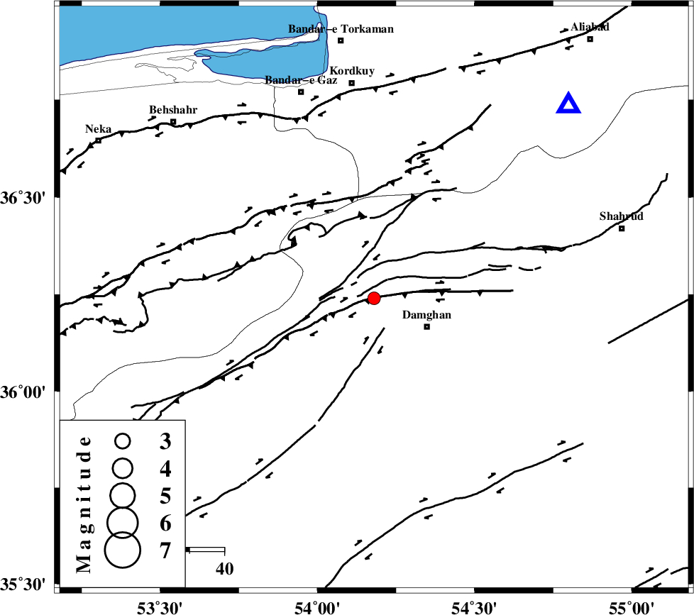
| Location | Lat:36.24 Lon: 54.18 |
| Region | Semnan Province, 17 km West of Damghan |
Nearest Cities |
|
| 17 km North West of Damghan, Semnan Province | |
| 21 km North of Seydabad, Semnan Province | |
| 24 km North of Amirabad, Semnan Province | |
| 34 km North West of Mehmandust, Semnan Province | |
| 36 km North East of Darvar, Semnan Province | |
| Depth | 31 km |
| Agency | |
Faults within 150 km: |
|
| DAMGHAN_F (Length: 95 km) , Distance to epicenter: 7 km | |
| ASTANEH_F (Length: 72 km) , Distance to epicenter: 9 km | |
| ATARI_F (Length: 185 km) , Distance to epicenter: 11 km | |
| Number of Phases | 7 |
| RMS | 0.3 |
| Number of Stations | 6 |
| Error in Latitude | >5.5 km |
| Error in Longitude | 3.5 km |
| Error in Depth | 9.2 km |
Download waveform in seisan format
to download seisan software Click here
to access information about IIEES stations Click here
Amplitude | ||||||||
| UID | Agency | Station | Component | Amplitude | Period | Arrival Time | Proccessing Time | Signal Clip |
| 88211 | IIEES | GHVR | N | 19.4 | 0.4 | 2013-03-15 02:04:50 | 2013-03-15 02:38:00 | n |
| 88212 | IIEES | GHVR | E | 21 | 0.44 | 2013-03-15 02:04:52 | 2013-03-15 02:38:00 | n |
Phase | ||||||||||||
| Agency | Station | Component | Phase Type | Phase Quality | First Motion | Observed Arrival Time | Time Residual | Loc. Flag | Input Weight | Distance | Azimuth | |
| IIEES | SHRO | Z | Pn | E | 2013-03-15 02:03:38 | -0.05 | y | 167 | 98 | |||
| IIEES | SHRO | N | Sg | E | 2013-03-15 02:03:59 | 0 | y | 167 | 98 | |||
| IIEES | DAMV | Z | Pn | E | 2013-03-15 02:03:44 | -0.53 | y | 211 | 252 | |||
| IIEES | MRVT | Z | Pn | E | 2013-03-15 02:03:46 | 0.04 | y | 231 | 47 | |||
| IIEES | CHTH | Z | Pn | E | 2013-03-15 02:03:53 | 0.27 | y | 278 | 263 | |||
| IIEES | GHVR | Z | Pn | E | 2013-03-15 02:03:59 | 0.3 | y | 331 | 235 | |||
| IIEES | TABS | Z | Pn | E | 2013-03-15 02:04:07 | 0.02 | y | 393 | 136 | |||