
Magnitude |
3.1 |
| Date & Time (UTC) | 2013-03-16 19:33:38.1 |
| Date & Time (Local) | 1391/12/26 23:03:38.1 |
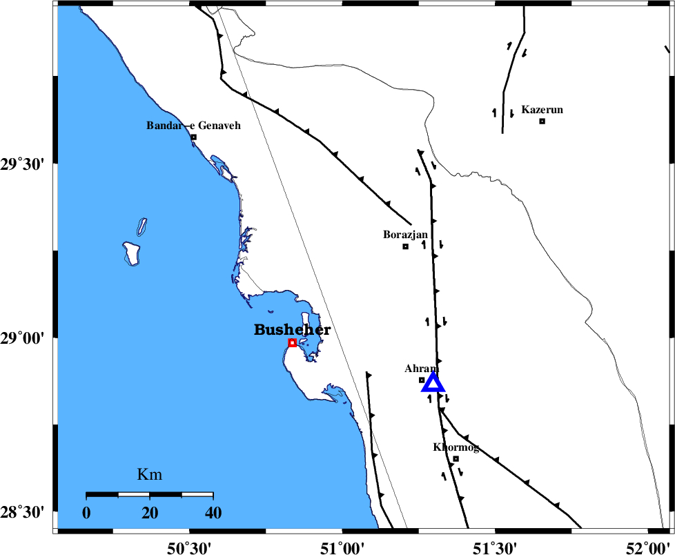
| Location | Lat:29.2 Lon: 51.07 |
| Region | Bushehr Province, 15 km West of Borazjan |
Nearest Cities |
|
| 9 km of Ziyarat, Bushehr Province | |
| 13 km North West of Sarkareh, Bushehr Province | |
| 15 km East of Shabankareh, Bushehr Province | |
| 15 km West of Borazjan, Bushehr Province | |
| 16 km East of Kareband, Bushehr Province | |
| Depth | 17 km |
| Agency | |
Faults within 150 km: |
|
| ZFF3 (Length: 125 km) , Distance to epicenter: 20 km | |
| BORAZJAN_F (Length: 168 km) , Distance to epicenter: 23 km | |
| ZFF2 (Length: 84 km) , Distance to epicenter: 33 km | |
| Number of Phases | 5 |
| RMS | 0.1 |
| Number of Stations | 3 |
| Error in Latitude | >7.9 km |
| Error in Longitude | 3.7 km |
| Error in Depth | 15.6 km |
Download waveform in seisan format
to download seisan software Click here
to access information about IIEES stations Click here
Amplitude | ||||||||
| UID | Agency | Station | Component | Amplitude | Period | Arrival Time | Proccessing Time | Signal Clip |
| 88237 | IIEES | AHRM | N | 879.2 | 0.6 | 2013-03-16 19:33:56 | 2013-03-16 07:49:00 | n |
| 88238 | IIEES | AHRM | E | 908.5 | 0.32 | 2013-03-16 19:33:58 | 2013-03-16 07:49:00 | n |
| 88239 | IIEES | GHIR | N | 302.3 | 0.36 | 2013-03-16 19:34:42 | 2013-03-16 07:49:00 | n |
| 88240 | IIEES | GHIR | E | 276.4 | 0.28 | 2013-03-16 19:34:42 | 2013-03-16 07:49:00 | n |
Phase | ||||||||||||
| Agency | Station | Component | Phase Type | Phase Quality | First Motion | Observed Arrival Time | Time Residual | Loc. Flag | Input Weight | Distance | Azimuth | |
| IIEES | AHRM | Z | Pg | E | 2013-03-16 19:33:46 | 0.07 | y | 42.8 | 149 | |||
| IIEES | AHRM | N | Sg | E | 2013-03-16 19:33:51 | -0.04 | y | 42.8 | 149 | |||
| IIEES | GHIR | Z | Pg | E | 2013-03-16 19:34:13 | -0.07 | y | 213 | 118 | |||
| IIEES | GHIR | N | Sg | E | 2013-03-16 19:34:38 | 0.04 | y | 213 | 118 | |||
| IIEES | YZKH | Z | Pn | E | 2013-03-16 19:34:46 | 0 | y | 489 | 43 | |||