
Magnitude |
2.4 |
| Date & Time (UTC) | 2013-03-19 01:50:39.3 |
| Date & Time (Local) | 1391/12/29 05:20:39.3 |
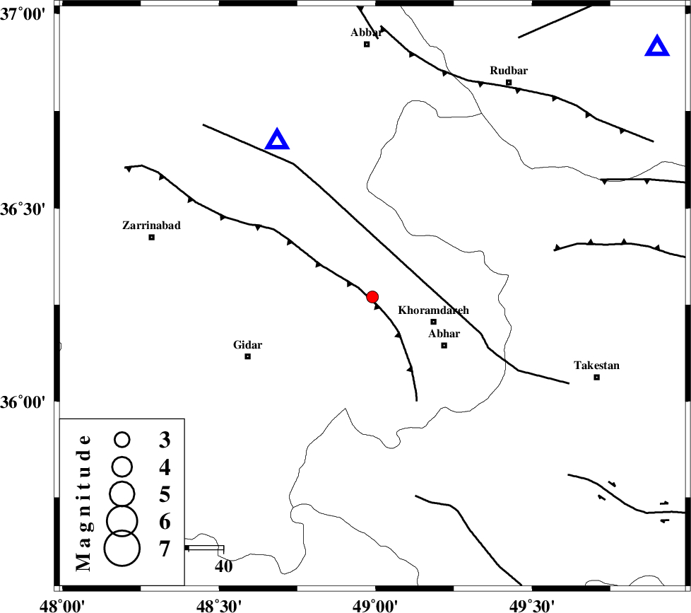
| Location | Lat:36.27 Lon: 48.99 |
| Region | Zanjan Province, 19 km West of Khoramdareh |
Nearest Cities |
|
| 6 km of Saeen qaleh, Zanjan Province | |
| 8 km of Saeen qaleh, Zanjan Province | |
| 11 km of Void, Zanjan Province | |
| 12 km North West of Hidaj, Zanjan Province | |
| 14 km North of Kinehvars, Zanjan Province | |
| Depth | 14 km |
| Agency | |
Faults within 150 km: |
|
| SOLTANIYEH_F (Length: 119 km) , Distance to epicenter: 4 km | |
| ZANJAN_F (Length: 137 km) , Distance to epicenter: 15 km | |
| N_QAZVIN_F (Length: 72 km) , Distance to epicenter: 54 km | |
| Number of Phases | 5 |
| RMS | 0.1 |
| Number of Stations | 5 |
| Error in Latitude | >2.3 km |
| Error in Longitude | 4.4 km |
| Error in Depth | 7.3 km |
Download waveform in seisan format
to download seisan software Click here
to access information about IIEES stations Click here
Amplitude | ||||||||
| UID | Agency | Station | Component | Amplitude | Period | Arrival Time | Proccessing Time | Signal Clip |
| 88256 | IIEES | ZNJK | E | 265.1 | 0.16 | 2013-03-19 01:51:01 | 2013-03-19 03:32:00 | n |
| 88257 | IIEES | GRMI | N | 13.8 | 0.44 | 2013-03-19 01:52:11 | 2013-03-19 03:32:00 | n |
Phase | ||||||||||||
| Agency | Station | Component | Phase Type | Phase Quality | First Motion | Observed Arrival Time | Time Residual | Loc. Flag | Input Weight | Distance | Azimuth | |
| IIEES | ZNJK | Z | Pg | E | 2013-03-19 01:50:48 | -0.16 | y | 52.2 | 329 | |||
| IIEES | CHTH | Z | Pn | E | 2013-03-19 01:51:11 | -0.1 | y | 197 | 101 | |||
| IIEES | SNGE | Z | Pg | E | 2013-03-19 01:51:11 | 0.01 | y | 198 | 229 | |||
| IIEES | DAMV | Z | Pn | E | 2013-03-19 01:51:21 | 0.07 | y | 278 | 104 | |||
| IIEES | GRMI | Z | Pn | E | 2013-03-19 01:51:24 | 0.2 | y | 298 | 341 | |||