
Magnitude |
2.2 |
| Date & Time (UTC) | 2013-03-21 04:10:38.2 |
| Date & Time (Local) | 1392/1/1 07:40:38.2 |
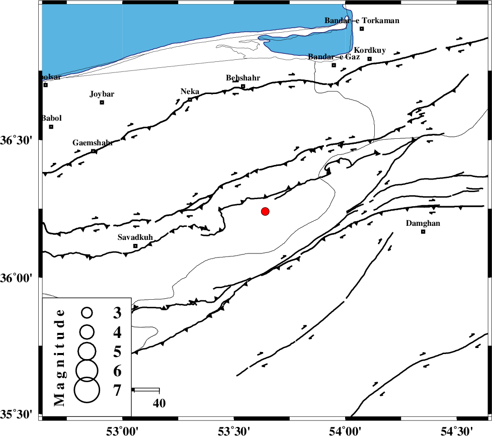
| Location | Lat:36.24 Lon: 53.64 |
| Region | Mazandaran Province, 51 km South of Behshahr |
Nearest Cities |
|
| 6 km North of Talma darreh, Mazandaran Province | |
| 9 km North East of Kiasar, Mazandaran Province | |
| 28 km East of Khalkhil, Mazandaran Province | |
| 36 km North West of Darvar, Semnan Province | |
| 39 km South West of Bishehboneh, Mazandaran Province | |
| Depth | 14 km |
| Agency | |
Faults within 150 km: |
|
| N_ALBORZ_F (Length: 360 km) , Distance to epicenter: 19 km | |
| DAMGHAN_F (Length: 95 km) , Distance to epicenter: 21 km | |
| ASTANEH_F (Length: 72 km) , Distance to epicenter: 32 km | |
| Number of Phases | 4 |
| RMS | 0 |
| Number of Stations | 3 |
| Error in Latitude | >5.4 km |
| Error in Longitude | 1.5 km |
| Error in Depth | 5.2 km |
Download waveform in seisan format
to download seisan software Click here
to access information about IIEES stations Click here
Amplitude | ||||||||
| UID | Agency | Station | Component | Amplitude | Period | Arrival Time | Proccessing Time | Signal Clip |
| 88275 | IIEES | SHRO | N | 18 | 0.4 | 2013-03-21 04:11:44 | 2013-03-21 08:02:00 | n |
Phase | ||||||||||||
| Agency | Station | Component | Phase Type | Phase Quality | First Motion | Observed Arrival Time | Time Residual | Loc. Flag | Input Weight | Distance | Azimuth | |
| IIEES | DAMV | Z | Pg | E | 2013-03-21 04:11:05 | 0 | y | 165 | 246 | |||
| IIEES | SHRO | Z | Pn | E | 2013-03-21 04:11:12 | 0.01 | y | 215 | 96 | |||
| IIEES | SHRO | N | Sg | E | 2013-03-21 04:11:39 | 0 | y | 215 | 96 | |||
| IIEES | MRVT | Z | Pn | E | 2013-03-21 04:11:19 | -0.01 | y | 269 | 53 | |||