
Magnitude |
2.8 |
| Date & Time (UTC) | 2013-03-23 07:32:37.6 |
| Date & Time (Local) | 1392/1/3 12:02:37.6 |
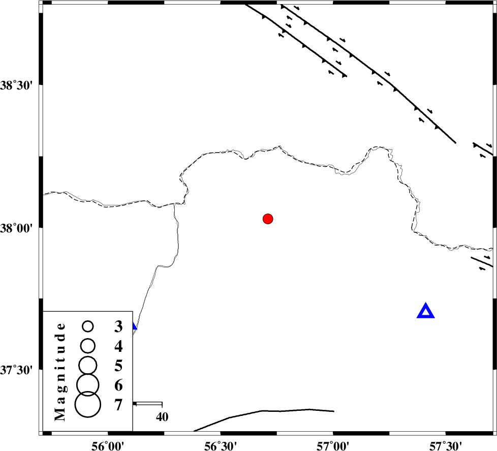
| Location | Lat:38.03 Lon: 56.71 |
| Region | Khorasan(north) Province, 57 km North-West of Ashkhaneh |
Nearest Cities |
|
| 17 km South of Yekehsoud-e paeen, Khorasan(north) Province | |
| 22 km North West of Tangehzar, Khorasan(north) Province | |
| 38 km North West of Raz, Khorasan(north) Province | |
| 42 km North East of Qazanqayeh, Golestan Province | |
| 47 km North East of Garmab, Khorasan(north) Province | |
| Depth | 14 km |
| Agency | |
Faults within 150 km: |
|
| MAIN_KOPEHDAGH_F1 (Length: 318 km) , Distance to epicenter: 63 km | |
| MAIN_KOPEHDAGH_F2 (Length: 131 km) , Distance to epicenter: 71 km | |
| ROBATE_QARABIL_F (Length: 168 km) , Distance to epicenter: 75 km | |
| Number of Phases | 4 |
| RMS | 0.1 |
| Number of Stations | 3 |
| Error in Latitude | >2.7 km |
| Error in Longitude | 2.5 km |
| Error in Depth | 4.2 km |
Download waveform in seisan format
to download seisan software Click here
to access information about IIEES stations Click here
Amplitude | ||||||||
| UID | Agency | Station | Component | Amplitude | Period | Arrival Time | Proccessing Time | Signal Clip |
| 88295 | IIEES | MRVT | N | 487.8 | 0.31 | 2013-03-23 07:33:03 | 2013-03-23 07:46:00 | n |
| 88296 | IIEES | BJRD | E | 423.6 | 0.19 | 2013-03-23 07:33:00 | 2013-03-23 07:46:00 | n |
Phase | ||||||||||||
| Agency | Station | Component | Phase Type | Phase Quality | First Motion | Observed Arrival Time | Time Residual | Loc. Flag | Input Weight | Distance | Azimuth | |
| IIEES | MRVT | Z | Pg | E | 2013-03-23 07:32:49 | -0.04 | y | 68.5 | 233 | |||
| IIEES | BJRD | Z | Pg | E | 2013-03-23 07:32:50 | -0.03 | y | 71.3 | 121 | |||
| IIEES | SHRO | Z | Pn | E | 2013-03-23 07:33:14 | 0.09 | y | 233 | 196 | |||
| IIEES | SHRO | E | Sg | E | 2013-03-23 07:33:43 | -0.01 | y | 233 | 196 | |||