
Magnitude |
2.5 |
| Date & Time (UTC) | 2013-03-30 05:59:12.2 |
| Date & Time (Local) | 1392/1/10 10:29:12.2 |
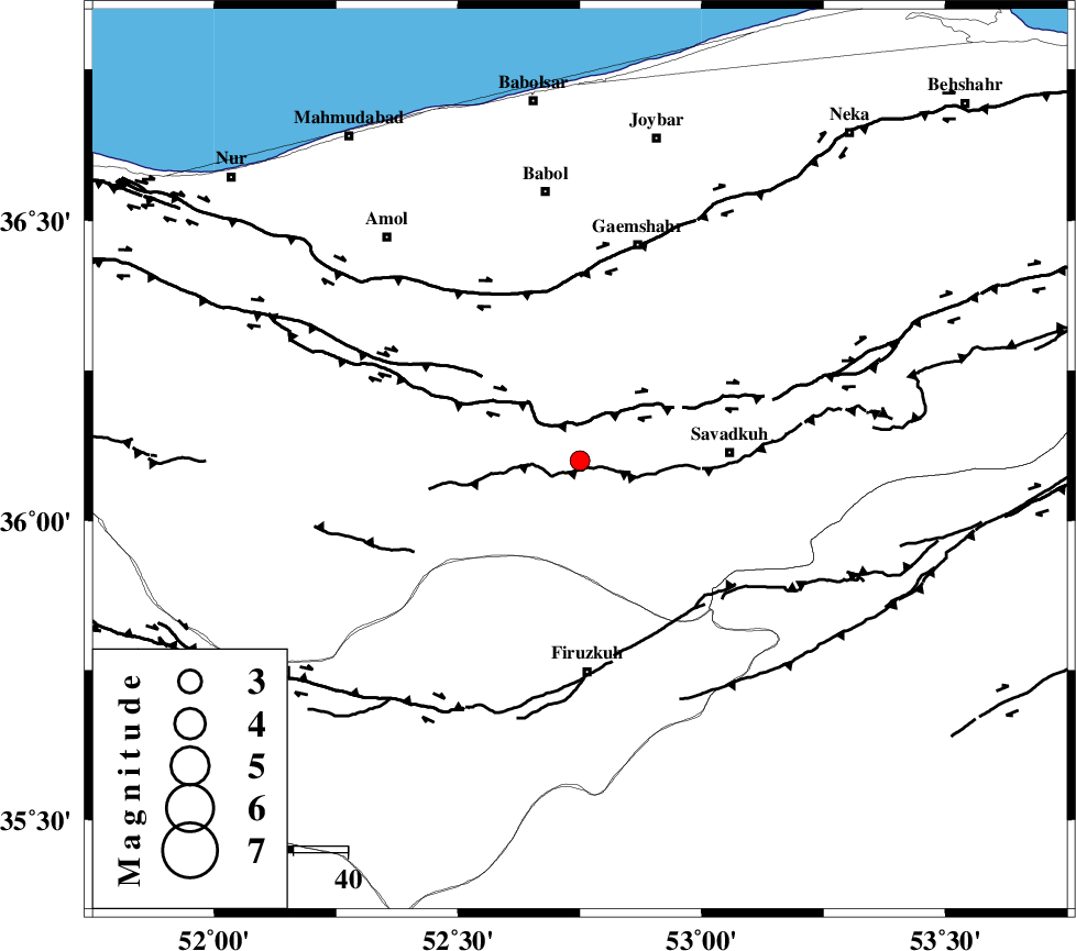
| Location | Lat:36.1 Lon: 52.75 |
| Region | Mazandaran Province, 28 km West of Pol-E-Sefid |
Nearest Cities |
|
| 8 km North of Alasht, Mazandaran Province | |
| 14 km East of Firoozjah-e sabet, Mazandaran Province | |
| 20 km North West of Elahband, Mazandaran Province | |
| 21 km West of Zirab, Mazandaran Province | |
| 25 km South of Derazkola, Mazandaran Province | |
| Depth | 14 km |
| Agency | |
Faults within 150 km: |
|
| N_ALBORZ_F (Length: 360 km) , Distance to epicenter: 8 km | |
| KHAZAR_F (Length: 523 km) , Distance to epicenter: 31 km | |
| MOSHA_F (Length: 234 km) , Distance to epicenter: 47 km | |
| Number of Phases | 6 |
| RMS | 0.2 |
| Number of Stations | 4 |
| Error in Latitude | >4.2 km |
| Error in Longitude | 4.6 km |
| Error in Depth | 7.3 km |
Download waveform in seisan format
to download seisan software Click here
to access information about IIEES stations Click here
Amplitude | ||||||||
| UID | Agency | Station | Component | Amplitude | Period | Arrival Time | Proccessing Time | Signal Clip |
| 88366 | IIEES | GHVR | E | 34.5 | 0.31 | 2013-03-30 06:00:23 | 2013-03-30 06:28:00 | n |
| 88367 | IIEES | GHVR | N | 32.1 | 0.35 | 2013-03-30 06:00:23 | 2013-03-30 06:28:00 | n |
| 88368 | IIEES | ASAO | E | 15.8 | 0.4 | 2013-03-30 06:00:38 | 2013-03-30 06:28:00 | n |
Phase | ||||||||||||
| Agency | Station | Component | Phase Type | Phase Quality | First Motion | Observed Arrival Time | Time Residual | Loc. Flag | Input Weight | Distance | Azimuth | |
| IIEES | CHTH | Z | Pg | E | 2013-03-30 05:59:36 | -0.14 | y | 148 | 262 | |||
| IIEES | GHVR | Z | Pn | E | 2013-03-30 05:59:48 | 0.3 | y | 226 | 218 | |||
| IIEES | GHVR | E | Sg | E | 2013-03-30 06:00:16 | -0.1 | y | 226 | 218 | |||
| IIEES | SHRO | Z | Pn | E | 2013-03-30 05:59:56 | -0.19 | y | 294 | 91 | |||
| IIEES | ASAO | Z | Pn | E | 2013-03-30 05:59:57 | 0.28 | y | 302 | 236 | |||
| IIEES | ASAO | E | Sg | E | 2013-03-30 06:00:37 | -0.16 | y | 302 | 236 | |||