
Magnitude |
2.9 |
| Date & Time (UTC) | 2013-04-03 01:49:02.3 |
| Date & Time (Local) | 1392/1/14 06:19:02.3 |
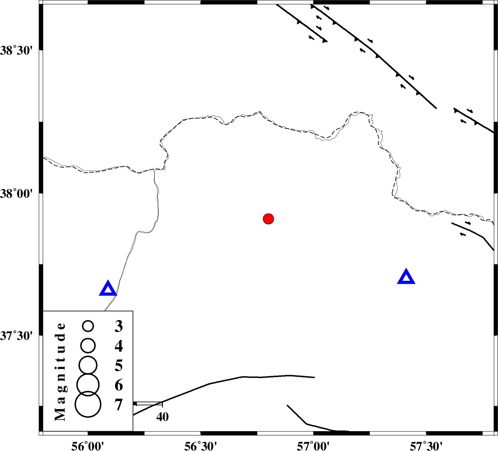
| Location | Lat:37.91 Lon: 56.8 |
| Region | Khorasan(north) Province, 42 km North-West of Ashkhaneh |
Nearest Cities |
|
| 13 km West of Tangehzar, Khorasan(north) Province | |
| 28 km West of Raz, Khorasan(north) Province | |
| 31 km South of Yekehsoud-e paeen, Khorasan(north) Province | |
| 34 km North West of Pish qaleh, Khorasan(north) Province | |
| 42 km North West of Ashkhaneh, Khorasan(north) Province | |
| Depth | 14 km |
| Agency | |
Faults within 150 km: |
|
| ROBATE_QARABIL_F (Length: 168 km) , Distance to epicenter: 62 km | |
| BAGHAN_GERMAB_F (Length: 79 km) , Distance to epicenter: 71 km | |
| MAIN_KOPEHDAGH_F1 (Length: 318 km) , Distance to epicenter: 73 km | |
| Number of Phases | 4 |
| RMS | 0.1 |
| Number of Stations | 3 |
| Error in Latitude | >2.4 km |
| Error in Longitude | 2.3 km |
| Error in Depth | 4.3 km |
Download waveform in seisan format
to download seisan software Click here
to access information about IIEES stations Click here
Amplitude | ||||||||
| UID | Agency | Station | Component | Amplitude | Period | Arrival Time | Proccessing Time | Signal Clip |
| 88388 | IIEES | BJRD | E | 734.9 | 0.2 | 2013-04-03 01:49:21 | 2013-04-03 03:15:00 | n |
Phase | ||||||||||||
| Agency | Station | Component | Phase Type | Phase Quality | First Motion | Observed Arrival Time | Time Residual | Loc. Flag | Input Weight | Distance | Azimuth | |
| IIEES | BJRD | N | Pg | E | 2013-04-03 01:49:12 | -0.03 | y | 58.7 | 113 | |||
| IIEES | MRVT | Z | Pg | E | 2013-04-03 01:49:14 | -0.05 | y | 68 | 246 | |||
| IIEES | SHRO | Z | Pn | E | 2013-04-03 01:49:37 | 0.11 | y | 222 | 199 | |||
| IIEES | SHRO | E | Sg | E | 2013-04-03 01:50:05 | -0.03 | y | 222 | 199 | |||