
Magnitude |
2.7 |
| Date & Time (UTC) | 2013-04-05 10:55:28.2 |
| Date & Time (Local) | 1392/1/16 15:25:28.2 |
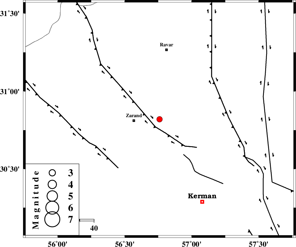
| Location | Lat:30.82 Lon: 56.76 |
| Region | Kerman Province, 18 km East of Zarand |
Nearest Cities |
|
| 4 km of Hatkan, Kerman Province | |
| 11 km North of Khankuk, Kerman Province | |
| 15 km North East of Bahaabad, Kerman Province | |
| 18 km North East of Zarand, Kerman Province | |
| 21 km North East of Mohammadabad, Kerman Province | |
| Depth | 14 km |
| Agency | |
Faults within 150 km: |
|
| KUHBANAN_F (Length: 189 km) , Distance to epicenter: 6 km | |
| CHATRUD_F (Length: 37 km) , Distance to epicenter: 30 km | |
| DARIVAN_F (Length: 131 km) , Distance to epicenter: 46 km | |
| Number of Phases | 5 |
| RMS | 0 |
| Number of Stations | 3 |
| Error in Latitude | >1.5 km |
| Error in Longitude | 2.6 km |
| Error in Depth | 4.8 km |
Download waveform in seisan format
to download seisan software Click here
to access information about IIEES stations Click here
Amplitude | ||||||||
| UID | Agency | Station | Component | Amplitude | Period | Arrival Time | Proccessing Time | Signal Clip |
| 88401 | IIEES | KRBR | E | 200.8 | 0.44 | 2013-04-05 10:55:59 | 2013-04-05 12:46:00 | n |
| 88402 | IIEES | YZKH | E | 40.4 | 0.56 | 2013-04-05 10:56:54 | 2013-04-05 12:46:00 | n |
Phase | ||||||||||||
| Agency | Station | Component | Phase Type | Phase Quality | First Motion | Observed Arrival Time | Time Residual | Loc. Flag | Input Weight | Distance | Azimuth | |
| IIEES | KRBR | Z | Pg | E | 2013-04-05 10:55:44 | -0.04 | y | 93 | 180 | |||
| IIEES | KRBR | N | Sg | E | 2013-04-05 10:55:56 | 0.02 | y | 93 | 180 | |||
| IIEES | BSRN | Z | Pn | E | 2013-04-05 10:56:08 | 0 | y | 259 | 60 | |||
| IIEES | YZKH | Z | Pn | E | 2013-04-05 10:56:09 | 0.02 | y | 269 | 311 | |||
| IIEES | YZKH | N | Sg | E | 2013-04-05 10:56:44 | -0.01 | y | 269 | 311 | |||