
Magnitude |
2.9 |
| Date & Time (UTC) | 2013-04-09 10:22:49.3 |
| Date & Time (Local) | 1392/1/20 14:52:49.3 |
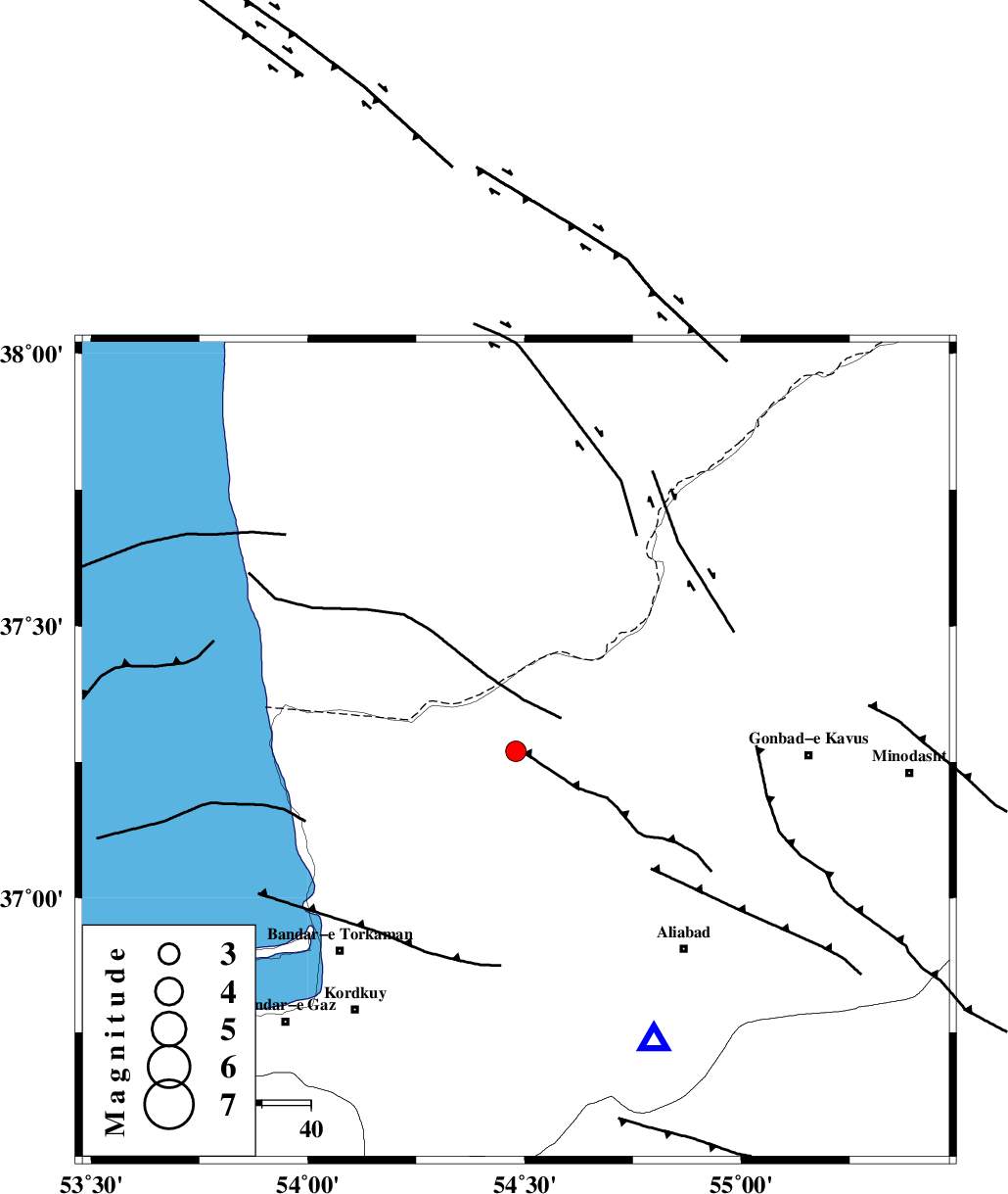
| Location | Lat:37.27 Lon: 54.48 |
| Region | Golestan Province, 29 km North of Aq Qaleh |
Nearest Cities |
|
| 29 km North of Qanqarmeh, Golestan Province | |
| 29 km North of Aq Qaleh, Golestan Province | |
| 30 km South West of Enchehborun, Golestan Province | |
| 31 km North West of Gariduji, Golestan Province | |
| 34 km North West of Nodeh malek, Golestan Province | |
| Depth | 14 km |
| Agency | |
Faults within 150 km: |
|
| KHAZAR_F (Length: 523 km) , Distance to epicenter: 46 km | |
| N_ALBORZ_F (Length: 360 km) , Distance to epicenter: 74 km | |
| SHAVAR_F (Length: 87 km) , Distance to epicenter: 78 km | |
| Number of Phases | 6 |
| RMS | 0.2 |
| Number of Stations | 3 |
| Error in Latitude | >2.8 km |
| Error in Longitude | 6.2 km |
| Error in Depth | 8 km |
Download waveform in seisan format
to download seisan software Click here
to access information about IIEES stations Click here
Amplitude | ||||||||
| UID | Agency | Station | Component | Amplitude | Period | Arrival Time | Proccessing Time | Signal Clip |
| 88445 | IIEES | MRVT | E | 174.8 | 0.2 | 2013-04-09 10:23:33 | 2013-04-09 12:45:00 | n |
| 88446 | IIEES | MRVT | N | 210.3 | 0.24 | 2013-04-09 10:23:33 | 2013-04-09 12:45:00 | n |
Phase | ||||||||||||
| Agency | Station | Component | Phase Type | Phase Quality | First Motion | Observed Arrival Time | Time Residual | Loc. Flag | Input Weight | Distance | Azimuth | |
| IIEES | MRVT | Z | Pg | E | 2013-04-09 10:23:13 | -0.29 | y | 148 | 73 | |||
| IIEES | MRVT | N | Sg | E | 2013-04-09 10:23:31 | -0.15 | y | 148 | 73 | |||
| IIEES | SHRO | Z | Pg | E | 2013-04-09 10:23:21 | 0.15 | y | 196 | 135 | |||
| IIEES | SHRO | N | Sg | E | 2013-04-09 10:23:44 | -0.13 | y | 196 | 135 | |||
| IIEES | BJRD | Z | Pn | E | 2013-04-09 10:23:29 | 0.14 | y | 263 | 79 | |||
| IIEES | BJRD | E | Sg | E | 2013-04-09 10:24:03 | 0.28 | y | 263 | 79 | |||