
Magnitude |
3.8 |
| Date & Time (UTC) | 2013-04-09 16:20:24.2 |
| Date & Time (Local) | 1392/1/20 20:50:24.2 |
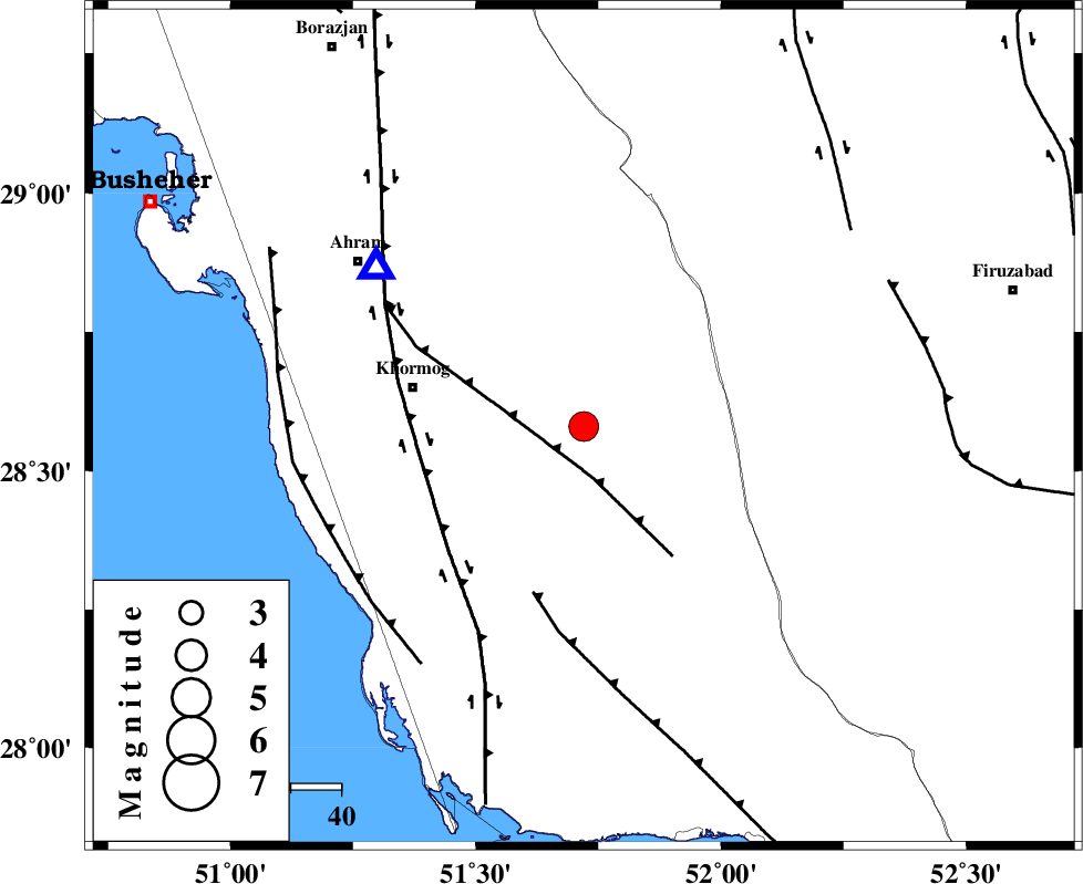
| Location | Lat:28.58 Lon: 51.72 |
| Region | Bushehr Province, 35 km East of Khormog |
Nearest Cities |
|
| 21 km North of Shanbeh, Bushehr Province | |
| 30 km North East of Baduleh, Bushehr Province | |
| 34 km North East of Kaki, Bushehr Province | |
| 34 km East of Buheyri, Bushehr Province | |
| 35 km East of Khormog, Bushehr Province | |
| Depth | 31 km |
| Agency | |
Faults within 150 km: |
|
| MFF5 (Length: 74 km) , Distance to epicenter: 10 km | |
| BORAZJAN_F (Length: 168 km) , Distance to epicenter: 33 km | |
| MFF3 (Length: 292 km) , Distance to epicenter: 35 km | |
| Number of Phases | 5 |
| RMS | 0 |
| Number of Stations | 5 |
| Error in Latitude | >13.2 km |
| Error in Longitude | 8.5 km |
| Error in Depth | 8.7 km |
Download waveform in seisan format
to download seisan software Click here
to access information about IIEES stations Click here
Amplitude | ||||||||
| UID | Agency | Station | Component | Amplitude | Period | Arrival Time | Proccessing Time | Signal Clip |
| 88473 | IIEES | AHRM | N | 6428.7 | 0.4 | 2013-04-09 16:20:47 | 2013-04-09 05:59:00 | n |
| 88474 | IIEES | AHRM | E | 6973.7 | 0.6 | 2013-04-09 16:20:47 | 2013-04-09 05:59:00 | n |
| 88475 | IIEES | GHIR | E | 2312.9 | 0.84 | 2013-04-09 16:21:07 | 2013-04-09 05:59:00 | n |
Phase | ||||||||||||
| Agency | Station | Component | Phase Type | Phase Quality | First Motion | Observed Arrival Time | Time Residual | Loc. Flag | Input Weight | Distance | Azimuth | |
| IIEES | AHRM | Z | Pg | E | 2013-04-09 16:20:34 | 0 | y | 51.9 | 308 | |||
| IIEES | GHIR | Z | Pg | E | 2013-04-09 16:20:45 | 0 | y | 129 | 104 | |||
| IIEES | YZKH | Z | Pn | E | 2013-04-09 16:21:33 | 0.01 | y | 505 | 32 | |||
| IIEES | KHMZ | Z | Pn | E | 2013-04-09 16:21:44 | 0 | y | 596 | 344 | |||
| IIEES | BSRN | Z | Pn | E | 2013-04-09 16:22:10 | -0.01 | y | 806 | 60 | |||