
Magnitude |
3.8 |
| Date & Time (UTC) | 2013-04-09 23:32:54.0 |
| Date & Time (Local) | 1392/1/21 04:02:54.0 |
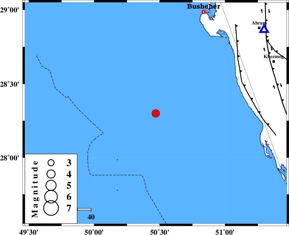
| Location | Lat:28.3 Lon: 50.47 |
| Region | Persian Gulf, 84 km South-West of Busheher |
Nearest Cities |
|
| 78 km South West of Delvar, Bushehr Province | |
| 82 km South West of Derazi, Bushehr Province | |
| 84 km South West of Busheher, Bushehr Province | |
| 89 km North West of Ziyarat, Bushehr Province | |
| 94 km South West of Buheyri, Bushehr Province | |
| Depth | 15 km |
| Agency | |
Faults within 150 km: |
|
| ZFF2 (Length: 84 km) , Distance to epicenter: 69 km | |
| BORAZJAN_F (Length: 168 km) , Distance to epicenter: 93 km | |
| MFF5 (Length: 74 km) , Distance to epicenter: 100 km | |
| Number of Phases | 3 |
| RMS | 0 |
| Number of Stations | 3 |
| Error in Latitude | >5.4 km |
| Error in Longitude | 5 km |
| Error in Depth | 0 km |
Download waveform in seisan format
to download seisan software Click here
to access information about IIEES stations Click here
Amplitude | ||||||||
| UID | Agency | Station | Component | Amplitude | Period | Arrival Time | Proccessing Time | Signal Clip |
| 88535 | IIEES | AHRM | E | 1317.5 | 0.44 | 2013-04-09 23:34:06 | 2013-04-10 02:54:00 | n |
| 88536 | IIEES | AHRM | N | 1738.5 | 0.68 | 2013-04-09 23:34:07 | 2013-04-10 02:54:00 | n |
| 88537 | IIEES | GHIR | E | 2318.7 | 0.32 | 2013-04-09 23:34:15 | 2013-04-10 02:54:00 | n |
Phase | ||||||||||||
| Agency | Station | Component | Phase Type | Phase Quality | First Motion | Observed Arrival Time | Time Residual | Loc. Flag | Input Weight | Distance | Azimuth | |
| IIEES | AHRM | Z | Pg | E | 2013-04-09 23:33:11 | 0 | y | 103 | 52 | |||
| IIEES | GHIR | Z | Pg | E | 2013-04-09 23:33:34 | 0 | y | 247 | 90 | |||
| IIEES | KHMZ | Z | Pn | E | 2013-04-09 23:34:16 | 0 | y | 605 | 356 | |||