
Magnitude |
3 |
| Date & Time (UTC) | 2013-04-10 04:01:41.6 |
| Date & Time (Local) | 1392/1/21 08:31:41.6 |
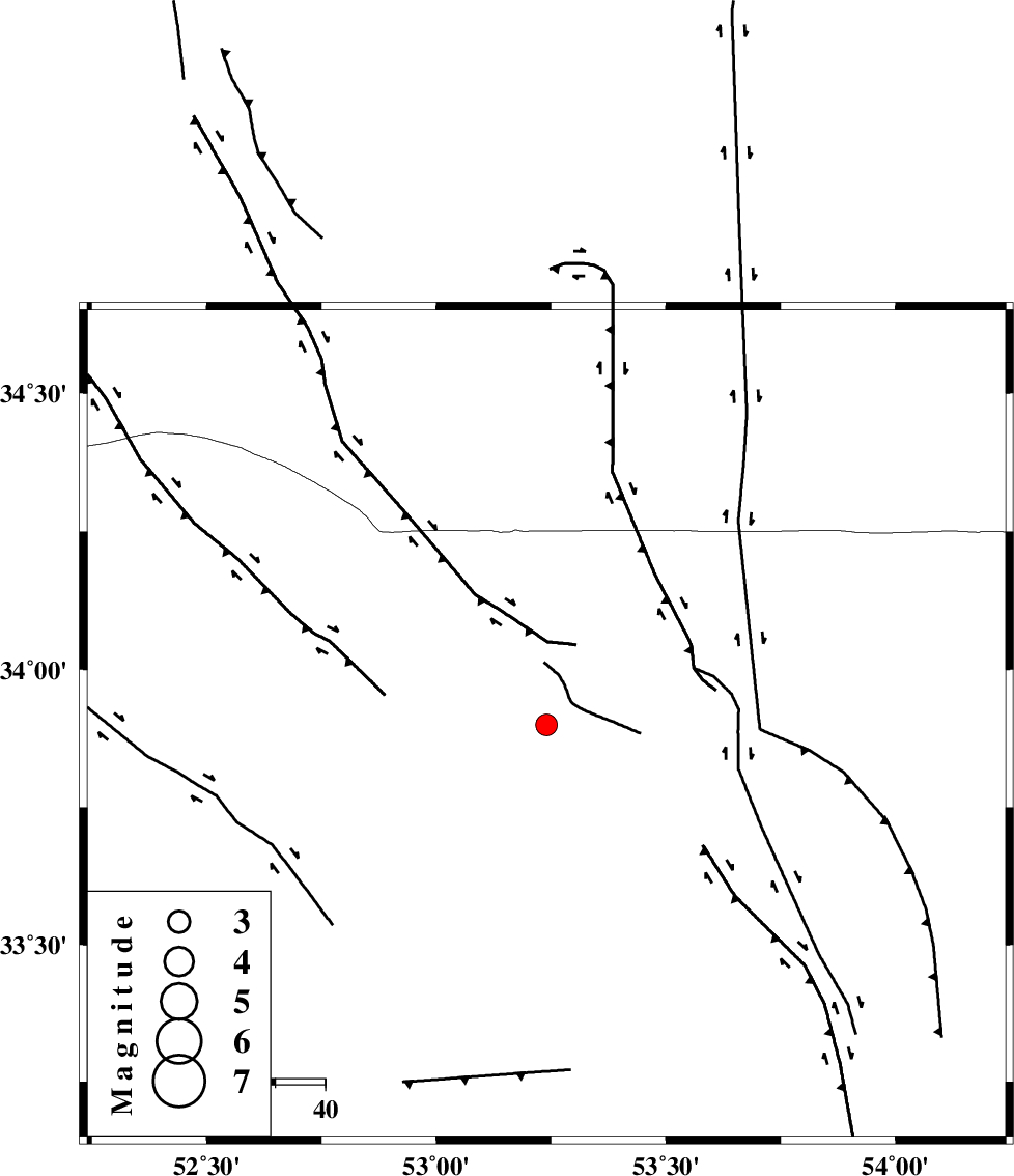
| Location | Lat:33.9 Lon: 53.24 |
| Region | Esfahan Province, 116 km North-East of Nain |
Nearest Cities |
|
| 30 km North West of Maedan, Esfahan Province | |
| 73 km North East of Jahanabad, Esfahan Province | |
| 75 km North East of Shahrab, Esfahan Province | |
| 78 km North West of Anarak, Esfahan Province | |
| 86 km North East of Zavareh, Esfahan Province | |
| Depth | 14 km |
| Agency | |
Faults within 150 km: |
|
| CHAH_ZANGUL_F (Length: 123 km) , Distance to epicenter: 79 km | |
| DORUNEH_F (Length: 713 km) , Distance to epicenter: 87 km | |
| BIABANAK_F (Length: 162 km) , Distance to epicenter: 96 km | |
| Number of Phases | 7 |
| RMS | 0.2 |
| Number of Stations | 5 |
| Error in Latitude | >2.4 km |
| Error in Longitude | 3.3 km |
| Error in Depth | 5.5 km |
Download waveform in seisan format
to download seisan software Click here
to access information about IIEES stations Click here
Amplitude | ||||||||
| UID | Agency | Station | Component | Amplitude | Period | Arrival Time | Proccessing Time | Signal Clip |
| 88547 | IIEES | GHVR | N | 135 | 0.44 | 2013-04-10 04:02:44 | 2013-04-10 05:23:00 | n |
Phase | ||||||||||||
| Agency | Station | Component | Phase Type | Phase Quality | First Motion | Observed Arrival Time | Time Residual | Loc. Flag | Input Weight | Distance | Azimuth | |
| IIEES | GHVR | Z | Pg | E | 2013-04-10 04:02:13 | 0.25 | y | 195 | 290 | |||
| IIEES | YZKH | Z | Pn | E | 2013-04-10 04:02:15 | -0.15 | y | 209 | 143 | |||
| IIEES | CHTH | Z | Pn | E | 2013-04-10 04:02:26 | 0.13 | y | 295 | 320 | |||
| IIEES | CHTH | N | Sg | E | 2013-04-10 04:03:04 | -0.2 | y | 295 | 320 | |||
| IIEES | KHMZ | Z | Pn | E | 2013-04-10 04:02:27 | 0.14 | y | 304 | 268 | |||
| IIEES | KHMZ | E | Sg | E | 2013-04-10 04:03:07 | -0.15 | y | 304 | 268 | |||
| IIEES | ASAO | Z | Pn | E | 2013-04-10 04:02:27 | -0.01 | y | 305 | 285 | |||