
Magnitude |
2.9 |
| Date & Time (UTC) | 2013-04-17 14:00:02.9 |
| Date & Time (Local) | 1392/1/28 18:30:02.9 |
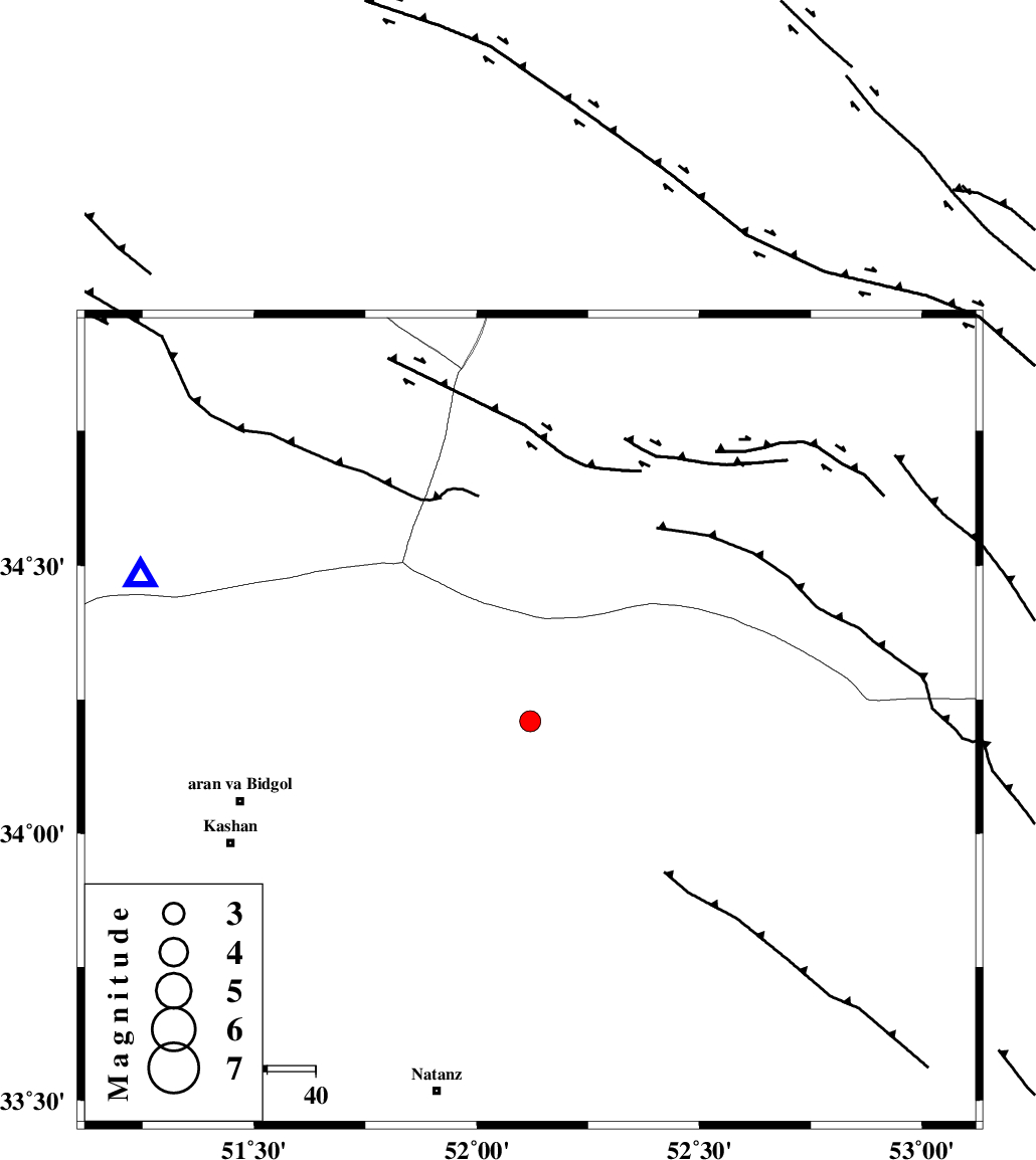
| Location | Lat:34.21 Lon: 52.12 |
| Region | Esfahan Province, 62 km North-East of Aran va bidgol |
Nearest Cities |
|
| 25 km East of Marnejab, Esfahan Province | |
| 45 km North East of Abuzeidabad, Esfahan Province | |
| 46 km North East of Hoseynabad, Esfahan Province | |
| 62 km North East of Arisman, Esfahan Province | |
| 62 km North East of Aran va bidgol, Esfahan Province | |
| Depth | 34 km |
| Agency | |
Faults within 150 km: |
|
| SIAHKUH_F (Length: 154 km) , Distance to epicenter: 51 km | |
| ZEFREH_F (Length: 124 km) , Distance to epicenter: 70 km | |
| KASHAN_F (Length: 44 km) , Distance to epicenter: 70 km | |
| Number of Phases | 4 |
| RMS | 0 |
| Number of Stations | 4 |
| Error in Latitude | >2.8 km |
| Error in Longitude | 2.8 km |
| Error in Depth | 4.1 km |
Download waveform in seisan format
to download seisan software Click here
to access information about IIEES stations Click here
Amplitude | ||||||||
| UID | Agency | Station | Component | Amplitude | Period | Arrival Time | Proccessing Time | Signal Clip |
| 88778 | IIEES | CHTH | N | 101.6 | 0.4 | 2013-04-17 14:01:04 | 2013-04-17 03:20:00 | n |
Phase | ||||||||||||
| Agency | Station | Component | Phase Type | Phase Quality | First Motion | Observed Arrival Time | Time Residual | Loc. Flag | Input Weight | Distance | Azimuth | |
| IIEES | GHVR | Z | P | E | 2013-04-17 14:00:17 | 0.01 | y | 85.7 | 291 | |||
| IIEES | KHMZ | Z | P | E | 2013-04-17 14:00:34 | 0 | y | 206 | 256 | |||
| IIEES | CHTH | Z | Pg | E | 2013-04-17 14:00:36 | -0.01 | y | 209 | 335 | |||
| IIEES | YZKH | N | Sg | E | 2013-04-17 14:01:27 | 0 | y | 306 | 131 | |||