
Magnitude |
1.9 |
| Date & Time (UTC) | 2013-04-17 16:06:14.0 |
| Date & Time (Local) | 1392/1/28 20:36:14.0 |
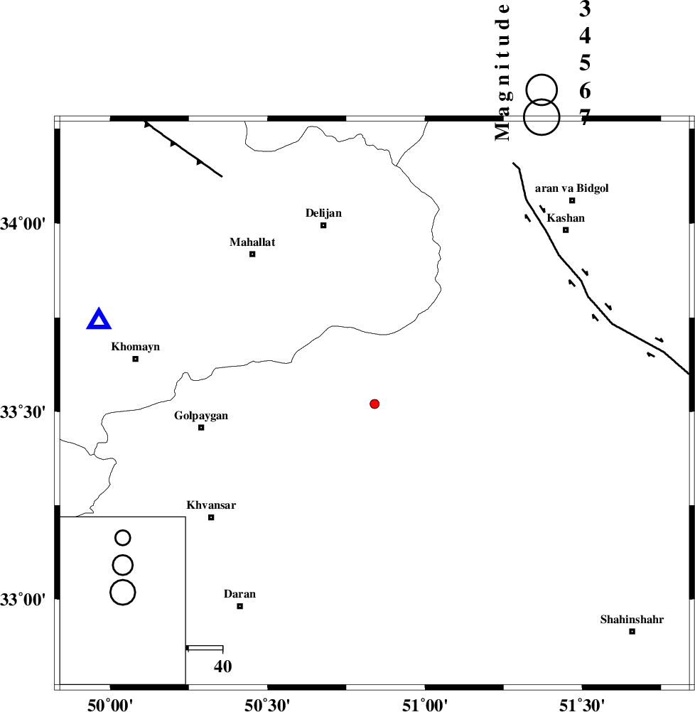
| Location | Lat:33.52 Lon: 50.84 |
| Region | Esfahan Province, 52 km East of Golpayegan |
Nearest Cities |
|
| 12 km North of Hasan robat, Esfahan Province | |
| 32 km North West of Meymeh, Esfahan Province | |
| 34 km North West of Vazvan, Esfahan Province | |
| 35 km North East of Konjedkhan, Esfahan Province | |
| 36 km West of Joshqan qali, Esfahan Province | |
| Depth | 45 km |
| Agency | |
Faults within 150 km: |
|
| KASHAN_F (Length: 44 km) , Distance to epicenter: 70 km | |
| ZEFREH_F (Length: 124 km) , Distance to epicenter: 70 km | |
| TAFRESH_F (Length: 117 km) , Distance to epicenter: 80 km | |
| Number of Phases | 5 |
| RMS | 0.1 |
| Number of Stations | 4 |
| Error in Latitude | >5.9 km |
| Error in Longitude | 4.6 km |
| Error in Depth | 9.2 km |
Download waveform in seisan format
to download seisan software Click here
to access information about IIEES stations Click here
Amplitude | ||||||||
| UID | Agency | Station | Component | Amplitude | Period | Arrival Time | Proccessing Time | Signal Clip |
| 88779 | IIEES | GHVR | N | 26.4 | 0.44 | 2013-04-17 16:06:48 | 2013-04-17 05:49:00 | n |
| 88780 | IIEES | CHTH | N | 7 | 0.28 | 2013-04-17 16:07:30 | 2013-04-17 05:49:00 | n |
| 88781 | IIEES | CHTH | E | 7 | 0.32 | 2013-04-17 16:07:30 | 2013-04-17 05:49:00 | n |
Phase | ||||||||||||
| Agency | Station | Component | Phase Type | Phase Quality | First Motion | Observed Arrival Time | Time Residual | Loc. Flag | Input Weight | Distance | Azimuth | |
| IIEES | KHMZ | Z | Pg | E | 2013-04-17 16:06:29 | -0.13 | y | 85.2 | 287 | |||
| IIEES | KHMZ | N | Sg | E | 2013-04-17 16:06:41 | 0.07 | y | 85.2 | 287 | |||
| IIEES | GHVR | Z | Pg | E | 2013-04-17 16:06:33 | 0.13 | y | 113 | 19 | |||
| IIEES | GHVR | N | Sg | E | 2013-04-17 16:06:47 | -0.07 | y | 113 | 19 | |||
| IIEES | ASAO | Z | Pg | E | 2013-04-17 16:06:37 | 0 | y | 137 | 327 | |||