
Magnitude |
2.4 |
| Date & Time (UTC) | 2013-04-20 15:32:56.7 |
| Date & Time (Local) | 1392/1/31 20:02:56.7 |
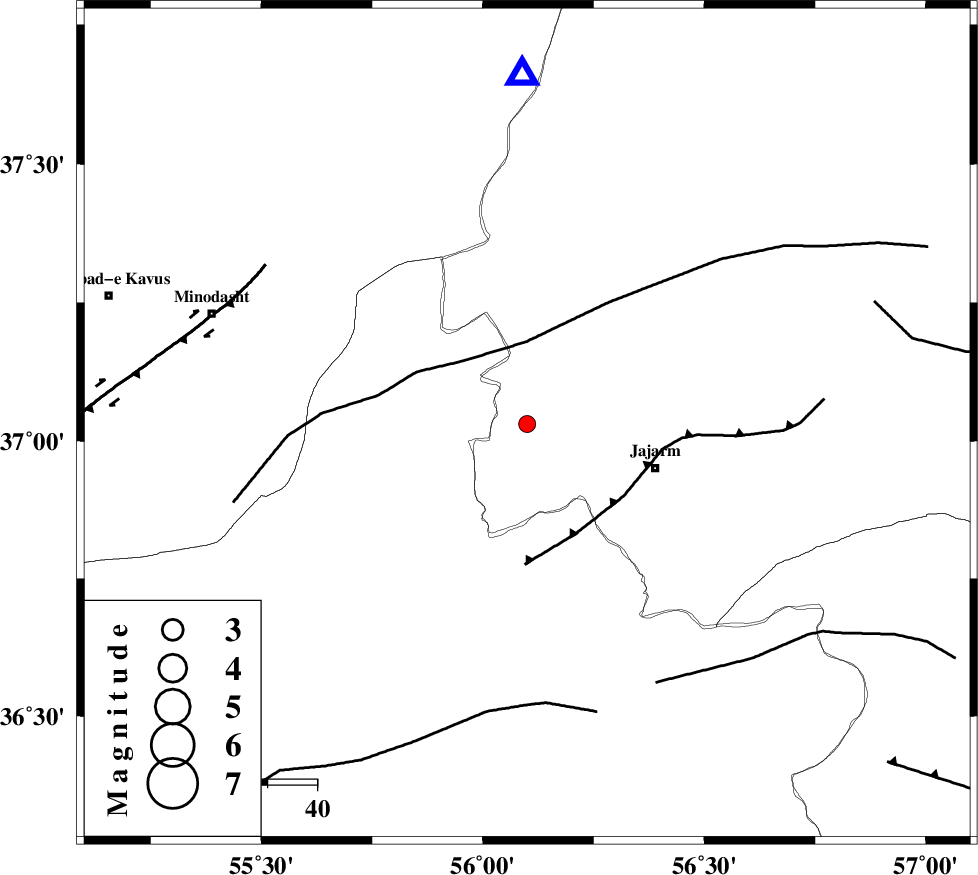
| Location | Lat:37.03 Lon: 56.1 |
| Region | Khorasan(north) Province, 27 km West of Jajarm |
Nearest Cities |
|
| 18 km North West of Garmeh, Khorasan(north) Province | |
| 27 km North West of Jajarm, Khorasan(north) Province | |
| 28 km East of Nardin, Semnan Province | |
| 37 km East of Rezvan, Semnan Province | |
| 42 km North East of Qaleh qafeh, Semnan Province | |
| Depth | 26 km |
| Agency | |
Faults within 150 km: |
|
| ROBATE_QARABIL_F (Length: 168 km) , Distance to epicenter: 17 km | |
| JAJARAM_F (Length: 77 km) , Distance to epicenter: 24 km | |
| MEYAMEY_F (Length: 141 km) , Distance to epicenter: 56 km | |
| Number of Phases | 5 |
| RMS | 0.2 |
| Number of Stations | 4 |
| Error in Latitude | >2.7 km |
| Error in Longitude | 4 km |
| Error in Depth | 7.1 km |
Download waveform in seisan format
to download seisan software Click here
to access information about IIEES stations Click here
Amplitude | ||||||||
| UID | Agency | Station | Component | Amplitude | Period | Arrival Time | Proccessing Time | Signal Clip |
| 88863 | IIEES | MRVT | E | 207.1 | 0.48 | 2013-04-20 15:33:15 | 2013-04-21 06:59:00 | n |
| 88864 | IIEES | MRVT | N | 200.3 | 0.28 | 2013-04-20 15:33:20 | 2013-04-21 06:59:00 | n |
| 88865 | IIEES | SHRO | E | 68.8 | 0.56 | 2013-04-20 15:33:37 | 2013-04-21 06:59:00 | n |
| 88866 | IIEES | BJRD | E | 71.6 | 0.72 | 2013-04-20 15:33:45 | 2013-04-21 06:59:00 | n |
Phase | ||||||||||||
| Agency | Station | Component | Phase Type | Phase Quality | First Motion | Observed Arrival Time | Time Residual | Loc. Flag | Input Weight | Distance | Azimuth | |
| IIEES | MRVT | Z | Pg | E | 2013-04-20 15:33:08 | -0.07 | y | 69.4 | 359 | |||
| IIEES | SHRO | Z | Pg | E | 2013-04-20 15:33:15 | -0.04 | y | 114 | 184 | |||
| IIEES | BJRD | Z | Pg | E | 2013-04-20 15:33:19 | 0.33 | y | 137 | 57 | |||
| IIEES | BJRD | E | Sg | E | 2013-04-20 15:33:35 | -0.19 | y | 137 | 57 | |||
| IIEES | TABS | Z | Pn | E | 2013-04-20 15:33:51 | -0.04 | y | 387 | 166 | |||