
Magnitude |
1.8 |
| Date & Time (UTC) | 2013-04-24 05:44:08.4 |
| Date & Time (Local) | 1392/2/4 10:14:08.4 |
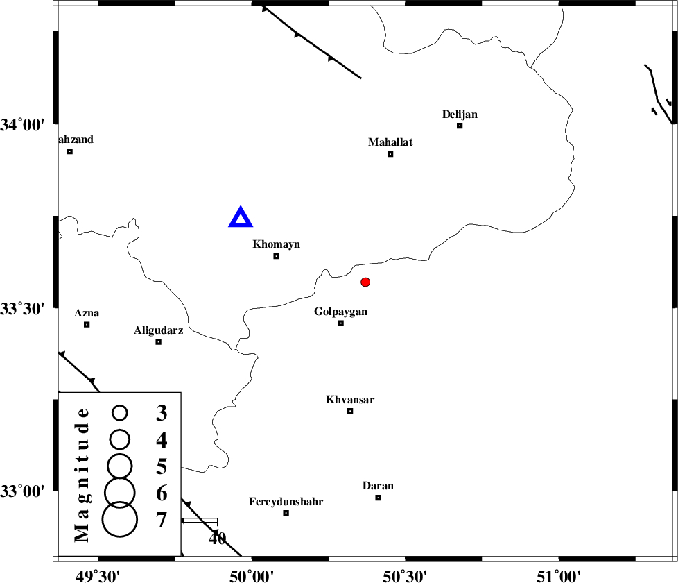
| Location | Lat:33.57 Lon: 50.37 |
| Region | Esfahan Province, 14 km North of Golpayegan |
Nearest Cities |
|
| 5 km North of Saeedabad, Esfahan Province | |
| 11 km North of Gogad, Esfahan Province | |
| 11 km North of Konjedkhan, Esfahan Province | |
| 13 km North of Nivan nar, Esfahan Province | |
| 14 km North of Golpayegan, Esfahan Province | |
| Depth | 26 km |
| Agency | |
Faults within 150 km: |
|
| TAFRESH_F (Length: 117 km) , Distance to epicenter: 61 km | |
| MAIN_ZAGROS_R_F (Length: 1106 km) , Distance to epicenter: 84 km | |
| DORUD (Length: 100 km) , Distance to epicenter: 90 km | |
| Number of Phases | 4 |
| RMS | 0 |
| Number of Stations | 3 |
| Error in Latitude | >6.4 km |
| Error in Longitude | 4.3 km |
| Error in Depth | 9.7 km |
Download waveform in seisan format
to download seisan software Click here
to access information about IIEES stations Click here
Amplitude | ||||||||
| UID | Agency | Station | Component | Amplitude | Period | Arrival Time | Proccessing Time | Signal Clip |
| 88939 | IIEES | KHMZ | N | 90.9 | 0.12 | 2013-04-24 05:44:25 | 2013-04-24 07:21:00 | n |
Phase | ||||||||||||
| Agency | Station | Component | Phase Type | Phase Quality | First Motion | Observed Arrival Time | Time Residual | Loc. Flag | Input Weight | Distance | Azimuth | |
| IIEES | KHMZ | Z | Pg | E | 2013-04-24 05:44:16 | 0 | y | 42 | 297 | |||
| IIEES | KHMZ | N | Sg | E | 2013-04-24 05:44:22 | 0 | y | 42 | 297 | |||
| IIEES | ASAO | Z | Pg | E | 2013-04-24 05:44:27 | 0 | y | 113 | 344 | |||
| IIEES | GHVR | Z | Pg | E | 2013-04-24 05:44:29 | 0 | y | 130 | 38 | |||