
Magnitude |
3.6 |
| Date & Time (UTC) | 2013-04-27 11:07:17.8 |
| Date & Time (Local) | 1392/2/7 15:37:17.8 |
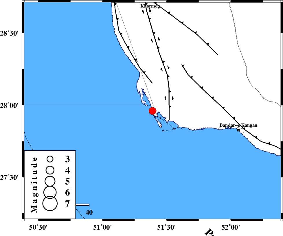
| Location | Lat:27.96 Lon: 51.39 |
| Region | Persian Gulf, 77 km South of Khormog |
Nearest Cities |
|
| 14 km of Bardkhun, Bushehr Province | |
| 23 km South of Ziyarat, Bushehr Province | |
| 26 km South West of Abkesh, Bushehr Province | |
| 39 km South West of Abdan, Bushehr Province | |
| 44 km South West of Kaki, Bushehr Province | |
| Depth | 28 km |
| Agency | |
Faults within 150 km: |
|
| BORAZJAN_F (Length: 168 km) , Distance to epicenter: 15 km | |
| ZFF2 (Length: 84 km) , Distance to epicenter: 21 km | |
| MFF3 (Length: 292 km) , Distance to epicenter: 39 km | |
| Number of Phases | 6 |
| RMS | 0 |
| Number of Stations | 4 |
| Error in Latitude | >3.1 km |
| Error in Longitude | 2.5 km |
| Error in Depth | 3.3 km |
Download waveform in seisan format
to download seisan software Click here
to access information about IIEES stations Click here
Amplitude | ||||||||
| UID | Agency | Station | Component | Amplitude | Period | Arrival Time | Proccessing Time | Signal Clip |
| 88979 | IIEES | AHRM | E | 1262.9 | 0.52 | 2013-04-27 11:08:02 | 2013-04-27 12:28:00 | n |
| 88980 | IIEES | GHIR | E | 947.6 | 0.52 | 2013-04-27 11:08:11 | 2013-04-27 12:28:00 | n |
Phase | ||||||||||||
| Agency | Station | Component | Phase Type | Phase Quality | First Motion | Observed Arrival Time | Time Residual | Loc. Flag | Input Weight | Distance | Azimuth | |
| IIEES | AHRM | Z | Pg | E | 2013-04-27 11:07:34 | -0.02 | y | 101 | 355 | |||
| IIEES | AHRM | E | Sg | E | 2013-04-27 11:07:47 | 0.01 | y | 101 | 355 | |||
| IIEES | GHIR | Z | Pg | E | 2013-04-27 11:07:44 | 0.01 | y | 161 | 77 | |||
| IIEES | GHIR | E | Sg | E | 2013-04-27 11:08:03 | 0 | y | 161 | 77 | |||
| IIEES | YZKH | Z | Pn | E | 2013-04-27 11:08:36 | -0.04 | y | 580 | 31 | |||
| IIEES | KHMZ | Z | Pn | E | 2013-04-27 11:08:45 | 0.05 | y | 656 | 348 | |||