
Magnitude |
2.7 |
| Date & Time (UTC) | 2013-04-28 12:40:36.8 |
| Date & Time (Local) | 1392/2/8 17:10:36.8 |
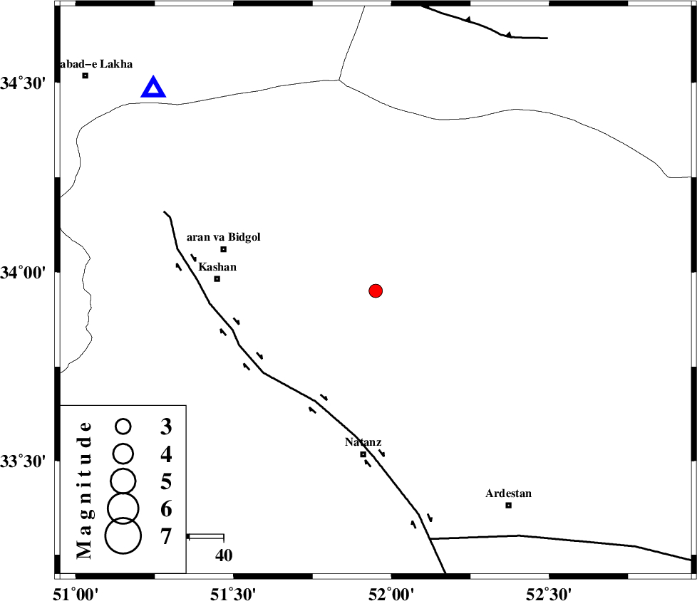
| Location | Lat:33.95 Lon: 51.95 |
| Region | Esfahan Province, 49 km North of Natanz |
Nearest Cities |
|
| 14 km North of Hoseynabad, Esfahan Province | |
| 16 km North East of Abuzeidabad, Esfahan Province | |
| 32 km North of Arisman, Esfahan Province | |
| 37 km North East of Khorramdasht, Esfahan Province | |
| 39 km South of Marnejab, Esfahan Province | |
| Depth | 18 km |
| Agency | |
Faults within 150 km: |
|
| ZEFREH_F (Length: 124 km) , Distance to epicenter: 37 km | |
| KASHAN_F (Length: 44 km) , Distance to epicenter: 43 km | |
| CHAH_ZANGUL_F (Length: 123 km) , Distance to epicenter: 75 km | |
| Number of Phases | 6 |
| RMS | 0.1 |
| Number of Stations | 4 |
| Error in Latitude | >4.3 km |
| Error in Longitude | 2.5 km |
| Error in Depth | 5.3 km |
Download waveform in seisan format
to download seisan software Click here
to access information about IIEES stations Click here
Amplitude | ||||||||
| UID | Agency | Station | Component | Amplitude | Period | Arrival Time | Proccessing Time | Signal Clip |
| 88991 | IIEES | GHVR | E | 276 | 0.36 | 2013-04-28 12:41:03 | 2013-04-28 02:05:00 | n |
Phase | ||||||||||||
| Agency | Station | Component | Phase Type | Phase Quality | First Motion | Observed Arrival Time | Time Residual | Loc. Flag | Input Weight | Distance | Azimuth | |
| IIEES | GHVR | Z | Pg | E | 2013-04-28 12:40:51 | -0.08 | y | 87.4 | 312 | |||
| IIEES | GHVR | E | Sg | E | 2013-04-28 12:41:02 | 0 | y | 87.4 | 312 | |||
| IIEES | KHMZ | Z | Pn | E | 2013-04-28 12:41:07 | -0.11 | y | 185 | 263 | |||
| IIEES | ASAO | Z | Pn | E | 2013-04-28 12:41:07 | 0.06 | y | 189 | 291 | |||
| IIEES | ASAO | E | Sg | E | 2013-04-28 12:41:31 | 0.09 | y | 189 | 291 | |||
| IIEES | YZKH | Z | Pn | E | 2013-04-28 12:41:21 | 0.06 | y | 301 | 124 | |||