
Magnitude |
4.5 |
| Date & Time (UTC) | 2013-05-01 16:31:30.5 |
| Date & Time (Local) | 1392/2/11 21:01:30.5 |
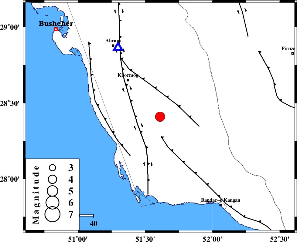
| Location | Lat:28.41 Lon: 51.61 |
| Region | Bushehr Province, 36 km South-East of Khormog |
Nearest Cities |
|
| 11 km North East of Baduleh, Bushehr Province | |
| 12 km North of Kaki, Bushehr Province | |
| 15 km North West of Shanbeh, Bushehr Province | |
| 28 km North of Abkesh, Bushehr Province | |
| 31 km South East of Buheyri, Bushehr Province | |
| Depth | 18 km |
| Agency | |
Faults within 150 km: |
|
| MFF3 (Length: 292 km) , Distance to epicenter: 14 km | |
| MFF5 (Length: 74 km) , Distance to epicenter: 15 km | |
| BORAZJAN_F (Length: 168 km) , Distance to epicenter: 17 km | |
| Number of Phases | 5 |
| RMS | 0.1 |
| Number of Stations | 4 |
| Error in Latitude | >8.5 km |
| Error in Longitude | 4.8 km |
| Error in Depth | 4.2 km |
Download waveform in seisan format
to download seisan software Click here
to access information about IIEES stations Click here
Amplitude | ||||||||
| UID | Agency | Station | Component | Amplitude | Period | Arrival Time | Proccessing Time | Signal Clip |
| 89023 | IIEES | AHRM | N | 28240.9 | 0.52 | 2013-05-01 16:32:00 | 2013-05-01 05:54:00 | n |
Phase | ||||||||||||
| Agency | Station | Component | Phase Type | Phase Quality | First Motion | Observed Arrival Time | Time Residual | Loc. Flag | Input Weight | Distance | Azimuth | |
| IIEES | AHRM | Z | Pg | E | 2013-05-01 16:31:41 | 0 | y | 59.1 | 329 | |||
| IIEES | GHIR | Z | Pg | E | 2013-05-01 16:31:53 | -0.04 | y | 136 | 95 | |||
| IIEES | GHIR | N | Sg | E | 2013-05-01 16:32:09 | 0.04 | y | 136 | 95 | |||
| IIEES | YZKH | Z | Pn | E | 2013-05-01 16:32:43 | -0.08 | y | 526 | 32 | |||
| IIEES | KHMZ | Z | Pn | E | 2013-05-01 16:32:54 | 0.09 | y | 612 | 346 | |||