
Magnitude |
2.6 |
| Date & Time (UTC) | 2013-05-02 19:45:07.3 |
| Date & Time (Local) | 1392/2/13 00:15:07.3 |
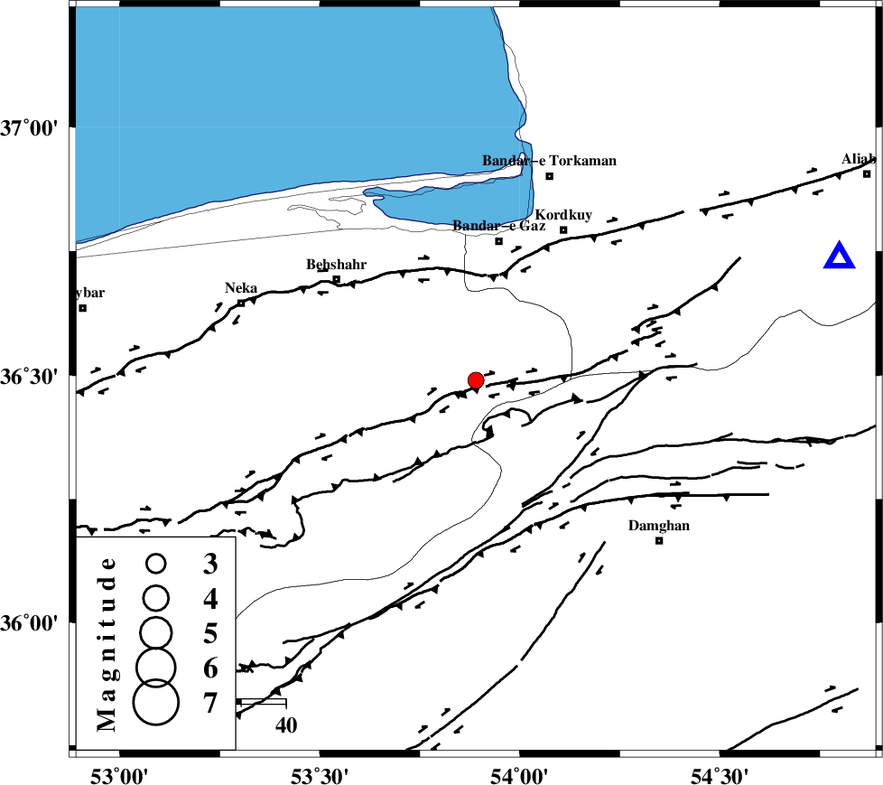
| Location | Lat:36.49 Lon: 53.89 |
| Region | Mazandaran Province, 31 km South of Bandar-e gaz |
Nearest Cities |
|
| 10 km of Bishehboneh, Mazandaran Province | |
| 12 km South of Sefid chah, Mazandaran Province | |
| 27 km South of Nokandeh, Golestan Province | |
| 27 km South of Galugah, Mazandaran Province | |
| 28 km South of Gaz-e gharbi, Golestan Province | |
| Depth | 45 km |
| Agency | |
Faults within 150 km: |
|
| N_ALBORZ_F (Length: 360 km) , Distance to epicenter: 4 km | |
| KHAZAR_F (Length: 523 km) , Distance to epicenter: 26 km | |
| ASTANEH_F (Length: 72 km) , Distance to epicenter: 29 km | |
| Number of Phases | 5 |
| RMS | 0.2 |
| Number of Stations | 5 |
| Error in Latitude | >7.2 km |
| Error in Longitude | 3.9 km |
| Error in Depth | 9.2 km |
Download waveform in seisan format
to download seisan software Click here
to access information about IIEES stations Click here
Amplitude | ||||||||
| UID | Agency | Station | Component | Amplitude | Period | Arrival Time | Proccessing Time | Signal Clip |
| 89037 | IIEES | DAMV | E | 51.7 | 0.48 | 2013-05-02 19:46:09 | 2013-05-02 09:36:00 | n |
| 89038 | IIEES | GHVR | E | 22 | 0.44 | 2013-05-02 19:46:44 | 2013-05-02 09:36:00 | n |
Phase | ||||||||||||
| Agency | Station | Component | Phase Type | Phase Quality | First Motion | Observed Arrival Time | Time Residual | Loc. Flag | Input Weight | Distance | Azimuth | |
| IIEES | DAMV | Z | Pn | E | 2013-05-02 19:45:36 | -0.3 | y | 198 | 242 | |||
| IIEES | SHRO | Z | Pn | E | 2013-05-02 19:45:36 | 0.09 | y | 198 | 105 | |||
| IIEES | SHRO | E | Sg | E | 2013-05-02 19:46:03 | 0 | y | 198 | 105 | |||
| IIEES | MRVT | Z | Pn | E | 2013-05-02 19:45:41 | -0.09 | y | 234 | 56 | |||
| IIEES | CHTH | Z | Pn | E | 2013-05-02 19:45:44 | 0.29 | y | 257 | 256 | |||