
Magnitude |
1.8 |
| Date & Time (UTC) | 2013-05-02 10:47:36.5 |
| Date & Time (Local) | 1392/2/12 15:17:36.5 |
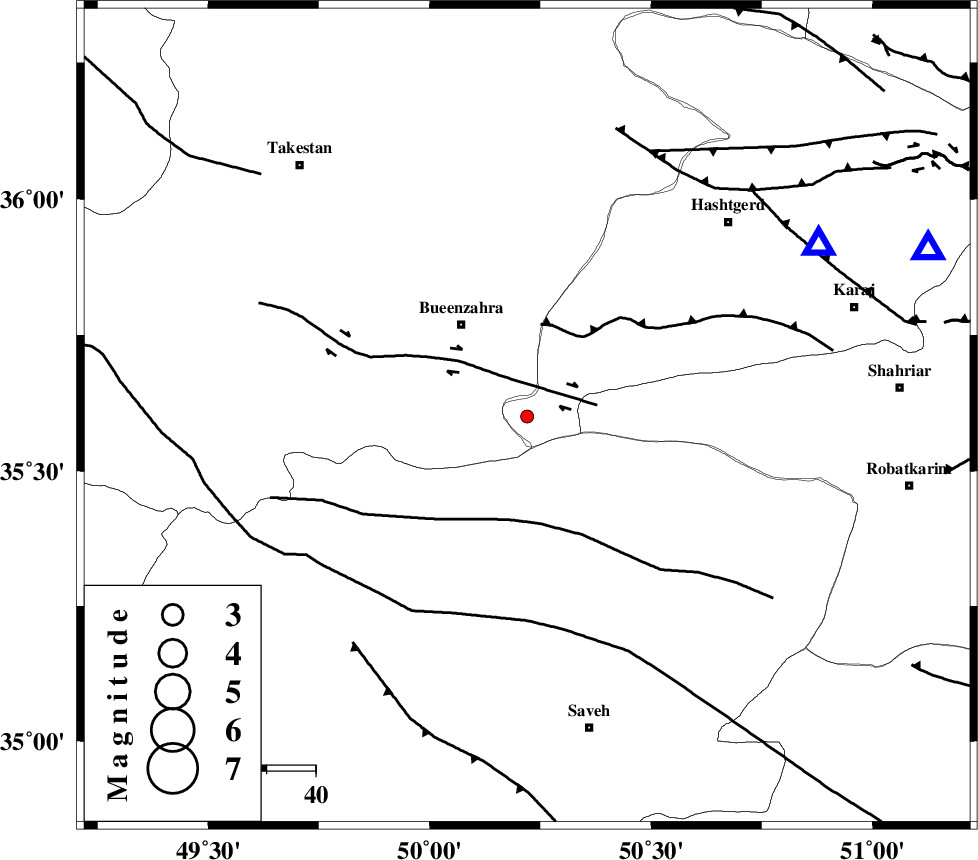
| Location | Lat:35.6 Lon: 50.22 |
| Region | Tehran Province, 23 km South-East of Buinzara |
Nearest Cities |
|
| 23 km South West of Eshtehard, Tehran Province | |
| 23 km South East of Buinzara, Ghazvin Province | |
| 25 km North West of Khoshkrud, Markazi Province | |
| 31 km South East of Sagezabad, Ghazvin Province | |
| 37 km South West of Najmabad, Tehran Province | |
| Depth | 36 km |
| Agency | |
Faults within 150 km: |
|
| IPAK_F (Length: 80 km) , Distance to epicenter: 9 km | |
| ESHTEHARD_F (Length: 69 km) , Distance to epicenter: 19 km | |
| S_PARANDAK_F (Length: 116 km) , Distance to epicenter: 22 km | |
| Number of Phases | 5 |
| RMS | 0.4 |
| Number of Stations | 3 |
| Error in Latitude | >5.2 km |
| Error in Longitude | 6.8 km |
| Error in Depth | 9.4 km |
Download waveform in seisan format
to download seisan software Click here
to access information about IIEES stations Click here
Amplitude | ||||||||
| UID | Agency | Station | Component | Amplitude | Period | Arrival Time | Proccessing Time | Signal Clip |
| 89056 | IIEES | GHVR | N | 14.6 | 0.44 | 2013-05-02 10:48:28 | 2013-05-03 02:04:00 | n |
| 89057 | IIEES | GHVR | E | 16.7 | 0.32 | 2013-05-02 10:48:32 | 2013-05-03 02:04:00 | n |
| 89058 | IIEES | ZNJK | E | 6.2 | 0.44 | 2013-05-02 10:48:32 | 2013-05-03 02:04:00 | n |
| 89059 | IIEES | ZNJK | N | 9 | 0.6 | 2013-05-02 10:48:34 | 2013-05-03 02:04:00 | n |
Phase | ||||||||||||
| Agency | Station | Component | Phase Type | Phase Quality | First Motion | Observed Arrival Time | Time Residual | Loc. Flag | Input Weight | Distance | Azimuth | |
| IIEES | CHTH | Z | Pg | E | 2013-05-02 10:47:52 | 0.04 | y | 89.2 | 67 | |||
| IIEES | GHVR | Z | Pg | E | 2013-05-02 10:48:01 | -0.67 | y | 156 | 143 | |||
| IIEES | GHVR | E | Sg | E | 2013-05-02 10:48:21 | 0.48 | y | 156 | 143 | |||
| IIEES | ZNJK | Z | Pn | E | 2013-05-02 10:48:05 | 0.09 | y | 182 | 311 | |||
| IIEES | ZNJK | N | Sg | E | 2013-05-02 10:48:27 | 0.06 | y | 182 | 311 | |||