
Magnitude |
4.2 |
| Date & Time (UTC) | 2013-05-04 04:13:16.9 |
| Date & Time (Local) | 1392/2/14 08:43:16.9 |
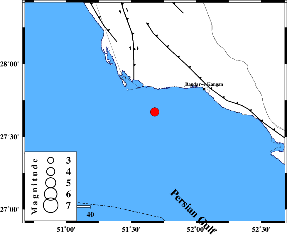
| Location | Lat:27.67 Lon: 51.68 |
| Region | Persian Gulf, 42 km South-West of Bandar-e kangan |
Nearest Cities |
|
| 41 km South West of Bandar-e kangan, Bushehr Province | |
| 46 km South of Abdan, Bushehr Province | |
| 48 km South East of Bardkhun, Bushehr Province | |
| 57 km South West of Riz, Bushehr Province | |
| 57 km South East of Abkesh, Bushehr Province | |
| Depth | 31 km |
| Agency | |
Faults within 150 km: |
|
| BORAZJAN_F (Length: 168 km) , Distance to epicenter: 30 km | |
| MFF3 (Length: 292 km) , Distance to epicenter: 43 km | |
| ZFF2 (Length: 84 km) , Distance to epicenter: 61 km | |
| Number of Phases | 9 |
| RMS | 0.3 |
| Number of Stations | 8 |
| Error in Latitude | >6.9 km |
| Error in Longitude | 3.6 km |
| Error in Depth | 5.5 km |
Download waveform in seisan format
to download seisan software Click here
to access information about IIEES stations Click here
Amplitude | ||||||||
| UID | Agency | Station | Component | Amplitude | Period | Arrival Time | Proccessing Time | Signal Clip |
| 89074 | IIEES | GHIR | N | 6559.2 | 0.65 | 2013-05-04 04:14:02 | 2013-05-04 05:48:00 | n |
| 89075 | IIEES | GHIR | E | 5252.2 | 0.72 | 2013-05-04 04:14:06 | 2013-05-04 05:48:00 | n |
| 89076 | IIEES | BNDS | E | 238.1 | 0.54 | 2013-05-04 04:15:39 | 2013-05-04 05:48:00 | n |
| 89077 | IIEES | BNDS | N | 204.1 | 0.78 | 2013-05-04 04:15:49 | 2013-05-04 05:48:00 | n |
Phase | ||||||||||||
| Agency | Station | Component | Phase Type | Phase Quality | First Motion | Observed Arrival Time | Time Residual | Loc. Flag | Input Weight | Distance | Azimuth | |
| IIEES | AHRM | Z | Pg | E | 2013-05-04 04:13:39 | -0.19 | y | 138 | 344 | |||
| IIEES | GHIR | Z | Pg | E | 2013-05-04 04:13:41 | 0.38 | y | 146 | 62 | |||
| IIEES | GHIR | E | Sg | E | 2013-05-04 04:13:58 | -0.16 | y | 146 | 62 | |||
| IIEES | BNDS | Z | Pn | E | 2013-05-04 04:14:18 | -0.29 | y | 445 | 93 | |||
| IIEES | YZKH | Z | Pn | E | 2013-05-04 04:14:37 | 0.07 | y | 594 | 28 | |||
| IIEES | KHMZ | Z | Pn | E | 2013-05-04 04:14:49 | -0.11 | y | 693 | 347 | |||
| IIEES | ASAO | Z | Pn | E | 2013-05-04 04:15:00 | 0.43 | y | 779 | 349 | |||
| IIEES | TABS | Z | Pn | E | 2013-05-04 04:15:07 | -0.11 | y | 843 | 37 | |||
| IIEES | BSRN | Z | Pn | E | 2013-05-04 04:15:10 | 0.26 | y | 863 | 55 | |||