
Magnitude |
3.3 |
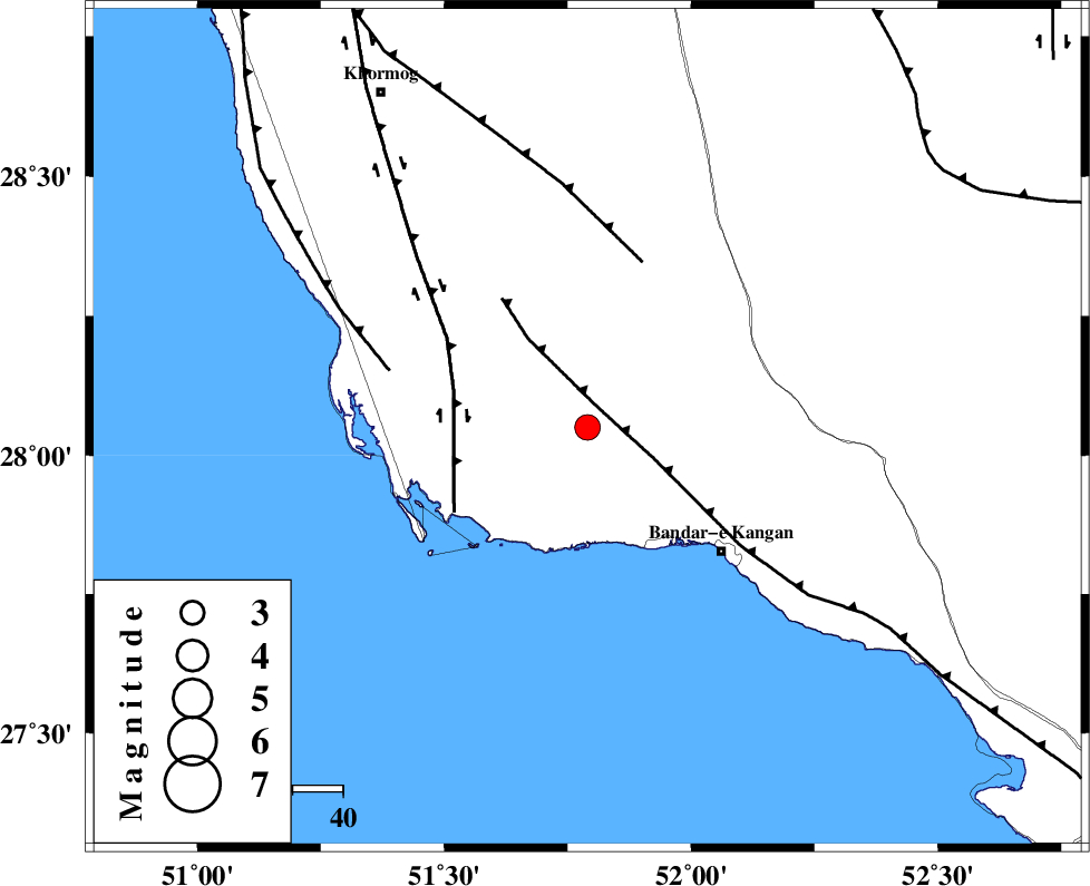
| Date & Time (UTC) | 2013-05-04 14:49:19.9 |
| Date & Time (Local) | 1392/2/14 19:19:19.9 |
| Location | Lat:28.05 Lon: 51.79 |
| Region | Bushehr Province, 37 km North-West of Bandar-e kangan |
Nearest Cities |
|
| 4 km of Abdan, Bushehr Province | |
| 28 km North West of Riz, Bushehr Province | |
| 29 km South East of Abkesh, Bushehr Province | |
| 31 km East of Bardkhun, Bushehr Province | |
| 36 km North West of Bandar-e kangan, Bushehr Province | |
| Depth | 28 km |
| Agency | |
Faults within 150 km: |
|
| MFF3 (Length: 292 km) , Distance to epicenter: 5 km | |
| BORAZJAN_F (Length: 168 km) , Distance to epicenter: 28 km | |
| MFF5 (Length: 74 km) , Distance to epicenter: 35 km | |
| Number of Phases | 4 |
| RMS | 0 |
| Number of Stations | 3 |
| Error in Latitude | >7.6 km |
| Error in Longitude | 5.8 km |
| Error in Depth | 4.8 km |
Download waveform in seisan format
to download seisan software Click here
to access information about IIEES stations Click here
Amplitude | ||||||||
| UID | Agency | Station | Component | Amplitude | Period | Arrival Time | Proccessing Time | Signal Clip |
| 89094 | IIEES | GHIR | N | 639.1 | 0.48 | 2013-05-04 14:50:09 | 2013-05-04 04:33:00 | n |
Phase | ||||||||||||
| Agency | Station | Component | Phase Type | Phase Quality | First Motion | Observed Arrival Time | Time Residual | Loc. Flag | Input Weight | Distance | Azimuth | |
| IIEES | AHRM | Z | Pg | E | 2013-05-04 14:49:37 | 0 | y | 102 | 332 | |||
| IIEES | AHRM | N | Sg | E | 2013-05-04 14:49:49 | 0 | y | 102 | 332 | |||
| IIEES | GHIR | Z | Pg | E | 2013-05-04 14:49:40 | 0 | y | 121 | 77 | |||
| IIEES | KHMZ | Z | Pn | E | 2013-05-04 14:50:47 | 0 | y | 654 | 345 | |||