
Magnitude |
2.8 |
| Date & Time (UTC) | 2013-05-05 07:58:28.8 |
| Date & Time (Local) | 1392/2/15 12:28:28.8 |
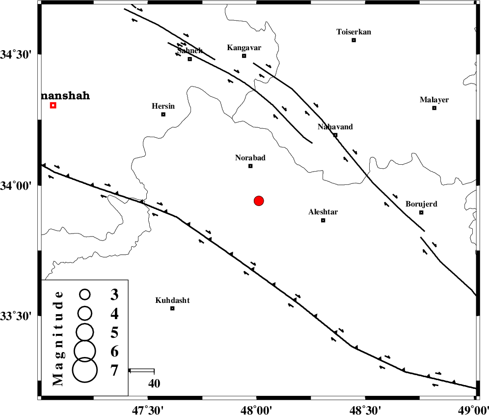
| Location | Lat:33.94 Lon: 48.01 |
| Region | Lorestan Province, 15 km South of Nurabad |
Nearest Cities |
|
| 4 km of Farhadabad, Lorestan Province | |
| 13 km North West of Firuz Abad, Lorestan Province | |
| 15 km South of Nurabad, Lorestan Province | |
| 16 km South of Zafarabad, Lorestan Province | |
| 17 km South of Kafraj, Lorestan Province | |
| Depth | 14 km |
| Agency | |
Faults within 150 km: |
|
| HZF4 (Length: 492 km) , Distance to epicenter: 26 km | |
| SAHANEH_F (Length: 77 km) , Distance to epicenter: 33 km | |
| NAHAVAND_F (Length: 102 km) , Distance to epicenter: 43 km | |
| Number of Phases | 5 |
| RMS | 0.2 |
| Number of Stations | 4 |
| Error in Latitude | >6.2 km |
| Error in Longitude | 3.7 km |
| Error in Depth | 8 km |
Download waveform in seisan format
to download seisan software Click here
to access information about IIEES stations Click here
Amplitude | ||||||||
| UID | Agency | Station | Component | Amplitude | Period | Arrival Time | Proccessing Time | Signal Clip |
| 89100 | IIEES | GHVR | N | 29.2 | 0.57 | 2013-05-05 08:00:01 | 2013-05-05 09:32:00 | n |
| 89101 | IIEES | GHVR | E | 36.1 | 0.57 | 2013-05-05 08:00:02 | 2013-05-05 09:32:00 | n |
Phase | ||||||||||||
| Agency | Station | Component | Phase Type | Phase Quality | First Motion | Observed Arrival Time | Time Residual | Loc. Flag | Input Weight | Distance | Azimuth | |
| IIEES | SNGE | Z | Pg | E | 2013-05-05 07:58:52 | 0 | y | 141 | 335 | |||
| IIEES | KHMZ | Z | Pg | E | 2013-05-05 07:58:58 | -0.08 | y | 183 | 96 | |||
| IIEES | ASAO | Z | Pg | E | 2013-05-05 07:59:01 | -0.35 | y | 198 | 70 | |||
| IIEES | ASAO | E | Sg | E | 2013-05-05 07:59:25 | 0.09 | y | 198 | 70 | |||
| IIEES | GHVR | Z | Pn | E | 2013-05-05 07:59:14 | 0.37 | y | 304 | 78 | |||