
Magnitude |
2.8 |
| Date & Time (UTC) | 2013-05-12 20:29:52.3 |
| Date & Time (Local) | 1392/2/23 00:59:52.3 |
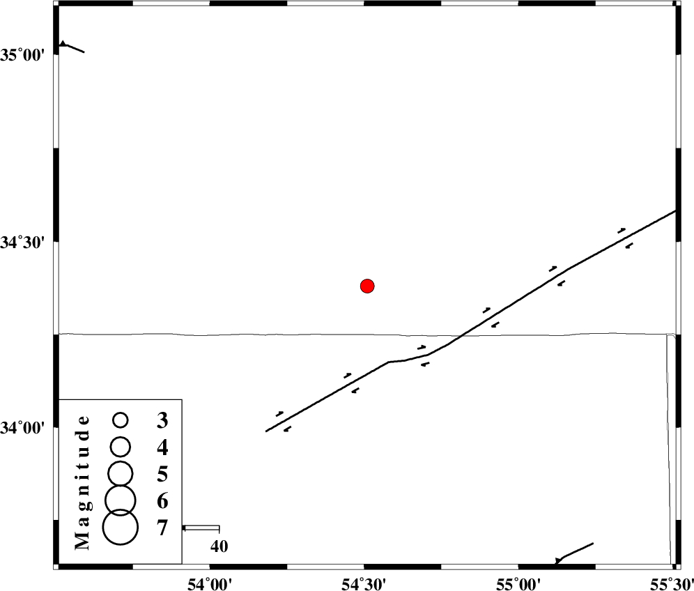
| Location | Lat:34.38 Lon: 54.51 |
| Region | Semnan Province, 199 km South-East of Damghan |
Nearest Cities |
|
| 38 km North of Jondaq, Esfahan Province | |
| 72 km North West of Farrokhi, Esfahan Province | |
| 85 km North West of Khur, Esfahan Province | |
| 86 km North East of Chupanan, Esfahan Province | |
| 115 km North West of Mehranjan, Esfahan Province | |
| Depth | 18 km |
| Agency | |
Faults within 150 km: |
|
| DORUNEH_F (Length: 713 km) , Distance to epicenter: 24 km | |
| TORUD_F (Length: 136 km) , Distance to epicenter: 97 km | |
| BIABANAK_F (Length: 162 km) , Distance to epicenter: 100 km | |
| Number of Phases | 6 |
| RMS | 0 |
| Number of Stations | 4 |
| Error in Latitude | >2.1 km |
| Error in Longitude | 1.2 km |
| Error in Depth | 3.2 km |
Download waveform in seisan format
to download seisan software Click here
to access information about IIEES stations Click here
Amplitude | ||||||||
| UID | Agency | Station | Component | Amplitude | Period | Arrival Time | Proccessing Time | Signal Clip |
| 89241 | IIEES | SHRO | N | 68.1 | 0.48 | 2013-05-12 20:31:02 | 2013-05-12 09:56:00 | n |
| 89242 | IIEES | GHVR | N | 31.2 | 0.4 | 2013-05-12 20:31:18 | 2013-05-12 09:56:00 | n |
| 89243 | IIEES | GHVR | E | 32.8 | 0.44 | 2013-05-12 20:31:18 | 2013-05-12 09:56:00 | n |
Phase | ||||||||||||
| Agency | Station | Component | Phase Type | Phase Quality | First Motion | Observed Arrival Time | Time Residual | Loc. Flag | Input Weight | Distance | Azimuth | |
| IIEES | SHRO | Z | Pn | E | 2013-05-12 20:30:27 | -0.02 | y | 227 | 37 | |||
| IIEES | SHRO | N | Sg | E | 2013-05-12 20:30:56 | 0.01 | y | 227 | 37 | |||
| IIEES | TABS | Z | Pn | E | 2013-05-12 20:30:31 | 0.01 | y | 254 | 108 | |||
| IIEES | DAMV | Z | Pn | E | 2013-05-12 20:30:33 | 0 | y | 270 | 302 | |||
| IIEES | GHVR | Z | Pn | E | 2013-05-12 20:30:36 | -0.02 | y | 300 | 273 | |||
| IIEES | GHVR | E | Sg | E | 2013-05-12 20:31:16 | 0.02 | y | 300 | 273 | |||