
Magnitude |
2.6 |
| Date & Time (UTC) | 2013-05-14 06:43:02.1 |
| Date & Time (Local) | 1392/2/24 11:13:02.1 |
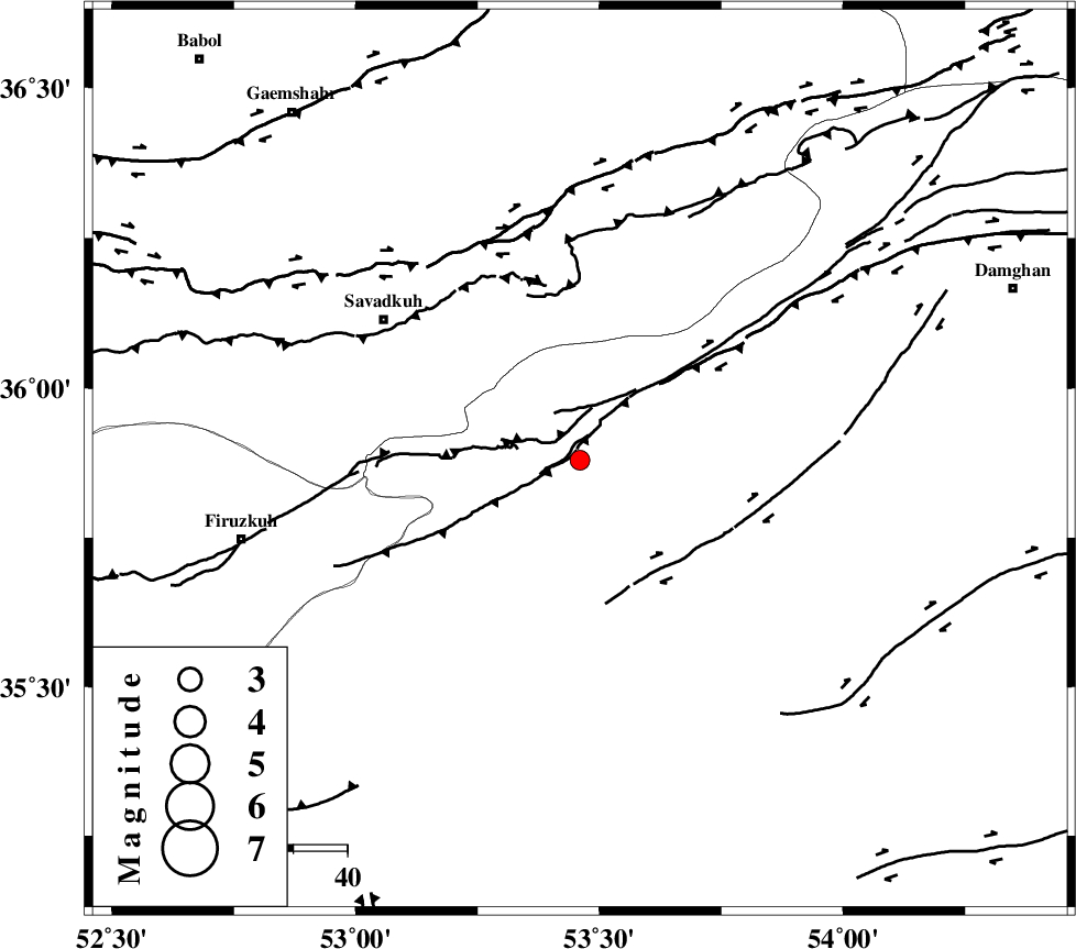
| Location | Lat:35.88 Lon: 53.46 |
| Region | Semnan Province, 35 km North of Semnan |
Nearest Cities |
|
| 18 km North East of Shahmirzad, Semnan Province | |
| 18 km East of Chashem, Semnan Province | |
| 22 km North East of Mehdishahr, Semnan Province | |
| 30 km South East of Sangdeh, Mazandaran Province | |
| 35 km North of Semnan, Semnan Province | |
| Depth | 15 km |
| Agency | |
Faults within 150 km: |
|
| ATARI_F (Length: 185 km) , Distance to epicenter: 15 km | |
| N_ALBORZ_F (Length: 360 km) , Distance to epicenter: 44 km | |
| DAMGHAN_F (Length: 95 km) , Distance to epicenter: 45 km | |
| Number of Phases | 5 |
| RMS | 0.2 |
| Number of Stations | 5 |
| Error in Latitude | >8.8 km |
| Error in Longitude | 3.8 km |
| Error in Depth | 5 km |
Download waveform in seisan format
to download seisan software Click here
to access information about IIEES stations Click here
Amplitude | ||||||||
| UID | Agency | Station | Component | Amplitude | Period | Arrival Time | Proccessing Time | Signal Clip |
| 89275 | IIEES | DAMV | E | 83.7 | 0.26 | 2013-05-14 06:43:46 | 2013-05-14 08:04:00 | n |
| 89276 | IIEES | GHVR | N | 41.3 | 0.61 | 2013-05-14 06:44:21 | 2013-05-14 08:04:00 | n |
Phase | ||||||||||||
| Agency | Station | Component | Phase Type | Phase Quality | First Motion | Observed Arrival Time | Time Residual | Loc. Flag | Input Weight | Distance | Azimuth | |
| IIEES | DAMV | Z | Pg | E | 2013-05-14 06:43:24 | -0.29 | y | 137 | 259 | |||
| IIEES | CHTH | Z | Pn | E | 2013-05-14 06:43:36 | 0.16 | y | 210 | 271 | |||
| IIEES | SHRO | Z | Pn | E | 2013-05-14 06:43:38 | -0.05 | y | 231 | 86 | |||
| IIEES | GHVR | Z | Pn | E | 2013-05-14 06:43:41 | 0 | y | 254 | 233 | |||
| IIEES | ASAO | Z | Pn | E | 2013-05-14 06:43:53 | 0.21 | y | 346 | 246 | |||