
Magnitude |
3.4 |
| Date & Time (UTC) | 2013-05-19 20:16:14.5 |
| Date & Time (Local) | 1392/2/30 00:46:14.5 |
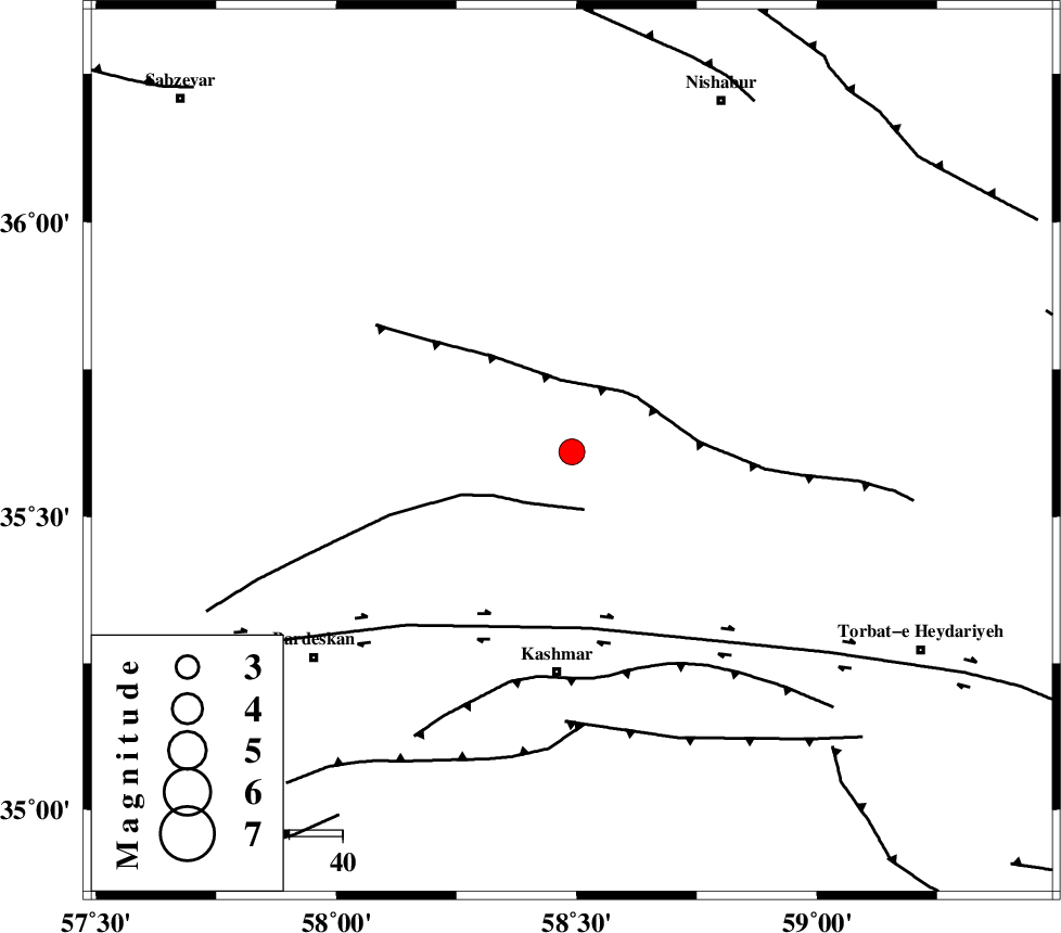
| Location | Lat:35.61 Lon: 58.49 |
| Region | Khorasan(center) Province, 41 km North of Kashmar |
Nearest Cities |
|
| 15 km North East of Ondar, Khorasan(center) Province | |
| 16 km North of Rivash, Khorasan(center) Province | |
| 17 km North of Toroq, Khorasan(center) Province | |
| 32 km East of Ghaleh meidan, Khorasan(center) Province | |
| 36 km North West of Kadkan, Khorasan(center) Province | |
| Depth | 18 km |
| Agency | |
Faults within 150 km: |
|
| BIJVARD_F (Length: 83 km) , Distance to epicenter: 11 km | |
| BALHAR_F (Length: 117 km) , Distance to epicenter: 14 km | |
| DORUNEH_F (Length: 713 km) , Distance to epicenter: 33 km | |
| Number of Phases | 6 |
| RMS | 0.1 |
| Number of Stations | 4 |
| Error in Latitude | >2.5 km |
| Error in Longitude | 7.7 km |
| Error in Depth | 8.9 km |
Download waveform in seisan format
to download seisan software Click here
to access information about IIEES stations Click here
Amplitude | ||||||||
| UID | Agency | Station | Component | Amplitude | Period | Arrival Time | Proccessing Time | Signal Clip |
| 89352 | IIEES | TABS | N | 291.2 | 0.52 | 2013-05-19 20:17:35 | 2013-05-19 09:41:00 | n |
| 89353 | IIEES | TABS | E | 154.2 | 0.6 | 2013-05-19 20:17:35 | 2013-05-19 09:41:00 | n |
Phase | ||||||||||||
| Agency | Station | Component | Phase Type | Phase Quality | First Motion | Observed Arrival Time | Time Residual | Loc. Flag | Input Weight | Distance | Azimuth | |
| IIEES | SHRO | Z | Pn | E | 2013-05-19 20:16:50 | -0.07 | y | 228 | 282 | |||
| IIEES | SHRO | E | Sg | E | 2013-05-19 20:17:19 | 0 | y | 228 | 282 | |||
| IIEES | TABS | Z | Pn | E | 2013-05-19 20:16:52 | -0.04 | y | 251 | 210 | |||
| IIEES | TABS | N | Sg | E | 2013-05-19 20:17:25 | 0.07 | y | 251 | 210 | |||
| IIEES | MRVT | Z | Pn | E | 2013-05-19 20:17:00 | 0.12 | y | 313 | 317 | |||
| IIEES | NASN | Z | Pn | E | 2013-05-19 20:17:37 | -0.12 | y | 609 | 241 | |||