
Magnitude |
1.8 |
| Date & Time (UTC) | 2013-05-20 13:38:43.5 |
| Date & Time (Local) | 1392/2/30 18:08:43.5 |
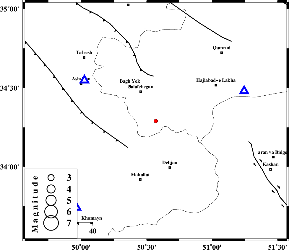
| Location | Lat:34.29 Lon: 50.57 |
| Region | Qom Province, 35 km North-West of Delijan |
Nearest Cities |
|
| 17 km North of Dudhak, Markazi Province | |
| 23 km South East of Salafchegan, Qom Province | |
| 26 km North of Khorheh, Markazi Province | |
| 29 km North West of Vasqonqan, Markazi Province | |
| 29 km West of Kahak, Qom Province | |
| Depth | 29 km |
| Agency | |
Faults within 150 km: |
|
| TAFRESH_F (Length: 117 km) , Distance to epicenter: 27 km | |
| INDES_F (Length: 98 km) , Distance to epicenter: 32 km | |
| KASHAN_F (Length: 44 km) , Distance to epicenter: 67 km | |
| Number of Phases | 5 |
| RMS | 0.2 |
| Number of Stations | 4 |
| Error in Latitude | >3 km |
| Error in Longitude | 4.2 km |
| Error in Depth | 5.9 km |
Download waveform in seisan format
to download seisan software Click here
to access information about IIEES stations Click here
Amplitude | ||||||||
| UID | Agency | Station | Component | Amplitude | Period | Arrival Time | Proccessing Time | Signal Clip |
| 89360 | IIEES | GHVR | E | 66.8 | 0.4 | 2013-05-20 13:39:08 | 2013-05-20 03:02:00 | n |
| 89361 | IIEES | GHVR | N | 71.5 | 0.32 | 2013-05-20 13:39:09 | 2013-05-20 03:02:00 | n |
| 89362 | IIEES | KHMZ | N | 29.5 | 0.24 | 2013-05-20 13:39:11 | 2013-05-20 03:02:00 | n |
| 89363 | IIEES | KHMZ | E | 24.8 | 0.24 | 2013-05-20 13:39:16 | 2013-05-20 03:02:00 | n |
| 89364 | IIEES | CHTH | N | 6.9 | 0.24 | 2013-05-20 13:39:43 | 2013-05-20 03:02:00 | n |
Phase | ||||||||||||
| Agency | Station | Component | Phase Type | Phase Quality | First Motion | Observed Arrival Time | Time Residual | Loc. Flag | Input Weight | Distance | Azimuth | |
| IIEES | ASAO | Z | Pg | E | 2013-05-20 13:38:54 | -0.3 | y | 57.3 | 300 | |||
| IIEES | GHVR | Z | Pg | E | 2013-05-20 13:38:55 | -0.18 | y | 65.7 | 71 | |||
| IIEES | KHMZ | Z | Pg | E | 2013-05-20 13:38:58 | 0.29 | y | 82.9 | 222 | |||
| IIEES | CHTH | Z | Pn | E | 2013-05-20 13:39:13 | -0.11 | y | 186 | 16 | |||
| IIEES | CHTH | E | Sg | E | 2013-05-20 13:39:36 | 0.29 | y | 186 | 16 | |||