
Magnitude |
1.7 |
| Date & Time (UTC) | 2013-05-20 09:46:55.1 |
| Date & Time (Local) | 1392/2/30 14:16:55.1 |
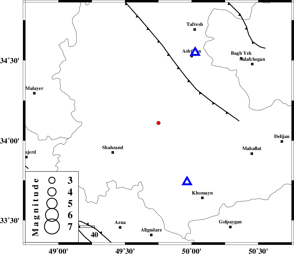
| Location | Lat:34.11 Lon: 49.75 |
| Region | Markazi Province, 6 km Arak |
Nearest Cities |
|
| 7 km North of Arak, Markazi Province | |
| 10 km East of Marzijaran, Markazi Province | |
| 17 km South of Ebakabad, Markazi Province | |
| 17 km North East of Sanjan, Markazi Province | |
| 22 km North West of Amanabad, Markazi Province | |
| Depth | 27 km |
| Agency | |
Faults within 150 km: |
|
| TAFRESH_F (Length: 117 km) , Distance to epicenter: 35 km | |
| MAIN_ZAGROS_R_F (Length: 1106 km) , Distance to epicenter: 86 km | |
| INDES_F (Length: 98 km) , Distance to epicenter: 86 km | |
| Number of Phases | 5 |
| RMS | 0.1 |
| Number of Stations | 3 |
| Error in Latitude | >1.9 km |
| Error in Longitude | 3.6 km |
| Error in Depth | 3.2 km |
Download waveform in seisan format
to download seisan software Click here
to access information about IIEES stations Click here
Amplitude | ||||||||
| UID | Agency | Station | Component | Amplitude | Period | Arrival Time | Proccessing Time | Signal Clip |
| 89368 | IIEES | GHVR | N | 14.3 | 0.16 | 2013-05-20 09:47:37 | 2013-05-20 11:59:00 | n |
| 89369 | IIEES | GHVR | E | 14.5 | 0.2 | 2013-05-20 09:47:38 | 2013-05-20 11:59:00 | n |
Phase | ||||||||||||
| Agency | Station | Component | Phase Type | Phase Quality | First Motion | Observed Arrival Time | Time Residual | Loc. Flag | Input Weight | Distance | Azimuth | |
| IIEES | KHMZ | Z | Pg | E | 2013-05-20 09:47:04 | -0.05 | y | 45.2 | 154 | |||
| IIEES | ASAO | Z | Pg | E | 2013-05-20 09:47:05 | 0.22 | y | 55.3 | 27 | |||
| IIEES | ASAO | E | Sg | E | 2013-05-20 09:47:12 | -0.16 | y | 55.3 | 27 | |||
| IIEES | GHVR | Z | Pn | E | 2013-05-20 09:47:19 | -0.06 | y | 144 | 73 | |||
| IIEES | GHVR | E | Sg | E | 2013-05-20 09:47:36 | 0.06 | y | 144 | 73 | |||