
Magnitude |
1.9 |
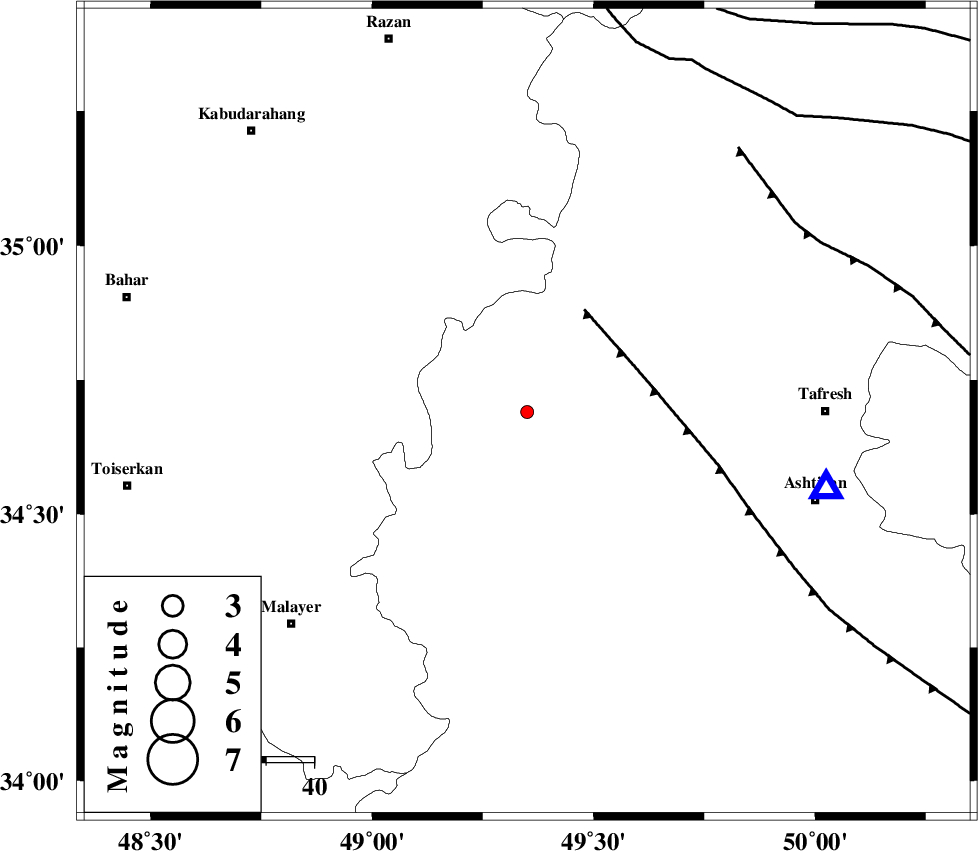
| Date & Time (UTC) | 2013-05-22 10:36:26.1 |
| Date & Time (Local) | 1392/3/1 15:06:26.1 |
| Location | Lat:34.69 Lon: 49.35 |
| Region | Markazi Province, 61 km West of Tafresh |
Nearest Cities |
|
| 8 km North of Safandan, Markazi Province | |
| 9 km of Komijan, Markazi Province | |
| 11 km North East of Khosrobeyk, Markazi Province | |
| 17 km North East of Milajerd, Markazi Province | |
| 18 km South of Vafs, Markazi Province | |
| Depth | 6 km |
| Agency | |
Faults within 150 km: |
|
| TAFRESH_F (Length: 117 km) , Distance to epicenter: 24 km | |
| INDES_F (Length: 98 km) , Distance to epicenter: 68 km | |
| KUSHK_E_NOSRAT_F (Length: 230 km) , Distance to epicenter: 79 km | |
| Number of Phases | 6 |
| RMS | 0.1 |
| Number of Stations | 4 |
| Error in Latitude | >5.5 km |
| Error in Longitude | 3.8 km |
| Error in Depth | 9.8 km |
Download waveform in seisan format
to download seisan software Click here
to access information about IIEES stations Click here
Amplitude | ||||||||
| UID | Agency | Station | Component | Amplitude | Period | Arrival Time | Proccessing Time | Signal Clip |
| 89404 | IIEES | KHMZ | N | 27.3 | 0.27 | 2013-05-22 10:37:03 | 2013-05-23 05:21:00 | n |
| 89405 | IIEES | GHVR | N | 15.9 | 0.24 | 2013-05-22 10:37:19 | 2013-05-23 05:21:00 | n |
| 89406 | IIEES | GHVR | E | 11.8 | 0.16 | 2013-05-22 10:37:19 | 2013-05-23 05:21:00 | n |
Phase | ||||||||||||
| Agency | Station | Component | Phase Type | Phase Quality | First Motion | Observed Arrival Time | Time Residual | Loc. Flag | Input Weight | Distance | Azimuth | |
| IIEES | ASAO | Z | Pg | E | 2013-05-22 10:36:37 | 0.23 | y | 63.9 | 104 | |||
| IIEES | ASAO | E | Sg | E | 2013-05-22 10:36:46 | 0.11 | y | 63.9 | 104 | |||
| IIEES | KHMZ | Z | Pg | E | 2013-05-22 10:36:47 | -0.04 | y | 120 | 152 | |||
| IIEES | GHVR | Z | Pg | E | 2013-05-22 10:36:56 | -0.24 | y | 175 | 97 | |||
| IIEES | GHVR | E | Sg | E | 2013-05-22 10:37:18 | -0.1 | y | 175 | 97 | |||
| IIEES | CHTH | Z | Pn | E | 2013-05-22 10:37:01 | 0.04 | y | 210 | 50 | |||