
Magnitude |
2.5 |
| Date & Time (UTC) | 2013-05-25 02:50:01.7 |
| Date & Time (Local) | 1392/3/4 07:20:01.7 |
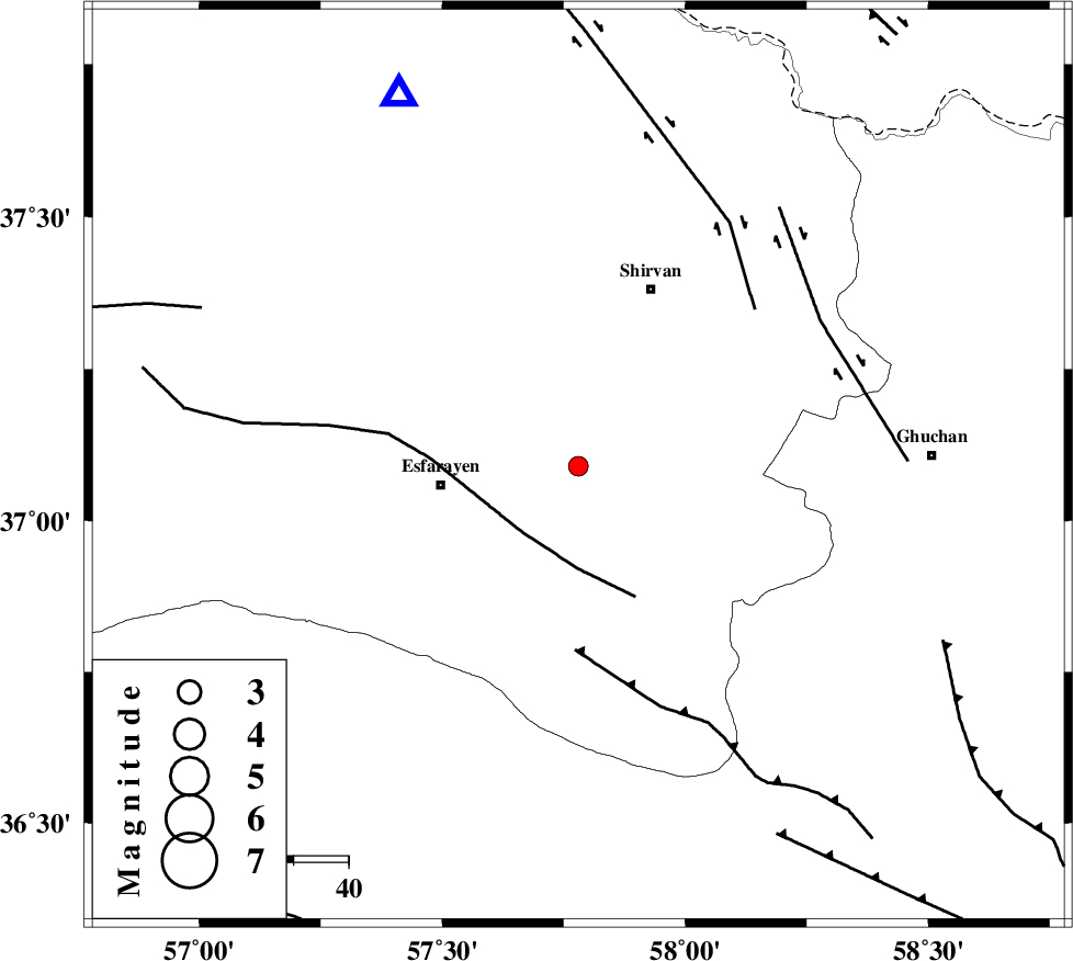
| Location | Lat:37.09 Lon: 57.78 |
| Region | Khorasan(north) Province, 25 km East of Esfarayen |
Nearest Cities |
|
| 16 km North East of Parkanlu, Khorasan(north) Province | |
| 19 km South West of Geliyan, Khorasan(north) Province | |
| 25 km South of Zavarom, Khorasan(north) Province | |
| 25 km North West of Bam, Khorasan(north) Province | |
| 25 km North East of Esfarayen, Khorasan(north) Province | |
| Depth | 38 km |
| Agency | |
Faults within 150 km: |
|
| ESFARAYEN_F (Length: 111 km) , Distance to epicenter: 16 km | |
| RIVAND_F (Length: 70 km) , Distance to epicenter: 34 km | |
| BAGHAN_GERMAB_F (Length: 79 km) , Distance to epicenter: 43 km | |
| Number of Phases | 5 |
| RMS | 0.1 |
| Number of Stations | 3 |
| Error in Latitude | >1.5 km |
| Error in Longitude | 3.1 km |
| Error in Depth | 2.5 km |
Download waveform in seisan format
to download seisan software Click here
to access information about IIEES stations Click here
Amplitude | ||||||||
| UID | Agency | Station | Component | Amplitude | Period | Arrival Time | Proccessing Time | Signal Clip |
| 89428 | IIEES | MRVT | N | 62.6 | 0.24 | 2013-05-25 02:50:52 | 2013-05-25 04:24:00 | n |
Phase | ||||||||||||
| Agency | Station | Component | Phase Type | Phase Quality | First Motion | Observed Arrival Time | Time Residual | Loc. Flag | Input Weight | Distance | Azimuth | |
| IIEES | BJRD | N | Pg | E | 2013-05-25 02:50:15 | 0 | y | 75 | 334 | |||
| IIEES | MRVT | Z | Pn | E | 2013-05-25 02:50:27 | -0.07 | y | 162 | 293 | |||
| IIEES | MRVT | E | Sg | E | 2013-05-25 02:50:47 | 0.03 | y | 162 | 293 | |||
| IIEES | SHRO | Z | Pn | E | 2013-05-25 02:50:32 | 0.07 | y | 198 | 233 | |||
| IIEES | SHRO | N | Sg | E | 2013-05-25 02:50:57 | -0.04 | y | 198 | 233 | |||