
Magnitude |
3.3 |
| Date & Time (UTC) | 2013-05-27 12:24:37.1 |
| Date & Time (Local) | 1392/3/6 16:54:37.1 |
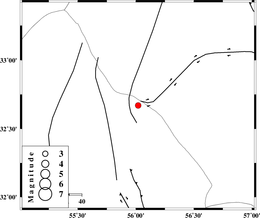
| Location | Lat:32.67 Lon: 56.02 |
| Region | Yazd Province, 132 km North-East of Bafq |
Nearest Cities |
|
| 58 km South East of Robat-e posht-e badam, Yazd Province | |
| 89 km North of Behabad, Yazd Province | |
| 104 km North of Benestan, Yazd Province | |
| 106 km North East of Kushk, Yazd Province | |
| 110 km South of Darin, Yazd Province | |
| Depth | 30 km |
| Agency | |
Faults within 150 km: |
|
| CHESHMEH_ROSTAM_ (Length: 142 km) , Distance to epicenter: 4 km | |
| NAINI_F (Length: 342 km) , Distance to epicenter: 7 km | |
| SARBALA_F (Length: 92 km) , Distance to epicenter: 27 km | |
| Number of Phases | 7 |
| RMS | 0.1 |
| Number of Stations | 5 |
| Error in Latitude | >2.3 km |
| Error in Longitude | 2.2 km |
| Error in Depth | 3.5 km |
Download waveform in seisan format
to download seisan software Click here
to access information about IIEES stations Click here
Amplitude | ||||||||
| UID | Agency | Station | Component | Amplitude | Period | Arrival Time | Proccessing Time | Signal Clip |
| 89457 | IIEES | TABS | N | 384.1 | 0.36 | 2013-05-27 12:25:21 | 2013-05-27 01:51:00 | n |
| 89458 | IIEES | KRBR | E | 167.9 | 0.24 | 2013-05-27 12:26:03 | 2013-05-27 01:51:00 | n |
Phase | ||||||||||||
| Agency | Station | Component | Phase Type | Phase Quality | First Motion | Observed Arrival Time | Time Residual | Loc. Flag | Input Weight | Distance | Azimuth | |
| IIEES | YZKH | Z | Pg | E | 2013-05-27 12:24:59 | 0.07 | y | 137 | 257 | |||
| IIEES | YZKH | E | Sg | E | 2013-05-27 12:25:16 | -0.05 | y | 137 | 257 | |||
| IIEES | TABS | Z | Pn | E | 2013-05-27 12:25:01 | -0.23 | y | 150 | 43 | |||
| IIEES | TABS | E | Sg | E | 2013-05-27 12:25:19 | -0.02 | y | 150 | 43 | |||
| IIEES | KRBR | Z | Pn | E | 2013-05-27 12:25:21 | -0.06 | y | 306 | 166 | |||
| IIEES | SHRO | Z | Pn | E | 2013-05-27 12:25:29 | 0.1 | y | 371 | 360 | |||
| IIEES | SHRT | Z | Pn | E | 2013-05-27 12:25:34 | 0.24 | y | 413 | 74 | |||