
Magnitude |
2.1 |
| Date & Time (UTC) | 2013-05-29 01:28:58.9 |
| Date & Time (Local) | 1392/3/8 05:58:58.9 |
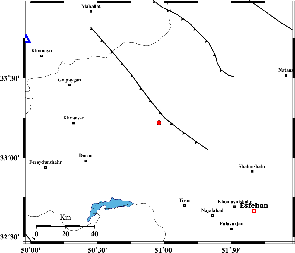
| Location | Lat:33.22 Lon: 50.96 |
| Region | Esfahan Province, 59 km East of Khvansar |
Nearest Cities |
|
| 12 km North of Dehaq, Esfahan Province | |
| 21 km North of Hoseinieh, Esfahan Province | |
| 24 km North West of Alavijeh, Esfahan Province | |
| 25 km South East of Hasan robat, Esfahan Province | |
| 28 km North of Hoseynabad, Esfahan Province | |
| Depth | 14 km |
| Agency | |
Faults within 150 km: |
|
| ZEFREH_F (Length: 124 km) , Distance to epicenter: 82 km | |
| KASHAN_F (Length: 44 km) , Distance to epicenter: 83 km | |
| MAIN_ZAGROS_R_F (Length: 1106 km) , Distance to epicenter: 98 km | |
| Number of Phases | 5 |
| RMS | 0.2 |
| Number of Stations | 4 |
| Error in Latitude | >5.6 km |
| Error in Longitude | 4.6 km |
| Error in Depth | 15 km |
Download waveform in seisan format
to download seisan software Click here
to access information about IIEES stations Click here
Amplitude | ||||||||
| UID | Agency | Station | Component | Amplitude | Period | Arrival Time | Proccessing Time | Signal Clip |
| 89465 | IIEES | KHMZ | N | 54.5 | 0.72 | 2013-05-29 01:29:33 | 2013-05-29 03:31:00 | n |
Phase | ||||||||||||
| Agency | Station | Component | Phase Type | Phase Quality | First Motion | Observed Arrival Time | Time Residual | Loc. Flag | Input Weight | Distance | Azimuth | |
| IIEES | KHMZ | Z | Pg | E | 2013-05-29 01:29:17 | 0.19 | y | 109 | 302 | |||
| IIEES | KHMZ | N | S | E | 2013-05-29 01:29:30 | 0.06 | y | 109 | 302 | |||
| IIEES | GHVR | Z | Pg | E | 2013-05-29 01:29:22 | 0.23 | y | 142 | 11 | |||
| IIEES | ASAO | Z | Pg | E | 2013-05-29 01:29:26 | -0.44 | y | 170 | 330 | |||
| IIEES | NASN | Z | Pg | E | 2013-05-29 01:29:28 | -0.03 | y | 179 | 105 | |||