
Magnitude |
2.8 |
| Date & Time (UTC) | 2013-05-28 01:51:55.2 |
| Date & Time (Local) | 1392/3/7 06:21:55.2 |
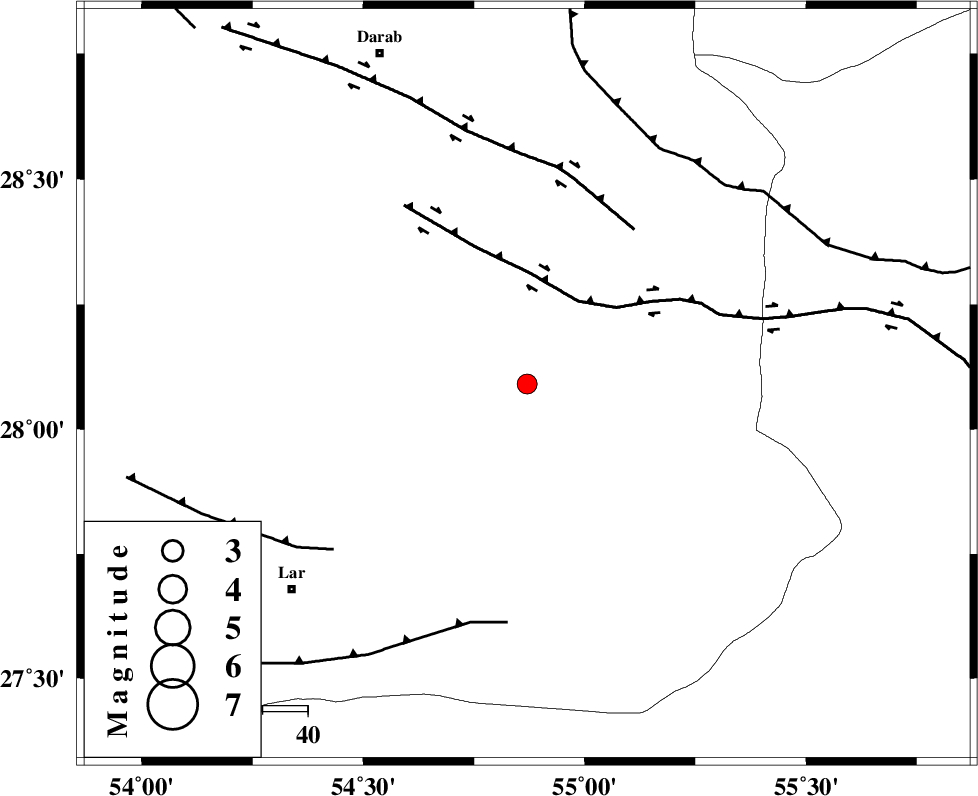
| Location | Lat:28.09 Lon: 54.87 |
| Region | Fars Province, 70 km North-East of Lar |
Nearest Cities |
|
| 33 km South West of Fadami, Fars Province | |
| 41 km South West of Doborji, Fars Province | |
| 45 km South West of Rostaq, Fars Province | |
| 51 km North East of Dehkuyeh, Fars Province | |
| 53 km South East of Hajiabad, Fars Province | |
| Depth | 18 km |
| Agency | |
Faults within 150 km: |
|
| HZF2 (Length: 437 km) , Distance to epicenter: 22 km | |
| HZF1 (Length: 102 km) , Distance to epicenter: 42 km | |
| LAR_F (Length: 99 km) , Distance to epicenter: 53 km | |
| Number of Phases | 5 |
| RMS | 0.3 |
| Number of Stations | 3 |
| Error in Latitude | >3.4 km |
| Error in Longitude | 2.1 km |
| Error in Depth | 6.1 km |
Download waveform in seisan format
to download seisan software Click here
to access information about IIEES stations Click here
Amplitude | ||||||||
| UID | Agency | Station | Component | Amplitude | Period | Arrival Time | Proccessing Time | Signal Clip |
| 89468 | IIEES | KRBR | E | 44.5 | 0.44 | 2013-05-28 01:53:21 | 2013-05-28 04:15:00 | n |
| 89469 | IIEES | KRBR | N | 42 | 0.4 | 2013-05-28 01:53:22 | 2013-05-28 04:15:00 | n |
Phase | ||||||||||||
| Agency | Station | Component | Phase Type | Phase Quality | First Motion | Observed Arrival Time | Time Residual | Loc. Flag | Input Weight | Distance | Azimuth | |
| IIEES | BNDS | Z | Pg | E | 2013-05-28 01:52:20 | 0.02 | y | 149 | 121 | |||
| IIEES | GHIR | Z | Pn | E | 2013-05-28 01:52:25 | -0.41 | y | 186 | 277 | |||
| IIEES | GHIR | N | Sg | E | 2013-05-28 01:52:48 | 0.22 | y | 186 | 277 | |||
| IIEES | KRBR | Z | Pn | E | 2013-05-28 01:52:37 | 0.29 | y | 279 | 41 | |||
| IIEES | KRBR | N | Sg | E | 2013-05-28 01:53:13 | -0.12 | y | 279 | 41 | |||

 IIEES All Rights Reserved