
Magnitude |
2.5 |
| Date & Time (UTC) | 2013-06-03 10:55:53.2 |
| Date & Time (Local) | 1392/3/13 15:25:53.2 |
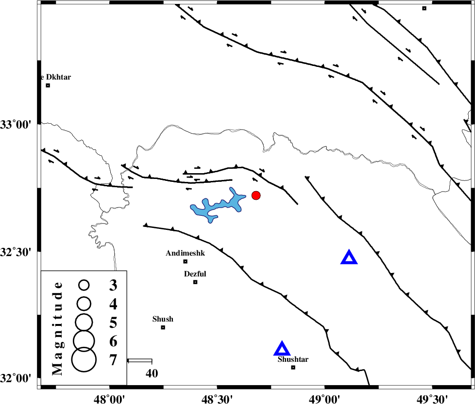
| Location | Lat:32.72 Lon: 48.68 |
| Region | Khoozestan Province, 42 km North-East of Andimeshk |
Nearest Cities |
|
| 15 km West of Shuy, Khoozestan Province | |
| 28 km North West of Sardasht, Khoozestan Province | |
| 33 km East of Sorkhakan, Khoozestan Province | |
| 36 km North of Mahur berenji, Khoozestan Province | |
| 41 km North East of Hoseinieh, Khoozestan Province | |
| Depth | 6 km |
| Agency | |
Faults within 150 km: |
|
| BALARUD_F_Z2 (Length: 58 km) , Distance to epicenter: 8 km | |
| BALARUD_F_Z3 (Length: 53 km) , Distance to epicenter: 12 km | |
| MFF2 (Length: 205 km) , Distance to epicenter: 23 km | |
| Number of Phases | 7 |
| RMS | 0.3 |
| Number of Stations | 5 |
| Error in Latitude | >3 km |
| Error in Longitude | 7.1 km |
| Error in Depth | 8.5 km |
Download waveform in seisan format
to download seisan software Click here
to access information about IIEES stations Click here
Amplitude | ||||||||
| UID | Agency | Station | Component | Amplitude | Period | Arrival Time | Proccessing Time | Signal Clip |
| 89532 | IIEES | SHGR | E | 209.5 | 0.32 | 2013-06-03 10:56:16 | 2013-06-03 12:33:00 | n |
| 89533 | IIEES | SHGR | N | 268 | 0.44 | 2013-06-03 10:56:21 | 2013-06-03 12:33:00 | n |
Phase | ||||||||||||
| Agency | Station | Component | Phase Type | Phase Quality | First Motion | Observed Arrival Time | Time Residual | Loc. Flag | Input Weight | Distance | Azimuth | |
| IIEES | SHGR | Z | Pg | E | 2013-06-03 10:56:05 | -0.24 | y | 68.6 | 171 | |||
| IIEES | SHGR | E | Sg | E | 2013-06-03 10:56:14 | 0.09 | y | 68.6 | 171 | |||
| IIEES | KHMZ | Z | Pn | E | 2013-06-03 10:56:22 | -0.12 | y | 165 | 46 | |||
| IIEES | KHMZ | N | Sg | E | 2013-06-03 10:56:42 | -0.16 | y | 165 | 46 | |||
| IIEES | ASAO | Z | Pn | E | 2013-06-03 10:56:31 | -0.22 | y | 238 | 31 | |||
| IIEES | SNGE | Z | Pn | E | 2013-06-03 10:56:38 | 0.01 | y | 291 | 335 | |||
| IIEES | GHVR | Z | Pn | E | 2013-06-03 10:56:40 | 0.7 | y | 308 | 50 | |||